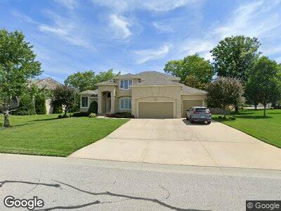
4215 NE Edmonson Ct Lees Summit, MO 64064
Chapel Ridge NeighborhoodEstimated Value: $484,897 - $660,000
4
Beds
4
Baths
2,278
Sq Ft
$244/Sq Ft
Est. Value
About This Home
This home is located at 4215 NE Edmonson Ct, Lees Summit, MO 64064 and is currently estimated at $555,474, approximately $243 per square foot. 4215 NE Edmonson Ct is a home located in Jackson County with nearby schools including Chapel Lakes Elementary School, Delta Woods Middle School, and Blue Springs South High School.
Ownership History
Date
Name
Owned For
Owner Type
Purchase Details
Closed on
Jul 28, 2013
Sold by
Brown Devan B and Brown Pamela S
Bought by
Brown Devan B and Brown Pamela S
Current Estimated Value
Purchase Details
Closed on
Feb 13, 2002
Sold by
Longhorn Asset Management Ltd
Bought by
Ron Myrick Design Builders Inc
Create a Home Valuation Report for This Property
The Home Valuation Report is an in-depth analysis detailing your home's value as well as a comparison with similar homes in the area
Home Values in the Area
Average Home Value in this Area
Purchase History
| Date | Buyer | Sale Price | Title Company |
|---|---|---|---|
| Brown Devan B | -- | None Available | |
| Ron Myrick Design Builders Inc | -- | Security Land Title Company |
Source: Public Records
Mortgage History
| Date | Status | Borrower | Loan Amount |
|---|---|---|---|
| Closed | Brown Devan B | $213,000 |
Source: Public Records
Tax History Compared to Growth
Tax History
| Year | Tax Paid | Tax Assessment Tax Assessment Total Assessment is a certain percentage of the fair market value that is determined by local assessors to be the total taxable value of land and additions on the property. | Land | Improvement |
|---|---|---|---|---|
| 2024 | $4,720 | $62,757 | $7,005 | $55,752 |
| 2023 | $4,720 | $62,757 | $7,754 | $55,003 |
| 2022 | $5,922 | $69,730 | $11,894 | $57,836 |
| 2021 | $5,916 | $69,730 | $11,894 | $57,836 |
| 2020 | $5,597 | $65,241 | $11,894 | $53,347 |
| 2019 | $5,425 | $65,241 | $11,894 | $53,347 |
| 2018 | $5,297 | $61,789 | $6,886 | $54,903 |
| 2017 | $5,297 | $61,789 | $6,886 | $54,903 |
| 2016 | $4,903 | $57,380 | $10,716 | $46,664 |
| 2014 | $4,868 | $56,616 | $10,716 | $45,900 |
Source: Public Records
Map
Nearby Homes
- 4232 NE Tremont Ct
- 712 NE Plumbrook Place
- 4104 NE Edmonson Cir
- 4121 NE Courtney Dr
- 604 NE Silverleaf Place
- 826 NE Algonquin St Unit B
- 824 NE Algonquin St Unit A
- 4027 NE Sagamore Dr Unit A
- 793 NE Algonquin St Unit A
- 829 NE Algonquin St
- 801 NE Lone Hill Dr
- 416 NE Brockton Dr
- 4709 NE Freehold Dr
- 4813 NE Jamestown Dr
- 4134 NE Hampstead Dr
- 529 NE Sienna Place
- 4004 NE Independence Ave
- 1133 NE Cardinal Ct
- 4641 NE Fairway Homes Dr
- 4001 NE Apple Grove Dr
- 4215 NE Edmonson Ct
- 4219 NE Edmonson Ct
- 4220 NE Tremont Ct
- 4206 NE Edmonson Ct
- 4236 NE Tremont Ct
- 4223 NE Edmonson Ct
- 4240 NE Tremont Ct
- 4216 NE Tremont Cir
- 4210 NE Edmonson Ct
- 4214 NE Edmonson Ct
- 4227 NE Edmonson Ct
- 4222 NE Edmonson Ct
- 4244 NE Tremont Ct
- 4233 NE Tremont Ct
- 4229 NE Tremont Ct
- 4225 NE Tremont Ct
- 4237 NE Tremont Ct
- 4226 NE Edmonson Ct
- 4221 NE Tremont Ct
- 4231 NE Edmonson Ct