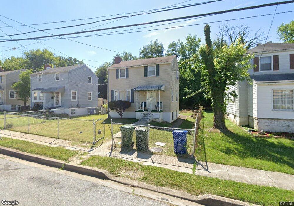
4221 Kenshaw Ave Baltimore, MD 21215
Reisterstown Station NeighborhoodEstimated Value: $147,000 - $164,214
--
Bed
1
Bath
912
Sq Ft
$171/Sq Ft
Est. Value
About This Home
This home is located at 4221 Kenshaw Ave, Baltimore, MD 21215 and is currently estimated at $155,607, approximately $170 per square foot. 4221 Kenshaw Ave is a home located in Baltimore City with nearby schools including Cross Country Elementary School, Booker T. Washington Middle School, and Forest Park High School.
Ownership History
Date
Name
Owned For
Owner Type
Purchase Details
Closed on
Oct 11, 2013
Sold by
Parsons Anette G
Bought by
Braxton Celestine
Current Estimated Value
Purchase Details
Closed on
Mar 4, 2009
Sold by
Parsons James E
Bought by
Parsons Annette
Purchase Details
Closed on
Jun 7, 1994
Sold by
Vaughn M E
Bought by
Parsons James E
Home Financials for this Owner
Home Financials are based on the most recent Mortgage that was taken out on this home.
Original Mortgage
$63,240
Interest Rate
8.49%
Create a Home Valuation Report for This Property
The Home Valuation Report is an in-depth analysis detailing your home's value as well as a comparison with similar homes in the area
Home Values in the Area
Average Home Value in this Area
Purchase History
| Date | Buyer | Sale Price | Title Company |
|---|---|---|---|
| Braxton Celestine | -- | None Available | |
| Parsons Annette | -- | -- | |
| Parsons James E | $62,000 | -- |
Source: Public Records
Mortgage History
| Date | Status | Borrower | Loan Amount |
|---|---|---|---|
| Previous Owner | Parsons James E | $63,240 |
Source: Public Records
Tax History Compared to Growth
Tax History
| Year | Tax Paid | Tax Assessment Tax Assessment Total Assessment is a certain percentage of the fair market value that is determined by local assessors to be the total taxable value of land and additions on the property. | Land | Improvement |
|---|---|---|---|---|
| 2025 | $2,335 | $113,333 | -- | -- |
| 2024 | $2,335 | $107,600 | $33,300 | $74,300 |
| 2023 | $2,297 | $107,600 | $33,300 | $74,300 |
| 2022 | $2,210 | $107,600 | $33,300 | $74,300 |
| 2021 | $2,549 | $108,000 | $33,300 | $74,700 |
| 2020 | $2,032 | $108,000 | $33,300 | $74,700 |
| 2019 | $1,940 | $108,000 | $33,300 | $74,700 |
| 2018 | $1,893 | $110,600 | $33,300 | $77,300 |
| 2017 | $1,836 | $105,200 | $0 | $0 |
| 2016 | $1,610 | $99,800 | $0 | $0 |
| 2015 | $1,610 | $94,400 | $0 | $0 |
| 2014 | $1,610 | $94,400 | $0 | $0 |
Source: Public Records
Map
Nearby Homes
- 4108 Fords Ln
- 6509 Parr Ave
- 6203 Hopeton Ave
- 3720 Bartwood Rd
- 6603 Fairmount Ave
- 3737 Clarks Ln
- 3803 Menlo Dr
- 6705 Fairmount Ave
- 6210 Park Heights Ave Unit 700
- 3601 Clarks Ln Unit 424
- 3601 Clarks Ln Unit 506
- 3601 Clarks Ln
- 3601 Clarks Ln
- 3601 Clarks Ln
- 3601 Clarks Ln
- 6606 Park Heights Ave Unit 305
- 6606 Park Heights Ave Unit 905
- 6606 Park Heights Ave Unit 615
- 4011 Mortimer Ave
- 3922 Mortimer Ave
- 4223 Kenshaw Ave
- 4219 Kenshaw Ave
- 4217 Kenshaw Ave
- 4215 Kenshaw Ave
- 4301 Kenshaw Ave
- 4220 Kenshaw Ave
- 4218 Kenshaw Ave
- 4213 Kenshaw Ave
- 4222 Kenshaw Ave
- 4216 Kenshaw Ave
- 4214 Kenshaw Ave
- 4305 Kenshaw Ave
- 4211 Kenshaw Ave
- 4212 Kenshaw Ave
- 4210 Kenshaw Ave
- 4209 Kenshaw Ave
- 4219 Fords Ln
- 4221 Fords Ln
- 4217 Fords Ln
- 4223 Fords Ln