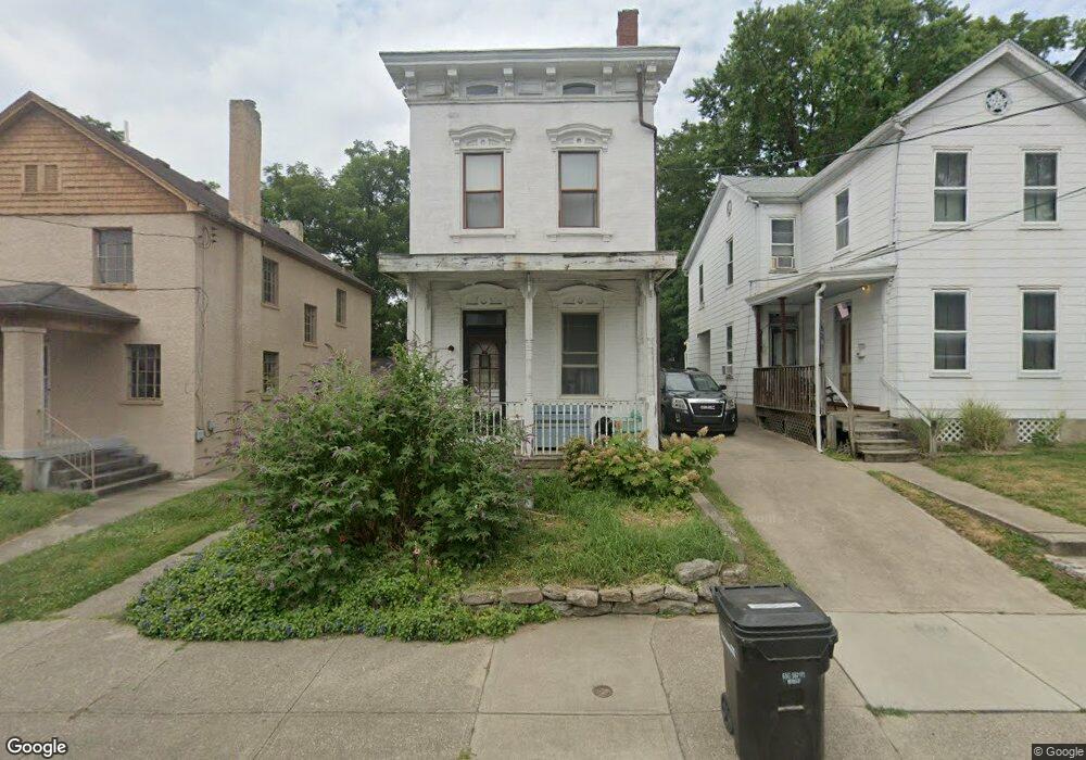
4223 Langland St Cincinnati, OH 45223
Northside NeighborhoodEstimated Value: $205,197 - $388,000
3
Beds
2
Baths
1,572
Sq Ft
$179/Sq Ft
Est. Value
About This Home
This home is located at 4223 Langland St, Cincinnati, OH 45223 and is currently estimated at $280,799, approximately $178 per square foot. 4223 Langland St is a home located in Hamilton County with nearby schools including Chase Elementary School, Robert A. Taft Information Technology High School, and Western Hills High School.
Ownership History
Date
Name
Owned For
Owner Type
Purchase Details
Closed on
Aug 28, 1996
Sold by
Jameson Lisa B
Bought by
Carroll Daniel E
Current Estimated Value
Home Financials for this Owner
Home Financials are based on the most recent Mortgage that was taken out on this home.
Original Mortgage
$45,000
Outstanding Balance
$3,888
Interest Rate
8.27%
Estimated Equity
$276,911
Create a Home Valuation Report for This Property
The Home Valuation Report is an in-depth analysis detailing your home's value as well as a comparison with similar homes in the area
Home Values in the Area
Average Home Value in this Area
Purchase History
| Date | Buyer | Sale Price | Title Company |
|---|---|---|---|
| Carroll Daniel E | -- | -- |
Source: Public Records
Mortgage History
| Date | Status | Borrower | Loan Amount |
|---|---|---|---|
| Open | Carroll Daniel E | $45,000 |
Source: Public Records
Tax History Compared to Growth
Tax History
| Year | Tax Paid | Tax Assessment Tax Assessment Total Assessment is a certain percentage of the fair market value that is determined by local assessors to be the total taxable value of land and additions on the property. | Land | Improvement |
|---|---|---|---|---|
| 2024 | $2,568 | $42,953 | $12,261 | $30,692 |
| 2023 | $2,626 | $42,953 | $12,261 | $30,692 |
| 2022 | $1,500 | $21,938 | $6,349 | $15,589 |
| 2021 | $1,442 | $21,938 | $6,349 | $15,589 |
| 2020 | $1,484 | $21,938 | $6,349 | $15,589 |
| 2019 | $1,363 | $18,435 | $5,334 | $13,101 |
| 2018 | $1,365 | $18,435 | $5,334 | $13,101 |
| 2017 | $1,297 | $18,435 | $5,334 | $13,101 |
| 2016 | $1,127 | $15,789 | $5,198 | $10,591 |
| 2015 | $1,017 | $15,789 | $5,198 | $10,591 |
| 2014 | $1,024 | $15,789 | $5,198 | $10,591 |
| 2013 | $982 | $14,897 | $4,904 | $9,993 |
Source: Public Records
Map
Nearby Homes
- 4208 Brookside Ave
- 4236 Brookside Ave
- 4216 Williamson Place
- 4256 Langland St
- 1545 Pullan Ave
- 1535 Pullan Ave
- 4262 Langland St
- 4244 Hamilton Ave
- 4228 Fergus St
- 4230 Fergus St
- 4226 Mad Anthony St
- 4326 Hamilton Ave
- 4251 Chambers St
- 1402 Ludlow Place
- 4216 Delaney St
- 4226 Chambers St
- 1412 Knowlton St
- 1318 Knowlton St
- 1325 Knowlton St
- 4125 Chambers St
- 4221 Langland St
- 4225 Langland St
- 4227 Langland St
- 4229 Langland St
- 4231 Langland St
- 4213 Langland St
- 4216 Brookside Ave
- 4220 Brookside Ave
- 4214 Brookside Ave
- 4222 Brookside Ave
- 4224 Brookside Ave
- 4233 Langland St
- 4212 Brookside Ave
- 4222 Langland St
- 4220 Langland St
- 4224 Langland St
- 4209 Langland St
- 4210 Brookside Ave
- 4226 Brookside Ave
- 4214 Langland St