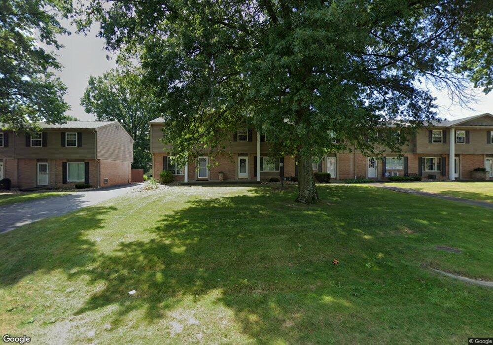
4229 New Rd Youngstown, OH 44515
Austintown NeighborhoodEstimated Value: $86,000 - $97,765
3
Beds
1
Bath
1,144
Sq Ft
$81/Sq Ft
Est. Value
About This Home
This home is located at 4229 New Rd, Youngstown, OH 44515 and is currently estimated at $92,691, approximately $81 per square foot. 4229 New Rd is a home located in Mahoning County with nearby schools including Austintown Elementary School, Austintown Intermediate School, and Austintown Middle School.
Ownership History
Date
Name
Owned For
Owner Type
Purchase Details
Closed on
Aug 9, 2017
Sold by
Muir Sandra L
Bought by
Soldan Larry
Current Estimated Value
Purchase Details
Closed on
Aug 4, 2017
Sold by
Soldan Larry
Bought by
Soldan William R
Purchase Details
Closed on
Apr 30, 2015
Sold by
Muir Sandra L
Bought by
Soldan Larry
Home Financials for this Owner
Home Financials are based on the most recent Mortgage that was taken out on this home.
Original Mortgage
$35,000
Interest Rate
6%
Mortgage Type
Seller Take Back
Purchase Details
Closed on
Aug 3, 2012
Sold by
Muir Thomas W
Bought by
Muir Sandra L
Purchase Details
Closed on
Mar 14, 1994
Bought by
Lawler William A and R A
Create a Home Valuation Report for This Property
The Home Valuation Report is an in-depth analysis detailing your home's value as well as a comparison with similar homes in the area
Home Values in the Area
Average Home Value in this Area
Purchase History
| Date | Buyer | Sale Price | Title Company |
|---|---|---|---|
| Soldan Larry | $37,000 | None Available | |
| Soldan William R | -- | None Available | |
| Soldan Larry | $37,000 | Attorney | |
| Muir Sandra L | -- | Attorney | |
| Lawler William A | $30,000 | -- |
Source: Public Records
Mortgage History
| Date | Status | Borrower | Loan Amount |
|---|---|---|---|
| Previous Owner | Soldan Larry | $35,000 |
Source: Public Records
Tax History Compared to Growth
Tax History
| Year | Tax Paid | Tax Assessment Tax Assessment Total Assessment is a certain percentage of the fair market value that is determined by local assessors to be the total taxable value of land and additions on the property. | Land | Improvement |
|---|---|---|---|---|
| 2024 | $1,062 | $23,170 | $1,680 | $21,490 |
| 2023 | $1,046 | $23,170 | $1,680 | $21,490 |
| 2022 | $747 | $13,250 | $1,680 | $11,570 |
| 2021 | $747 | $13,250 | $1,680 | $11,570 |
| 2020 | $750 | $13,250 | $1,680 | $11,570 |
| 2019 | $689 | $11,050 | $1,400 | $9,650 |
| 2018 | $663 | $11,050 | $1,400 | $9,650 |
| 2017 | $670 | $11,050 | $1,400 | $9,650 |
| 2016 | $680 | $11,270 | $1,400 | $9,870 |
| 2015 | $659 | $11,270 | $1,400 | $9,870 |
| 2014 | $662 | $11,270 | $1,400 | $9,870 |
| 2013 | $655 | $11,270 | $1,400 | $9,870 |
Source: Public Records
Map
Nearby Homes
- 4235 Patricia Ave
- 4262 Pembrook Rd
- 4241 Wedgewood Dr
- 4234 Burkey Rd
- 4102 Burkey Rd
- 4289 Wedgewood Dr
- 3890 Ayrshire Dr
- 3852 Edinburgh Dr
- 532 Westgate Blvd
- 3913 Claridge Dr
- 3972 Artmar Dr
- 40 Woodleigh Ct
- 2430 Redgate Ln
- 2699 Hamman Dr
- 2414 Ardenwood Place
- 1560 S Meridian Rd
- 603 S Raccoon Rd Unit 9
- 603 S Raccoon Rd Unit 14
- 603 S Raccoon Rd Unit 61
- 2500 Redgate Ln
- 4231 New Rd
- 4227 New Rd
- 4233 New Rd
- 4219 New Rd Unit 5A
- 4235 New Rd
- 4217 New Rd
- 4237 New Rd Unit 4A
- 4215 New Rd
- 4213 New Rd Unit 5D
- 4245 New Rd Unit 3F
- 4211 New Rd Unit 5E
- 4247 New Rd Unit 3E
- 4247 New Rd Unit 3
- 4209 New Rd
- 4209 New Rd Unit 4209 new rd
- 4209 New Rd Unit Wedgewood condominiu
- 4258 Selkirk Ave
- 4249 New Rd
- 4262 Selkirk Ave
- 4256 Selkirk Ave