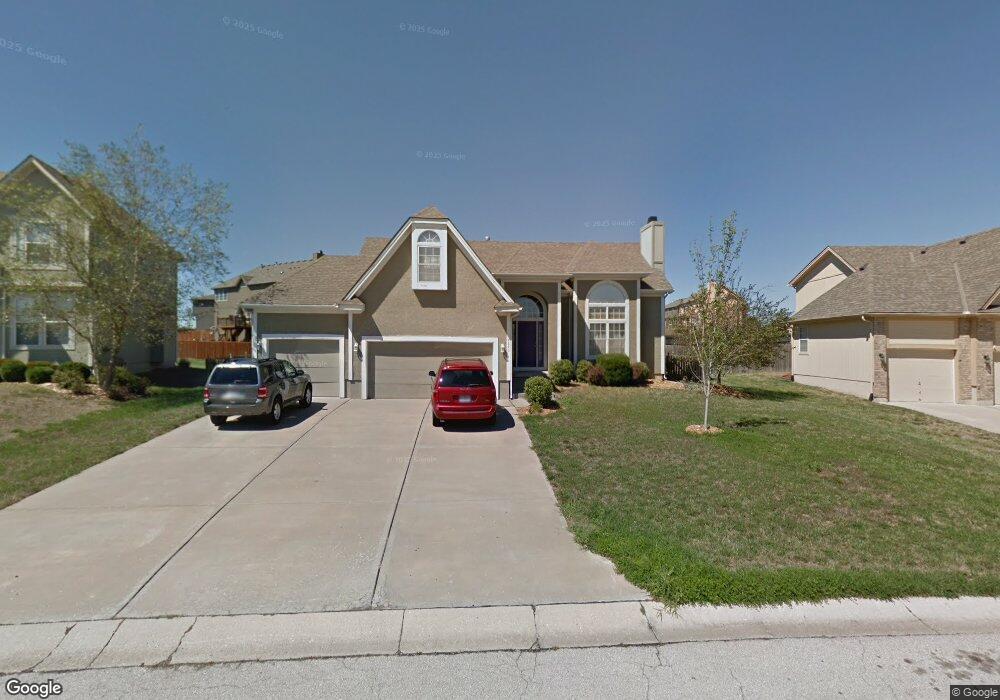
4240 SW Flintrock Dr Lees Summit, MO 64082
Estimated Value: $471,000 - $490,000
5
Beds
4
Baths
2,265
Sq Ft
$212/Sq Ft
Est. Value
About This Home
This home is located at 4240 SW Flintrock Dr, Lees Summit, MO 64082 and is currently estimated at $480,021, approximately $211 per square foot. 4240 SW Flintrock Dr is a home located in Jackson County with nearby schools including Summit Pointe Elementary School, Summit Lakes Middle School, and Lee's Summit West High School.
Ownership History
Date
Name
Owned For
Owner Type
Purchase Details
Closed on
Feb 13, 2004
Sold by
Mcgovern Builders Inc
Bought by
Mendenhall Joseph E and Mendenhall Sandy K
Current Estimated Value
Home Financials for this Owner
Home Financials are based on the most recent Mortgage that was taken out on this home.
Original Mortgage
$166,720
Outstanding Balance
$77,321
Interest Rate
5.67%
Mortgage Type
Purchase Money Mortgage
Estimated Equity
$402,700
Create a Home Valuation Report for This Property
The Home Valuation Report is an in-depth analysis detailing your home's value as well as a comparison with similar homes in the area
Home Values in the Area
Average Home Value in this Area
Purchase History
| Date | Buyer | Sale Price | Title Company |
|---|---|---|---|
| Mendenhall Joseph E | -- | Coffelt Land Title Inc |
Source: Public Records
Mortgage History
| Date | Status | Borrower | Loan Amount |
|---|---|---|---|
| Open | Mendenhall Joseph E | $166,720 | |
| Closed | Mendenhall Joseph E | $31,260 |
Source: Public Records
Tax History
| Year | Tax Paid | Tax Assessment Tax Assessment Total Assessment is a certain percentage of the fair market value that is determined by local assessors to be the total taxable value of land and additions on the property. | Land | Improvement |
|---|---|---|---|---|
| 2025 | $6,490 | $75,633 | $15,116 | $60,517 |
| 2024 | $6,443 | $89,878 | $14,434 | $75,444 |
| 2023 | $6,443 | $89,878 | $13,329 | $76,549 |
| 2022 | $4,617 | $57,190 | $11,457 | $45,733 |
| 2021 | $4,712 | $57,190 | $11,457 | $45,733 |
| 2020 | $4,530 | $54,448 | $11,457 | $42,991 |
| 2019 | $4,407 | $54,448 | $11,457 | $42,991 |
| 2018 | $4,065 | $46,607 | $5,612 | $40,995 |
| 2016 | $3,804 | $43,168 | $5,890 | $37,278 |
Source: Public Records
Map
Nearby Homes
- 1409 SW Whistle Dr
- 1937 SW Merryman Dr
- 4404 SW Flintrock Dr
- 4413 SW Flintrock Dr
- 4244 SW Stoney Brook Dr
- 1505 SW Georgetown Dr
- 3940 SW Flintrock Dr
- 3932 SW Flintrock Dr
- 4407 SW Briarbrook Dr
- 3925 SW Flintrock Dr
- 4212 SW Stoney Brook Dr
- 1329 SW Merryman Dr
- 3916 SW Flintrock Dr
- 3904 SW Flintrock Dr
- 1008 SW Whistle Dr
- 1009 SW Drake Cir
- 3916 SW Granite Ln
- 4432 SW Rivulet Dr
- 1929 SW Merryman Dr
- 1022 SW Cheshire Dr
- 4236 SW Flintrock Dr
- 4236 SW Flintrock Dr Unit 102H
- 1400 SW 42nd Cir
- 4244 SW Flintrock Dr
- 4232 SW Flintrock Dr
- 1401 SW 42nd Cir
- 4237 SW Flintrock Dr
- 4243 SW Flintrock Dr
- 4248 SW Flintrock Dr
- 4247 SW Flintrock Dr
- 4231 SW Flintrock Dr
- 1401 SW 41st Cir
- 4228 SW Flintrock Dr
- 1404 SW 42nd Cir
- 1405 SW 42nd Cir
- 1400 SW Whistle Dr
- 4225 SW Flintrock Dr
- 1405 SW 41st Cir
- 1404 SW Whistle Dr
- 4220 SW Flintrock Cir
Your Personal Tour Guide
Ask me questions while you tour the home.