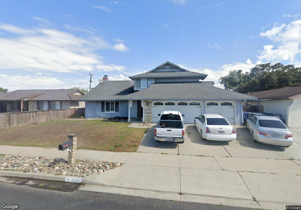
4241 Polaris Ave Lompoc, CA 93436
Estimated Value: $673,551 - $754,000
4
Beds
3
Baths
2,162
Sq Ft
$325/Sq Ft
Est. Value
About This Home
This home is located at 4241 Polaris Ave, Lompoc, CA 93436 and is currently estimated at $702,388, approximately $324 per square foot. 4241 Polaris Ave is a home located in Santa Barbara County with nearby schools including Buena Vista Elementary School, Cabrillo High School, and Olive Grove Charter - Lompoc.
Ownership History
Date
Name
Owned For
Owner Type
Purchase Details
Closed on
Mar 7, 2012
Sold by
Mti Capital Inc
Bought by
Kelley Randy and Molina Rose
Current Estimated Value
Home Financials for this Owner
Home Financials are based on the most recent Mortgage that was taken out on this home.
Original Mortgage
$233,916
Outstanding Balance
$159,761
Interest Rate
3.75%
Mortgage Type
FHA
Estimated Equity
$542,627
Purchase Details
Closed on
Jan 26, 2012
Sold by
Barnes Robert John
Bought by
Mti Capital Inc
Home Financials for this Owner
Home Financials are based on the most recent Mortgage that was taken out on this home.
Original Mortgage
$233,916
Outstanding Balance
$159,761
Interest Rate
3.75%
Mortgage Type
FHA
Estimated Equity
$542,627
Purchase Details
Closed on
Aug 13, 2007
Sold by
Barnes Robert John
Bought by
Barnes Robert John and Barnes Sylvia M
Home Financials for this Owner
Home Financials are based on the most recent Mortgage that was taken out on this home.
Original Mortgage
$93,000
Interest Rate
6.26%
Mortgage Type
Purchase Money Mortgage
Purchase Details
Closed on
Jul 26, 2007
Sold by
Davidson Gary and Davidson Tammy
Bought by
Barnes Robert John
Home Financials for this Owner
Home Financials are based on the most recent Mortgage that was taken out on this home.
Original Mortgage
$93,000
Interest Rate
6.26%
Mortgage Type
Purchase Money Mortgage
Purchase Details
Closed on
May 5, 1997
Sold by
Wibracht Gary and Wibracht Debbie
Bought by
Davidson Gary and Davidson Tammy
Home Financials for this Owner
Home Financials are based on the most recent Mortgage that was taken out on this home.
Original Mortgage
$164,571
Interest Rate
7.94%
Mortgage Type
FHA
Purchase Details
Closed on
Nov 20, 1995
Sold by
Wibracht Debbie J
Bought by
Wibracht Gary
Home Financials for this Owner
Home Financials are based on the most recent Mortgage that was taken out on this home.
Original Mortgage
$8,000
Interest Rate
7.58%
Purchase Details
Closed on
Sep 26, 1995
Sold by
Spear Lloyd
Bought by
Wibracht Gary and Wibracht Debbie
Home Financials for this Owner
Home Financials are based on the most recent Mortgage that was taken out on this home.
Original Mortgage
$8,000
Interest Rate
7.58%
Create a Home Valuation Report for This Property
The Home Valuation Report is an in-depth analysis detailing your home's value as well as a comparison with similar homes in the area
Home Values in the Area
Average Home Value in this Area
Purchase History
| Date | Buyer | Sale Price | Title Company |
|---|---|---|---|
| Kelley Randy | $240,000 | Fidelity National Title Co | |
| Mti Capital Inc | $173,000 | None Available | |
| Barnes Robert John | -- | Stewart Title Sb Griffith | |
| Barnes Robert John | -- | Stewart Title Sb Griffith | |
| Barnes Robert John | $465,000 | Stewart Title Guaranty Co | |
| Davidson Gary | $174,500 | Lawyers Title Company | |
| Wibracht Gary | -- | First American Title | |
| Wibracht Gary | $160,000 | Chicago Title Co |
Source: Public Records
Mortgage History
| Date | Status | Borrower | Loan Amount |
|---|---|---|---|
| Open | Kelley Randy | $233,916 | |
| Previous Owner | Barnes Robert John | $93,000 | |
| Previous Owner | Barnes Robert John | $372,000 | |
| Previous Owner | Davidson Gary | $164,571 | |
| Previous Owner | Wibracht Gary | $8,000 | |
| Previous Owner | Wibracht Gary | $152,000 |
Source: Public Records
Tax History Compared to Growth
Tax History
| Year | Tax Paid | Tax Assessment Tax Assessment Total Assessment is a certain percentage of the fair market value that is determined by local assessors to be the total taxable value of land and additions on the property. | Land | Improvement |
|---|---|---|---|---|
| 2025 | $3,541 | $301,441 | $125,599 | $175,842 |
| 2023 | $3,541 | $289,738 | $120,723 | $169,015 |
| 2022 | $3,485 | $284,057 | $118,356 | $165,701 |
| 2021 | $3,520 | $278,488 | $116,036 | $162,452 |
| 2020 | $3,485 | $275,634 | $114,847 | $160,787 |
| 2019 | $3,433 | $270,231 | $112,596 | $157,635 |
| 2018 | $3,385 | $264,934 | $110,389 | $154,545 |
| 2017 | $3,238 | $259,740 | $108,225 | $151,515 |
| 2016 | $2,912 | $254,648 | $106,103 | $148,545 |
| 2014 | $2,848 | $245,911 | $102,463 | $143,448 |
Source: Public Records
Map
Nearby Homes
- 252 Pegasus Ave
- 4139 Constellation Rd Unit 2
- 4108 Constellation Rd
- 129 Hercules Ave
- 113 Gemini Ave
- 4490 Sirius Ave
- 3951 Mesa Circle Dr
- 4021 Muirfield Place
- 52 Stanford Cir
- 210 Oak Hill Dr
- 240 Oak Hill Dr
- 3939 Saturn Ave
- 0 Oak Hill Dr Unit 24-783
- 298 Saint Andrews Way
- 4464 Greenbrier Rd
- 445 Firestone Way
- 384 Falcon Crest Dr
- 561 Andromeda Dr
- 579 Saint Andrews Way
- 721 Goddard Dr
- 4231 Polaris Ave
- 4250 Constellation Rd Unit 1
- 4240 Constellation Rd
- 4261 Polaris Ave
- 4221 Polaris Ave
- 4260 Constellation Rd
- 4240 Polaris Ave
- 4230 Constellation Rd
- 4230 Polaris Ave
- 4250 Polaris Ave
- 4271 Polaris Ave
- 4213 Polaris Ave
- 4222 Polaris Ave
- 4260 Polaris Ave
- 4270 Constellation Rd
- 4220 Constellation Rd
- 4212 Polaris Ave
- 4270 Polaris Ave
- 228 Pegasus Ave