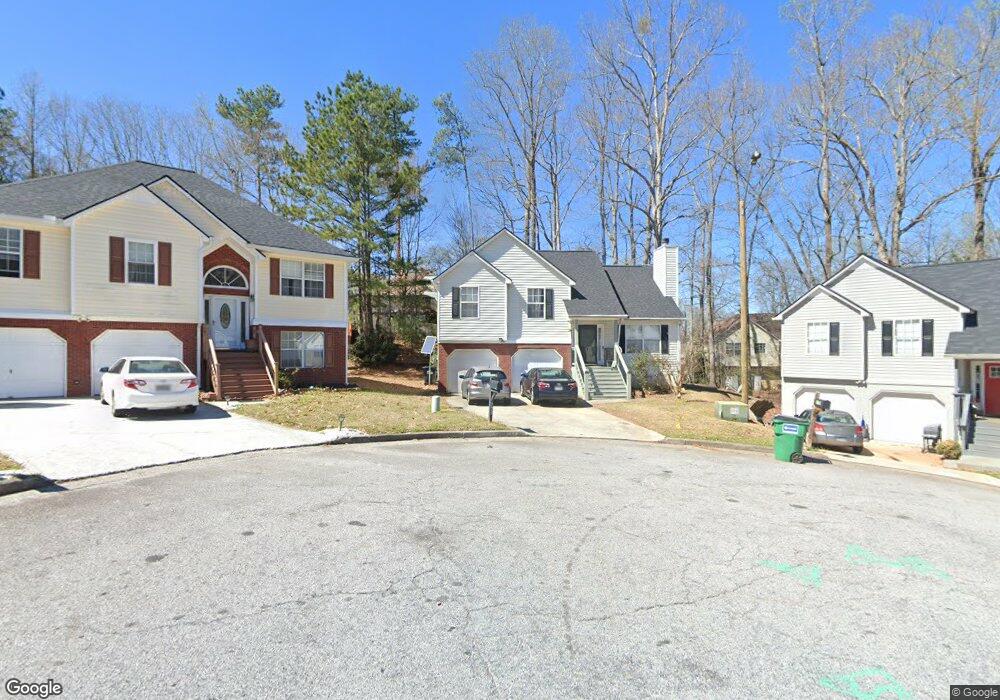
4252 Anderson Ridge Way Austell, GA 30106
Estimated Value: $283,000 - $338,000
3
Beds
2
Baths
1,274
Sq Ft
$242/Sq Ft
Est. Value
About This Home
This home is located at 4252 Anderson Ridge Way, Austell, GA 30106 and is currently estimated at $308,884, approximately $242 per square foot. 4252 Anderson Ridge Way is a home located in Cobb County with nearby schools including Deerwood Elementary School, Clarkdale Elementary School, and Garrett Middle School.
Ownership History
Date
Name
Owned For
Owner Type
Purchase Details
Closed on
Sep 9, 2003
Sold by
Mccall Brian P
Bought by
Onuigbo Eze J
Current Estimated Value
Home Financials for this Owner
Home Financials are based on the most recent Mortgage that was taken out on this home.
Original Mortgage
$116,000
Outstanding Balance
$52,973
Interest Rate
6.13%
Mortgage Type
New Conventional
Estimated Equity
$255,911
Purchase Details
Closed on
Oct 7, 1998
Sold by
Palladium Hms Inc
Bought by
Mccall Brian P Etal
Home Financials for this Owner
Home Financials are based on the most recent Mortgage that was taken out on this home.
Original Mortgage
$108,800
Interest Rate
6.76%
Mortgage Type
FHA
Create a Home Valuation Report for This Property
The Home Valuation Report is an in-depth analysis detailing your home's value as well as a comparison with similar homes in the area
Home Values in the Area
Average Home Value in this Area
Purchase History
| Date | Buyer | Sale Price | Title Company |
|---|---|---|---|
| Onuigbo Eze J | $145,000 | -- | |
| Mccall Brian P Etal | $108,900 | -- |
Source: Public Records
Mortgage History
| Date | Status | Borrower | Loan Amount |
|---|---|---|---|
| Open | Onuigbo Eze J | $116,000 | |
| Closed | Onuigbo Eze J | $14,500 | |
| Previous Owner | Mccall Brian P Etal | $108,800 |
Source: Public Records
Tax History Compared to Growth
Tax History
| Year | Tax Paid | Tax Assessment Tax Assessment Total Assessment is a certain percentage of the fair market value that is determined by local assessors to be the total taxable value of land and additions on the property. | Land | Improvement |
|---|---|---|---|---|
| 2025 | $2,535 | $109,748 | $14,000 | $95,748 |
| 2024 | $2,537 | $109,748 | $14,000 | $95,748 |
| 2023 | $1,995 | $109,748 | $14,000 | $95,748 |
| 2022 | $2,333 | $99,480 | $14,000 | $85,480 |
| 2021 | $1,795 | $74,940 | $14,000 | $60,940 |
| 2020 | $1,671 | $69,240 | $14,000 | $55,240 |
| 2019 | $1,276 | $51,200 | $12,000 | $39,200 |
| 2018 | $1,276 | $51,200 | $12,000 | $39,200 |
| 2017 | $1,038 | $45,024 | $6,000 | $39,024 |
| 2016 | $1,039 | $45,024 | $6,000 | $39,024 |
| 2015 | $522 | $26,548 | $6,000 | $20,548 |
| 2014 | $526 | $26,548 | $0 | $0 |
Source: Public Records
Map
Nearby Homes
- 4192 Rhinehart Dr
- 2013 Chesley Dr
- 2081 Lenoa Ln
- 2083 Lenoa Ln
- 4287 Keats Ct
- 4349 Kousa Rd Unit 4
- 2085 Lenoa Ln
- 1984 Padgett Dr
- 4420 Pink Rose Ct
- 2034 Drennon Ave
- 4470 Austell Rd
- 2072 Mcduffie Rd
- 2300 Anderson Mill Rd
- 2110 Plum Ln
- 3755 Mulkey Cir SW
- 1791 Fairview Dr SW
- 4582 Austell Rd
- 3782 Mulkey Cir SW Unit 18
- 3782 Mulkey Cir SW
- 4250 Anderson Ridge Way
- 4254 Anderson Ridge Way
- 4379 Rhinehart Ln
- 4383 Rhinehart Ln Unit 2
- 4375 Rhinehart Ln Unit 2
- 4251 Anderson Ridge Way
- 4256 Anderson Ridge Way
- 4387 Rhinehart Ln
- 4255 Anderson Ridge Way
- 4391 Rhinehart Ln
- 4382 Rhinehart Ln
- 4262 Anderson Ridge Way
- 4304 Anderson Ridge Dr
- 4371 Rhinehart Ln Unit 2
- 4257 Anderson Ridge Way
- 4378 Rhinehart Ln
- 4306 Anderson Ridge Dr
- 4308 Anderson Ridge Dr
- 4390 Rhinehart Ln Unit 2
- 4386 Rhinehart Ln