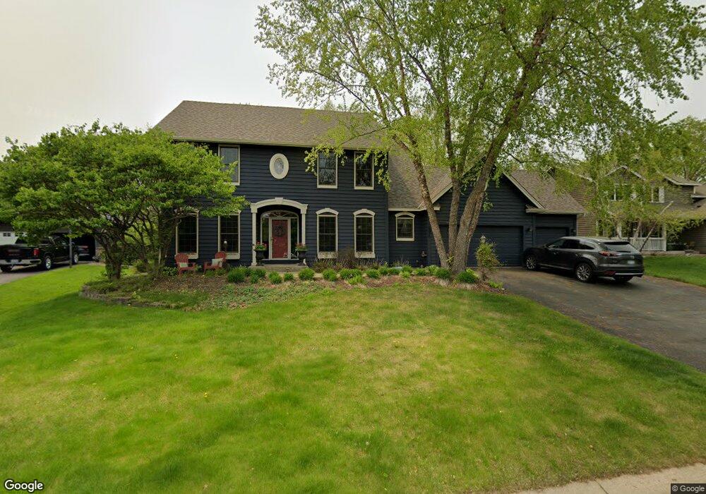
4254 Wexford Way Saint Paul, MN 55122
Estimated Value: $564,000 - $668,000
4
Beds
4
Baths
2,366
Sq Ft
$259/Sq Ft
Est. Value
About This Home
This home is located at 4254 Wexford Way, Saint Paul, MN 55122 and is currently estimated at $612,981, approximately $259 per square foot. 4254 Wexford Way is a home located in Dakota County with nearby schools including Thomas Lake Elementary School, Black Hawk Middle School, and Eastview Senior High School.
Ownership History
Date
Name
Owned For
Owner Type
Purchase Details
Closed on
Nov 30, 2023
Sold by
Soderholm Jeffrey and Soderholm Maureen
Bought by
Soderholm Kevin and Soderholm Elise
Current Estimated Value
Home Financials for this Owner
Home Financials are based on the most recent Mortgage that was taken out on this home.
Original Mortgage
$575,000
Outstanding Balance
$565,691
Interest Rate
7.63%
Mortgage Type
New Conventional
Estimated Equity
$47,290
Create a Home Valuation Report for This Property
The Home Valuation Report is an in-depth analysis detailing your home's value as well as a comparison with similar homes in the area
Home Values in the Area
Average Home Value in this Area
Purchase History
| Date | Buyer | Sale Price | Title Company |
|---|---|---|---|
| Soderholm Kevin | $575,000 | -- |
Source: Public Records
Mortgage History
| Date | Status | Borrower | Loan Amount |
|---|---|---|---|
| Open | Soderholm Kevin | $575,000 |
Source: Public Records
Tax History Compared to Growth
Tax History
| Year | Tax Paid | Tax Assessment Tax Assessment Total Assessment is a certain percentage of the fair market value that is determined by local assessors to be the total taxable value of land and additions on the property. | Land | Improvement |
|---|---|---|---|---|
| 2024 | $5,474 | $530,000 | $126,700 | $403,300 |
| 2023 | $5,474 | $503,400 | $127,100 | $376,300 |
| 2022 | $4,820 | $485,200 | $130,000 | $355,200 |
| 2021 | $4,932 | $428,700 | $113,000 | $315,700 |
| 2020 | $4,784 | $427,900 | $107,600 | $320,300 |
| 2019 | $4,662 | $404,500 | $102,500 | $302,000 |
| 2018 | $4,421 | $414,600 | $97,700 | $316,900 |
| 2017 | $4,612 | $369,800 | $93,000 | $276,800 |
| 2016 | $4,720 | $367,800 | $88,600 | $279,200 |
| 2015 | $4,686 | $369,003 | $87,721 | $281,282 |
| 2014 | -- | $372,055 | $85,409 | $286,646 |
| 2013 | -- | $319,408 | $76,338 | $243,070 |
Source: Public Records
Map
Nearby Homes
- 1612 Summit Hill
- 1610 Clemson Dr
- 4249 Boulder Ridge Point
- 4168 Arbor Ln
- 4163 Starbridge Ct
- 4199 Knob Cir Unit 102
- 4184 Knob Cir
- 1680 Oakbrooke Ct
- 4150 Knob Cir
- 1676 Hickory Ln
- 4049 Deerwood Trail
- 4100 Meadowlark Ln
- 1655 Walnut Ln
- 1384 Amaryllis Ln
- 4411 Clover Ln Unit A
- 4418 Clover Ln Unit B
- 1536 Stonewood Ln
- 4290 Blackhawk Rd
- 1778 Walnut Ln
- 4401 Clover Ln Unit B
- 4258 Wexford Way
- 4250 Wexford Way
- 1592 Wexford Cir
- 4262 Wexford Way
- 1588 Wexford Cir
- 4251 Wexford Way
- 4246 Wexford Way
- 4247 Wexford Way
- 4300 Clemson Cir Unit A
- 4300 Clemson Cir Unit B
- 4301 Clemson Cir Unit B
- 4301 Clemson Cir Unit A
- 1600 Wexford Cir
- 4243 Wexford Way
- 1585 Wexford Cir
- 4242 Wexford Way
- 4303 Clemson Cir Unit A
- 4303 Clemson Cir Unit B
- 4303 Clemson Cir
- 4304 Clemson Cir Unit A