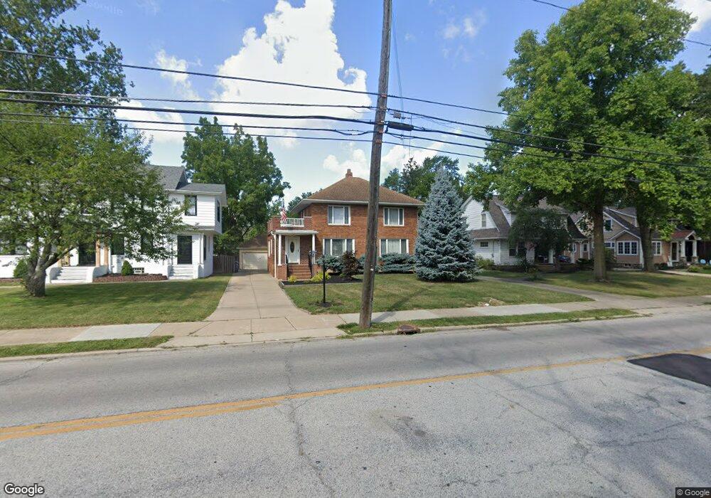
4254 Wooster Rd Cleveland, OH 44126
Estimated Value: $345,000 - $406,000
3
Beds
3
Baths
1,755
Sq Ft
$210/Sq Ft
Est. Value
About This Home
This home is located at 4254 Wooster Rd, Cleveland, OH 44126 and is currently estimated at $368,553, approximately $210 per square foot. 4254 Wooster Rd is a home located in Cuyahoga County with nearby schools including Gilles-Sweet Elementary School, Lewis F Mayer Middle School, and Fairview High School.
Ownership History
Date
Name
Owned For
Owner Type
Purchase Details
Closed on
May 12, 1993
Sold by
Bokisa George S
Bought by
Sandt Ferenc
Current Estimated Value
Purchase Details
Closed on
May 13, 1988
Sold by
Long Robert J
Bought by
Bokisa George S
Purchase Details
Closed on
Apr 30, 1982
Sold by
Long Robert J and Long Margaret J
Bought by
Long Robert J
Purchase Details
Closed on
Jan 1, 1975
Bought by
Long Robert J and Long Margaret J
Create a Home Valuation Report for This Property
The Home Valuation Report is an in-depth analysis detailing your home's value as well as a comparison with similar homes in the area
Home Values in the Area
Average Home Value in this Area
Purchase History
| Date | Buyer | Sale Price | Title Company |
|---|---|---|---|
| Sandt Ferenc | $115,000 | -- | |
| Bokisa George S | $85,500 | -- | |
| Long Robert J | -- | -- | |
| Long Robert J | -- | -- |
Source: Public Records
Tax History Compared to Growth
Tax History
| Year | Tax Paid | Tax Assessment Tax Assessment Total Assessment is a certain percentage of the fair market value that is determined by local assessors to be the total taxable value of land and additions on the property. | Land | Improvement |
|---|---|---|---|---|
| 2024 | $6,955 | $101,500 | $25,865 | $75,635 |
| 2023 | $6,360 | $79,420 | $20,480 | $58,940 |
| 2022 | $6,204 | $79,420 | $20,480 | $58,940 |
| 2021 | $6,343 | $79,420 | $20,480 | $58,940 |
| 2020 | $6,171 | $67,870 | $17,500 | $50,370 |
| 2019 | $5,483 | $193,900 | $50,000 | $143,900 |
| 2018 | $5,187 | $67,870 | $17,500 | $50,370 |
| 2017 | $5,127 | $58,600 | $12,990 | $45,610 |
| 2016 | $5,093 | $58,600 | $12,990 | $45,610 |
| 2015 | $4,401 | $58,600 | $12,990 | $45,610 |
| 2014 | $4,401 | $50,970 | $11,310 | $39,660 |
Source: Public Records
Map
Nearby Homes
- 19640 Lorain Rd
- 4336 W 196th St
- 4348 W 202nd St
- 19510 Lorain Rd Unit 201
- 20187 Grannis Rd
- 19575 Henry Rd
- 19270 Lorain Rd
- 19190 S Sagamore Rd
- 20663 Woodstock Ave
- 20778 Woodstock Ave
- 3457 Wooster Rd
- 18875 Riversouth Terrace Unit 27
- 3400 Wooster Rd Unit 401
- 3400 Wooster Rd Unit 622
- 3400 Wooster Rd Unit 412
- 3400 Wooster Rd Unit 301
- 18875 Riversouth Trace Unit 30
- 3394 Wooster Rd
- 3167 Linden Rd Unit 503
- 3167 Linden Rd Unit 309
- 4228 Wooster Rd
- 4278 Wooster Rd
- 19980 Speidel Ave
- 20010 Speidel Ave
- 4216 Wooster Rd
- 20019 Carolyn Ave
- 20020 Speidel Ave
- 20029 Carolyn Ave
- 4245 Wooster Rd
- 4304 Wooster Rd
- 4261 Wooster Rd
- 4211 Wooster Rd
- 4277 Wooster Rd
- 20030 Speidel Ave
- 20039 Carolyn Ave
- 4318 Wooster Rd
- 4194 Wooster Rd
- 20040 Speidel Ave
- 4289 Wooster Rd
- 20049 Carolyn Ave