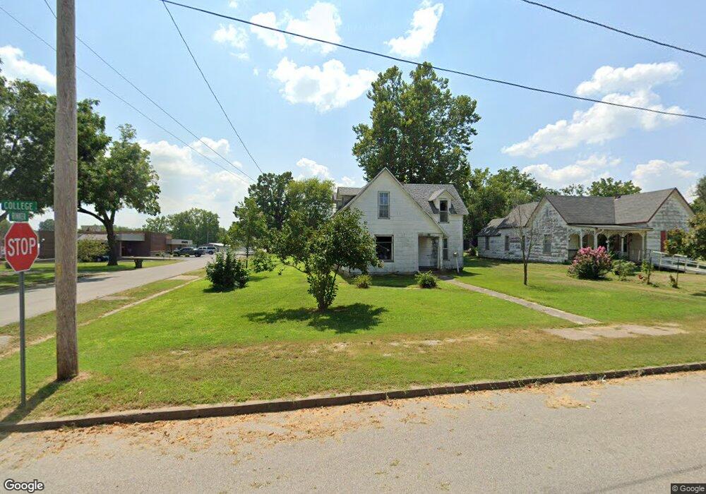
426 E College St Aurora, MO 65605
Estimated Value: $92,000 - $130,000
4
Beds
1
Bath
952
Sq Ft
$114/Sq Ft
Est. Value
About This Home
This home is located at 426 E College St, Aurora, MO 65605 and is currently estimated at $108,562, approximately $114 per square foot. 426 E College St is a home located in Lawrence County with nearby schools including Pate Early Childhood Center, Robinson Intermediate School, and Robinson Elementary School.
Ownership History
Date
Name
Owned For
Owner Type
Purchase Details
Closed on
Sep 14, 2022
Sold by
Morgan Cynthia P and Morgan Joseph D
Bought by
Valente Georgena Maria
Current Estimated Value
Purchase Details
Closed on
May 14, 2020
Sold by
Morgan Earvin
Bought by
Morgan Cynthia P and Morgan Joseph D
Purchase Details
Closed on
Nov 22, 2019
Sold by
Smith Jerry L and Smith Martha Ann
Bought by
Morgan Earvin
Create a Home Valuation Report for This Property
The Home Valuation Report is an in-depth analysis detailing your home's value as well as a comparison with similar homes in the area
Home Values in the Area
Average Home Value in this Area
Purchase History
| Date | Buyer | Sale Price | Title Company |
|---|---|---|---|
| Valente Georgena Maria | -- | -- | |
| Morgan Cynthia P | -- | None Available | |
| Morgan Earvin | -- | None Available |
Source: Public Records
Tax History
| Year | Tax Paid | Tax Assessment Tax Assessment Total Assessment is a certain percentage of the fair market value that is determined by local assessors to be the total taxable value of land and additions on the property. | Land | Improvement |
|---|---|---|---|---|
| 2025 | $151 | $3,020 | $1,520 | $1,500 |
| 2024 | $145 | $2,870 | $1,520 | $1,350 |
| 2023 | $144 | $2,870 | $1,520 | $1,350 |
| 2022 | $335 | $6,690 | $1,520 | $5,170 |
| 2021 | $336 | $6,690 | $1,520 | $5,170 |
| 2020 | $314 | $6,200 | $1,030 | $5,170 |
| 2019 | $309 | $6,200 | $1,030 | $5,170 |
| 2018 | $308 | $6,200 | $1,030 | $5,170 |
| 2017 | $307 | $6,200 | $1,030 | $5,170 |
| 2016 | -- | $5,690 | $1,030 | $4,660 |
| 2015 | -- | $5,690 | $1,030 | $4,660 |
| 2014 | -- | $5,690 | $1,030 | $4,660 |
Source: Public Records
Map
Nearby Homes
- 312 S Oak Ave
- 220 S Park Ave
- 216 S Elliott Ave
- 114 E College St
- 825 S Park Ave
- 537 S Jefferson Ave
- 112 N Madison Ave
- 000 Crescent St
- 806 E Springfield St
- 304 E Cofield St
- 23 W Anderson St
- 111 W Cofield St
- 1015 Mcphail Ave
- 141 W Pleasant St
- 1402 E Church St
- 303 N Hudson Ave
- 123 Cofield St
- 225 Morgan Ave
- 311 W Pleasant St
- 238 E Delta St
- 422 E College St
- 416 E College St
- 402 S Rinker Ave
- 404 E College St
- 425 E Church St Unit 60004003
- 425 E Church St
- 429 E College St
- 423 E College St
- 420 S Oak Ave
- 402 E College St
- 430 S Oak Ave
- 430 S Oak Ave
- 409 E College St
- 403 Oak Ave
- 403 S Oak Ave
- 401 E College St
- 509 E Church St
- 313 S Rinker Ave
- 313 S Rinker Ave Unit 1310150
- 428 E Church St
Your Personal Tour Guide
Ask me questions while you tour the home.