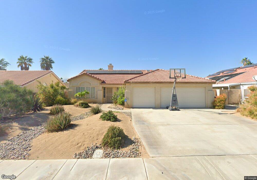
42603 Devonshire St Palm Desert, CA 92211
Palm Desert Country NeighborhoodEstimated Value: $533,848 - $623,000
3
Beds
3
Baths
2,139
Sq Ft
$272/Sq Ft
Est. Value
About This Home
This home is located at 42603 Devonshire St, Palm Desert, CA 92211 and is currently estimated at $580,962, approximately $271 per square foot. 42603 Devonshire St is a home located in Riverside County with nearby schools including Gerald R. Ford Elementary School, Colonel Mitchell Paige Middle School, and Palm Desert High School.
Ownership History
Date
Name
Owned For
Owner Type
Purchase Details
Closed on
Feb 25, 2011
Sold by
The Steven M & Jody L Phillips 2006 Trus
Bought by
Phillips Steven M and Phillips Jody L
Current Estimated Value
Home Financials for this Owner
Home Financials are based on the most recent Mortgage that was taken out on this home.
Original Mortgage
$148,600
Outstanding Balance
$101,717
Interest Rate
4.71%
Mortgage Type
New Conventional
Estimated Equity
$479,245
Purchase Details
Closed on
Feb 17, 2006
Sold by
Phillips Steven M and Phillips Jody
Bought by
The Steven M & Jody L Phillips 2006 Tr
Purchase Details
Closed on
Dec 6, 2000
Sold by
Saunders Mark L and Saunders Mary P
Bought by
Phillips Steven M and Phillips Jody
Home Financials for this Owner
Home Financials are based on the most recent Mortgage that was taken out on this home.
Original Mortgage
$168,000
Interest Rate
7.71%
Purchase Details
Closed on
Apr 13, 2000
Sold by
Saunders Mark L and Saunders Mary P
Bought by
Saunders Mark L and Saunders Mary P
Purchase Details
Closed on
Jan 6, 1999
Sold by
Lissey Albert O
Bought by
Saunders Mark L and Saunders Mary P
Home Financials for this Owner
Home Financials are based on the most recent Mortgage that was taken out on this home.
Original Mortgage
$120,000
Interest Rate
6.76%
Purchase Details
Closed on
Dec 14, 1998
Sold by
Lissoy Albert O and Lissoy Jill R
Bought by
Lissoy Albert O
Home Financials for this Owner
Home Financials are based on the most recent Mortgage that was taken out on this home.
Original Mortgage
$120,000
Interest Rate
6.76%
Purchase Details
Closed on
Jul 17, 1998
Sold by
Thottam Luke
Bought by
The Lissoy Family Trust
Purchase Details
Closed on
Jul 25, 1996
Sold by
Lissoy Albert O
Bought by
Far West Industries
Purchase Details
Closed on
Mar 14, 1996
Sold by
Far West Industries
Bought by
Thottam Luke and Thottam Peter
Create a Home Valuation Report for This Property
The Home Valuation Report is an in-depth analysis detailing your home's value as well as a comparison with similar homes in the area
Home Values in the Area
Average Home Value in this Area
Purchase History
| Date | Buyer | Sale Price | Title Company |
|---|---|---|---|
| Phillips Steven M | -- | Servicelink | |
| The Steven M & Jody L Phillips 2006 Tr | -- | None Available | |
| Phillips Steven M | $210,000 | Orange Coast Title | |
| Saunders Mark L | -- | -- | |
| Saunders Mark L | $170,000 | Fidelity National Title Co | |
| Lissoy Albert O | -- | Fidelity National Title Ins | |
| The Lissoy Family Trust | $154,921 | Fidelity National Title Co | |
| Far West Industries | -- | Fidelity National Title Ins | |
| Thottam Luke | -- | Fidelity National Title Ins |
Source: Public Records
Mortgage History
| Date | Status | Borrower | Loan Amount |
|---|---|---|---|
| Open | Phillips Steven M | $148,600 | |
| Closed | Phillips Steven M | $168,000 | |
| Previous Owner | Saunders Mark L | $120,000 | |
| Closed | Thottam Luke | $0 |
Source: Public Records
Tax History Compared to Growth
Tax History
| Year | Tax Paid | Tax Assessment Tax Assessment Total Assessment is a certain percentage of the fair market value that is determined by local assessors to be the total taxable value of land and additions on the property. | Land | Improvement |
|---|---|---|---|---|
| 2025 | $4,441 | $316,407 | $75,325 | $241,082 |
| 2023 | $4,441 | $304,122 | $72,401 | $231,721 |
| 2022 | $4,149 | $298,160 | $70,982 | $227,178 |
| 2021 | $4,050 | $292,315 | $69,591 | $222,724 |
| 2020 | $3,982 | $289,319 | $68,878 | $220,441 |
| 2019 | $3,909 | $283,647 | $67,528 | $216,119 |
| 2018 | $3,838 | $278,086 | $66,205 | $211,881 |
| 2017 | $3,778 | $272,634 | $64,907 | $207,727 |
| 2016 | $3,705 | $267,289 | $63,635 | $203,654 |
| 2015 | $3,704 | $263,276 | $62,680 | $200,596 |
| 2014 | $3,504 | $258,120 | $61,453 | $196,667 |
Source: Public Records
Map
Nearby Homes
- 42639 Devonshire St
- 77650 California Dr
- 77630 California Dr
- 77575 California Dr
- 77590 California Dr
- 42935 Texas Ave
- 77645 Mountain View
- 43170 Warner Trail
- 77380 Minnesota Ave
- 43140 Texas Ave
- 77583 Woodhaven Dr S Unit 832
- 77265 California Dr
- 77310 Minnesota Ave
- 41823 Preston Trail
- 77774 Woodhaven Dr S
- 42 Marricopa Ct
- 42605 Byron Place
- 41690 Woodhaven Dr W
- 42660 Iowa St
- 78135 Calico Glen Dr
- 42585 Devonshire St
- 42606 Sussex St
- 42644 Sussex St
- 42588 Sussex St
- 42659 Devonshire St
- 42608 Devonshire St
- 42662 Sussex St
- 42644 Devonshire St
- 42586 Devonshire St
- 77 California Dr
- 42662 Devonshire St
- 77672 Missouri Dr
- 77682 Missouri Dr
- 77662 Missouri Dr
- 77692 Missouri Dr
- 42605 Sussex St
- 42643 Sussex St
- 42587 Sussex St
- 42605 Hastings St
- 77644 Missouri Dr