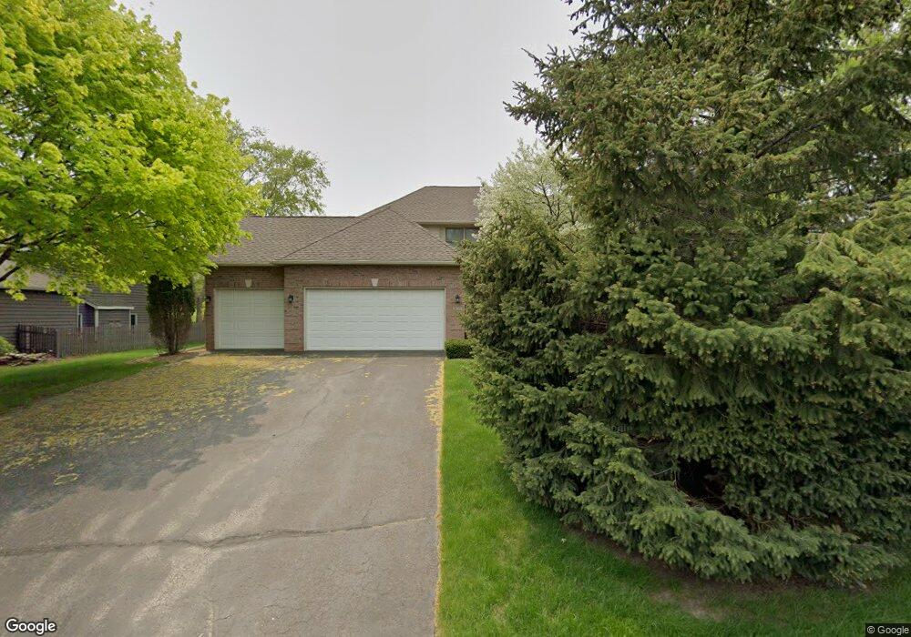
4262 Wexford Way Saint Paul, MN 55122
Estimated Value: $580,931 - $657,000
4
Beds
4
Baths
2,230
Sq Ft
$274/Sq Ft
Est. Value
About This Home
This home is located at 4262 Wexford Way, Saint Paul, MN 55122 and is currently estimated at $609,983, approximately $273 per square foot. 4262 Wexford Way is a home located in Dakota County with nearby schools including Thomas Lake Elementary School, Black Hawk Middle School, and Eastview Senior High School.
Ownership History
Date
Name
Owned For
Owner Type
Purchase Details
Closed on
Feb 28, 2013
Sold by
Sullivan Peggy
Bought by
The Peggy Ann Sullivan Living Trust
Current Estimated Value
Purchase Details
Closed on
Oct 29, 1998
Sold by
Sandor Paul A and Sandor Cathleen T
Bought by
Sullivan Peggy A
Purchase Details
Closed on
Mar 6, 1997
Sold by
Stock Lumber Inc
Bought by
Sandor Paul A and Sandor Cathleen T
Purchase Details
Closed on
Oct 14, 1996
Sold by
Stock Lumber Inc
Bought by
Stock Lumber Inc
Create a Home Valuation Report for This Property
The Home Valuation Report is an in-depth analysis detailing your home's value as well as a comparison with similar homes in the area
Home Values in the Area
Average Home Value in this Area
Purchase History
| Date | Buyer | Sale Price | Title Company |
|---|---|---|---|
| The Peggy Ann Sullivan Living Trust | -- | None Available | |
| Sullivan Peggy A | $244,900 | -- | |
| Sandor Paul A | $206,000 | -- | |
| Stock Lumber Inc | $33,334 | -- |
Source: Public Records
Tax History Compared to Growth
Tax History
| Year | Tax Paid | Tax Assessment Tax Assessment Total Assessment is a certain percentage of the fair market value that is determined by local assessors to be the total taxable value of land and additions on the property. | Land | Improvement |
|---|---|---|---|---|
| 2024 | $5,294 | $516,800 | $129,900 | $386,900 |
| 2023 | $4,686 | $487,400 | $130,300 | $357,100 |
| 2022 | $4,464 | $455,000 | $130,000 | $325,000 |
| 2021 | $4,630 | $398,100 | $113,000 | $285,100 |
| 2020 | $4,490 | $402,400 | $107,600 | $294,800 |
| 2019 | $4,395 | $381,200 | $102,500 | $278,700 |
| 2018 | $4,016 | $392,300 | $97,700 | $294,600 |
| 2017 | $4,140 | $349,800 | $93,000 | $256,800 |
| 2016 | $4,231 | $344,100 | $88,600 | $255,500 |
| 2015 | $4,232 | $342,407 | $87,101 | $255,306 |
| 2014 | -- | $348,402 | $84,885 | $263,517 |
| 2013 | -- | $304,257 | $75,943 | $228,314 |
Source: Public Records
Map
Nearby Homes
- 1612 Summit Hill
- 1610 Clemson Dr
- 4249 Boulder Ridge Point
- 4168 Arbor Ln
- 4163 Starbridge Ct
- 1680 Oakbrooke Ct
- 4199 Knob Cir Unit 102
- 4184 Knob Cir
- 4150 Knob Cir
- 4100 Meadowlark Ln
- 1676 Hickory Ln
- 4049 Deerwood Trail
- 4411 Clover Ln Unit A
- 4418 Clover Ln Unit B
- 4290 Blackhawk Rd
- 1655 Walnut Ln
- 4401 Clover Ln Unit B
- 1536 Stonewood Ln
- 1778 Walnut Ln
- 1630 Murphy Pkwy
- 4258 Wexford Way
- 1600 Wexford Cir
- 1592 Wexford Cir
- 4251 Wexford Way
- 4254 Wexford Way
- 4263 Wexford Way
- 1588 Wexford Cir
- 4247 Wexford Way
- 4259 Wexford Way
- 4250 Wexford Way
- 1605 Wexford Cir
- 1597 Wexford Cir
- 1601 Wexford Cir
- 1593 Wexford Cir
- 4267 Wexford Way
- 1585 Wexford Cir
- 4243 Wexford Way
- 1589 Wexford Cir
- 4270 Wexford Way
- 4301 Clemson Cir Unit B