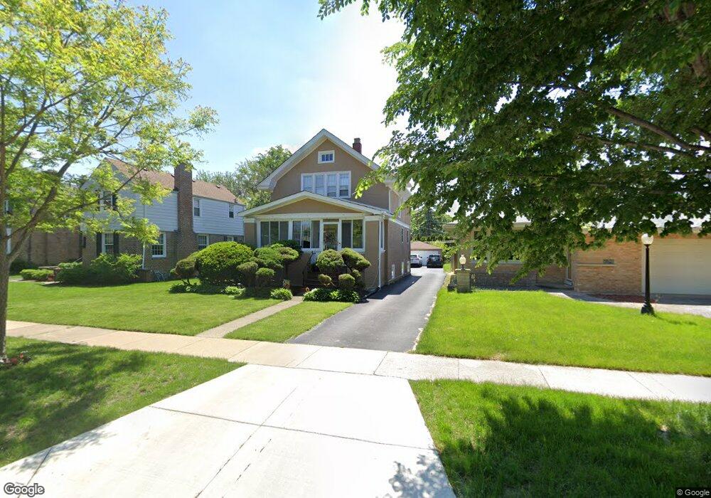
427 Shenstone Rd Riverside, IL 60546
Estimated Value: $481,484 - $551,000
3
Beds
1
Bath
1,604
Sq Ft
$324/Sq Ft
Est. Value
About This Home
This home is located at 427 Shenstone Rd, Riverside, IL 60546 and is currently estimated at $519,121, approximately $323 per square foot. 427 Shenstone Rd is a home located in Cook County with nearby schools including Blythe Park Elementary School, L J Hauser Jr High School, and Riverside Brookfield High School.
Ownership History
Date
Name
Owned For
Owner Type
Purchase Details
Closed on
Jan 29, 2001
Sold by
Zogas Christine
Bought by
Malloy Anthony and Malloy Rebecca
Current Estimated Value
Home Financials for this Owner
Home Financials are based on the most recent Mortgage that was taken out on this home.
Original Mortgage
$247,000
Interest Rate
7.22%
Create a Home Valuation Report for This Property
The Home Valuation Report is an in-depth analysis detailing your home's value as well as a comparison with similar homes in the area
Home Values in the Area
Average Home Value in this Area
Purchase History
| Date | Buyer | Sale Price | Title Company |
|---|---|---|---|
| Malloy Anthony | $260,500 | -- |
Source: Public Records
Mortgage History
| Date | Status | Borrower | Loan Amount |
|---|---|---|---|
| Closed | Malloy Anthony | $247,000 |
Source: Public Records
Tax History
| Year | Tax Paid | Tax Assessment Tax Assessment Total Assessment is a certain percentage of the fair market value that is determined by local assessors to be the total taxable value of land and additions on the property. | Land | Improvement |
|---|---|---|---|---|
| 2025 | $11,096 | $38,000 | $7,932 | $30,068 |
| 2024 | $11,096 | $38,000 | $7,932 | $30,068 |
| 2023 | $11,860 | $38,000 | $7,932 | $30,068 |
| 2022 | $11,860 | $34,385 | $6,941 | $27,444 |
| 2021 | $11,429 | $34,384 | $6,940 | $27,444 |
| 2020 | $11,793 | $36,230 | $6,940 | $29,290 |
| 2019 | $10,228 | $32,490 | $6,345 | $26,145 |
| 2018 | $9,926 | $32,490 | $6,345 | $26,145 |
| 2017 | $9,624 | $32,490 | $6,345 | $26,145 |
| 2016 | $9,377 | $29,124 | $5,552 | $23,572 |
| 2015 | $9,119 | $29,124 | $5,552 | $23,572 |
| 2014 | $8,981 | $29,124 | $5,552 | $23,572 |
| 2013 | $8,298 | $29,227 | $5,552 | $23,675 |
Source: Public Records
Map
Nearby Homes
- 475 Shenstone Rd Unit 104
- 475 Shenstone Rd Unit 304
- 475 Shenstone Rd Unit 303
- 369 Addison Rd
- 484 Shenstone Rd
- 478 Kent Rd
- 269 Shenstone Rd
- 3111 Wenonah Ave
- 562 Byrd Rd
- 7048 35th St
- 2816 Wenonah Ave
- 571 Byrd Rd
- 2817 Wenonah Ave
- 6828 30th Place
- 6840 29th Place
- 3330 Grove Ave Unit 1S
- 3303 Grove Ave Unit 310
- 231 Bartram Rd
- 3031 Oak Park Ave
- 2728 Grove Ave
- 429 Shenstone Rd
- 425 Shenstone Rd
- 435 Shenstone Rd
- 421 Shenstone Rd
- 439 Shenstone Rd
- 419 Shenstone Rd
- 398 Addison Rd
- 404 Addison Rd
- 396 Addison Rd
- 443 Shenstone Rd
- 417 Shenstone Rd
- 408 Addison Rd
- 392 Addison Rd
- 447 Shenstone Rd
- 415 Shenstone Rd
- 410 Addison Rd
- 416 Shenstone Rd
- 388 Addison Rd
- 436 Shenstone Rd
- 451 Shenstone Rd
Your Personal Tour Guide
Ask me questions while you tour the home.