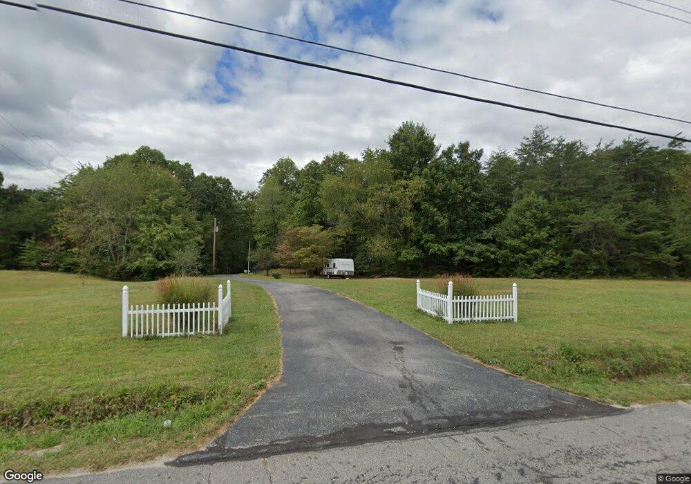
4278 Jonesville Rd Clarkrange, TN 38553
Estimated Value: $439,363 - $586,000
--
Bed
2
Baths
2,490
Sq Ft
$198/Sq Ft
Est. Value
About This Home
This home is located at 4278 Jonesville Rd, Clarkrange, TN 38553 and is currently estimated at $493,454, approximately $198 per square foot. 4278 Jonesville Rd is a home located in Fentress County.
Ownership History
Date
Name
Owned For
Owner Type
Purchase Details
Closed on
Jan 4, 2007
Sold by
Pearce Robert
Bought by
State Of Tennessee
Current Estimated Value
Purchase Details
Closed on
Aug 7, 2001
Bought by
Pearce Robert and Pearce Ronda
Purchase Details
Closed on
Nov 9, 2000
Bought by
Gunter James E
Purchase Details
Closed on
Aug 24, 1999
Bought by
Sharp Wilfred W and Sharp Betsy Kendall
Purchase Details
Closed on
May 13, 1997
Bought by
Gunter James E
Create a Home Valuation Report for This Property
The Home Valuation Report is an in-depth analysis detailing your home's value as well as a comparison with similar homes in the area
Home Values in the Area
Average Home Value in this Area
Purchase History
| Date | Buyer | Sale Price | Title Company |
|---|---|---|---|
| State Of Tennessee | $4,570 | -- | |
| Pearce Robert | $47,000 | -- | |
| Gunter James E | $5,300 | -- | |
| Sharp Wilfred W | $22,000 | -- | |
| Gunter James E | $15,000 | -- |
Source: Public Records
Tax History Compared to Growth
Tax History
| Year | Tax Paid | Tax Assessment Tax Assessment Total Assessment is a certain percentage of the fair market value that is determined by local assessors to be the total taxable value of land and additions on the property. | Land | Improvement |
|---|---|---|---|---|
| 2025 | $1,053 | $77,975 | $0 | $0 |
| 2024 | $1,053 | $77,975 | $7,650 | $70,325 |
| 2023 | $1,053 | $77,975 | $7,650 | $70,325 |
| 2022 | $918 | $48,075 | $5,925 | $42,150 |
| 2021 | $918 | $48,075 | $5,925 | $42,150 |
| 2020 | $918 | $48,075 | $5,925 | $42,150 |
| 2019 | $918 | $48,075 | $5,925 | $42,150 |
| 2018 | $918 | $48,075 | $5,925 | $42,150 |
| 2017 | $912 | $45,950 | $5,225 | $40,725 |
| 2016 | $912 | $45,950 | $5,225 | $40,725 |
| 2015 | $912 | $45,961 | $0 | $0 |
| 2014 | $912 | $45,961 | $0 | $0 |
Source: Public Records
Map
Nearby Homes
- 157 Triple J Tr
- 1561 Bicknell Rd
- 1182 Bill Black Rd
- 4420 Standing Rock Rd
- 4250 Standing Rock Rd
- 00 Standing Rock Rd
- 4504 Standing Rock Rd
- 1759 Meister Hills Rd 14 5 Acres
- 3179 Banner Springs Rd
- 1089 Bicknell Rd
- 135 Austin Ln
- 1292 Terry Ln
- 908 Riverchase Trail
- 908 River Chase Trail
- 1169 Terry Ln
- 0 Mae Unit 1286906
- 1255 Franklin Loop
- 545 Shelby Way
- 1101 Franklin Loop
- 1602 Hollis Poore Rd
- 4290 Jonesville Rd
- 4291 Jonesville Rd
- 4296 Jonesville Rd
- 4316 Jonesville Rd
- 0 Jonesville Rd Unit 648971
- 0 Jonesville Rd Unit 708570
- 0 Jonesville Rd Unit 783622
- 4105 Jonesville Rd
- 4320 Jonesville Rd
- 1956 Hall Rd
- 4319 Jonesville Rd Unit RD4319
- 4341 Jonesville Rd
- 4070 Jonesville Rd
- 1951 Hall Rd
- 0 Roslin Rd Unit RTC2827181
- 0 Roslin Rd Unit 1121656
- 0 Roslin Rd Unit 1058272
- 0 Roslin Rd Unit 1000090
- 1898 Hall Rd
- 701 Ernest Hall Rd
