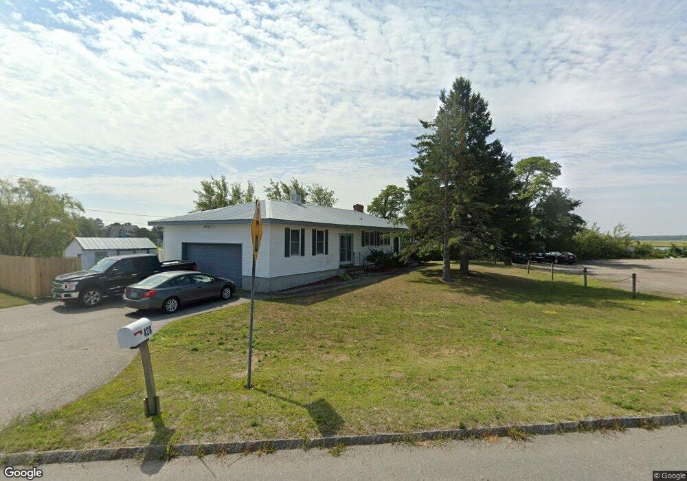
428 State Route 286 Seabrook, NH 03874
Seabrook Beach NeighborhoodEstimated Value: $664,334 - $992,000
2
Beds
2
Baths
1,288
Sq Ft
$589/Sq Ft
Est. Value
About This Home
This home is located at 428 State Route 286, Seabrook, NH 03874 and is currently estimated at $758,584, approximately $588 per square foot. 428 State Route 286 is a home with nearby schools including Triton Regional High School.
Ownership History
Date
Name
Owned For
Owner Type
Purchase Details
Closed on
Jun 28, 2021
Sold by
Markey Thomas F
Bought by
Bnr Seabrook Llc
Current Estimated Value
Home Financials for this Owner
Home Financials are based on the most recent Mortgage that was taken out on this home.
Original Mortgage
$300,000
Outstanding Balance
$272,203
Interest Rate
2.9%
Mortgage Type
Purchase Money Mortgage
Estimated Equity
$486,381
Purchase Details
Closed on
Mar 30, 2012
Sold by
Ferris Della and Ferris Joseph D
Bought by
Markeys Lobster Pound
Create a Home Valuation Report for This Property
The Home Valuation Report is an in-depth analysis detailing your home's value as well as a comparison with similar homes in the area
Home Values in the Area
Average Home Value in this Area
Purchase History
| Date | Buyer | Sale Price | Title Company |
|---|---|---|---|
| Bnr Seabrook Llc | $400,000 | None Available | |
| Markeys Lobster Pound | $249,500 | -- |
Source: Public Records
Mortgage History
| Date | Status | Borrower | Loan Amount |
|---|---|---|---|
| Open | Bnr Seabrook Llc | $300,000 |
Source: Public Records
Tax History Compared to Growth
Tax History
| Year | Tax Paid | Tax Assessment Tax Assessment Total Assessment is a certain percentage of the fair market value that is determined by local assessors to be the total taxable value of land and additions on the property. | Land | Improvement |
|---|---|---|---|---|
| 2024 | $8,212 | $700,700 | $530,400 | $170,300 |
| 2023 | $8,396 | $556,400 | $407,200 | $149,200 |
| 2022 | $7,372 | $556,400 | $407,200 | $149,200 |
| 2021 | $7,639 | $556,400 | $407,200 | $149,200 |
| 2020 | $2,072 | $434,700 | $325,500 | $109,200 |
| 2019 | $6,847 | $434,700 | $325,500 | $109,200 |
| 2018 | $7,075 | $417,900 | $308,700 | $109,200 |
| 2017 | $6,414 | $385,100 | $275,900 | $109,200 |
| 2016 | $5,605 | $379,000 | $279,900 | $99,100 |
| 2015 | $4,998 | $337,900 | $261,600 | $76,300 |
| 2014 | $5,160 | $337,900 | $261,600 | $76,300 |
| 2013 | $4,770 | $312,400 | $235,400 | $77,000 |
Source: Public Records
Map
Nearby Homes
- 308 State Route 286 Unit Lot 73
- 308 State Route 286 Unit Lot 108
- 308 State Route 286 Unit Lot 87
- 595 N End Blvd Unit 2
- 522 N End Blvd
- 498 N End Blvd
- 492 N End Blvd
- 479 N End Blvd
- 308 Route 286 Unit 77
- 308 Route 286 Unit Lot 58
- 432 N End Blvd
- 312 S Main St
- 27 Cross Beach Rd
- 9 Tyngsboro St
- 376 Ocean Blvd
- 18 River St
- 10 Liberty St
- 1 Old Salt Dr
- 188 N End Blvd Unit 3
- 178 N End Blvd Unit A
- 419 State Route 286
- 419 State Route 286 Unit 106
- 419 State Route 286 Unit 201
- 419 State Route 286 Unit 202
- 419 State Route 286 Unit 105
- 419 State Route 286 Unit 103
- 419 State Route 286 Unit 107
- 419 State Route 286 Unit 305
- 419 State Route 286 Unit 304
- 419 State Route 286 Unit 310
- 419 State Route 286 Unit 309
- 419 State Route 286 Unit 302
- 419 State Route 286 Unit 101
- 419 State Route 286 Unit 108
- 419 State Route 286 Unit 102
- 419 State Route 286 Unit 205
- 419 State Route 286 Unit Marsh-Mellow
- 419 Route 286 Unit 102
- 419 Route 286 Unit 306
- 419 Route 286 Unit 209