429 New Union Cir Dayton, TN 37321
Estimated Value: $236,829 - $290,000
--
Bed
2
Baths
1,334
Sq Ft
$204/Sq Ft
Est. Value
About This Home
This home is located at 429 New Union Cir, Dayton, TN 37321 and is currently estimated at $271,957, approximately $203 per square foot. 429 New Union Cir is a home located in Rhea County with nearby schools including Rhea County High School.
Ownership History
Date
Name
Owned For
Owner Type
Purchase Details
Closed on
Dec 20, 2022
Sold by
Kilpatrick Cindy L
Bought by
Brooks Kari
Current Estimated Value
Purchase Details
Closed on
Jul 12, 2011
Sold by
Mallory Lena S
Bought by
Kilpatrick Charles N and Kilpatrick Cindy L
Purchase Details
Closed on
Aug 7, 1991
Bought by
Kilpatrick Charles N and Kilpatrick Cindy L
Purchase Details
Closed on
Jan 18, 1990
Bought by
Bradell Kip D/B/A Bradell Const Co
Purchase Details
Closed on
Jun 24, 1977
Bought by
White Tommy and White Bonnie L
Purchase Details
Closed on
Jan 2, 1900
Bought by
Not Available
Create a Home Valuation Report for This Property
The Home Valuation Report is an in-depth analysis detailing your home's value as well as a comparison with similar homes in the area
Home Values in the Area
Average Home Value in this Area
Purchase History
| Date | Buyer | Sale Price | Title Company |
|---|---|---|---|
| Brooks Kari | -- | -- | |
| Kilpatrick Charles N | $10,500 | -- | |
| Kilpatrick Charles N | $53,000 | -- | |
| Bradell Kip D/B/A Bradell Const Co | -- | -- | |
| White Tommy | -- | -- | |
| -- | -- | -- |
Source: Public Records
Mortgage History
| Date | Status | Borrower | Loan Amount |
|---|---|---|---|
| Previous Owner | Kilpatrick Cindy L | $32,000 | |
| Previous Owner | Kilpatrick Charles N | $61,000 |
Source: Public Records
Tax History Compared to Growth
Tax History
| Year | Tax Paid | Tax Assessment Tax Assessment Total Assessment is a certain percentage of the fair market value that is determined by local assessors to be the total taxable value of land and additions on the property. | Land | Improvement |
|---|---|---|---|---|
| 2024 | $670 | $49,700 | $7,000 | $42,700 |
| 2023 | $722 | $32,000 | $4,075 | $27,925 |
| 2022 | $722 | $32,000 | $4,075 | $27,925 |
| 2021 | $722 | $32,000 | $4,075 | $27,925 |
| 2020 | $722 | $32,000 | $4,075 | $27,925 |
| 2019 | $710 | $31,500 | $4,075 | $27,425 |
| 2018 | $621 | $28,275 | $3,900 | $24,375 |
| 2017 | $621 | $28,275 | $3,900 | $24,375 |
| 2016 | $621 | $28,275 | $3,900 | $24,375 |
| 2015 | $593 | $28,275 | $3,900 | $24,375 |
| 2014 | $592 | $28,250 | $3,900 | $24,350 |
| 2013 | -- | $28,250 | $3,900 | $24,350 |
Source: Public Records
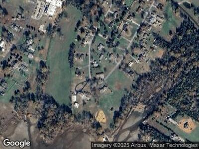
Map
Nearby Homes
- 3943 Double Rd S
- 281 Heavenlee Ln
- 253 Heavenlee Ln
- 1425 Shady Ln
- 1405 Shady Ln
- 1375 Shady Ln
- 1361 Shady Ln
- 3 Cottonport Rd
- 170 Blue Sky Dr
- 000 Blue Sky Dr
- 0 Blue Sky Dr Unit RTC2810495
- 0 Blue Sky Dr Unit RTC2810494
- 0 Blue Sky Dr Unit Tract 2
- 0 Blue Sky Dr Unit RTC2774527
- 0 Blue Sky Dr Unit 1505189
- 289 Overlook Dr
- 32 Overlook Dr
- 525 Overlook Dr
- 431 Overlook Dr
- 405 Overlook Dr
- 429 New Union Cir
- 343 New Union Cir
- 400 New Union Cir
- 354 New Union Cir
- 328 New Union Cir
- 328 New Union Cir
- 382 New Union Cir
- 311 New Union Cir
- 477 New Union Cir
- 480 New Union Cir
- 494 New Union Cir
- 300 New Union Cir
- 265 New Union Cir
- 265 New Union Cir
- 286 New Union Cir
- 512 New Union Cir
- 266 New Union Cir
- 548 New Union Cir
- 573 New Union Cir
- 203 New Union Cir