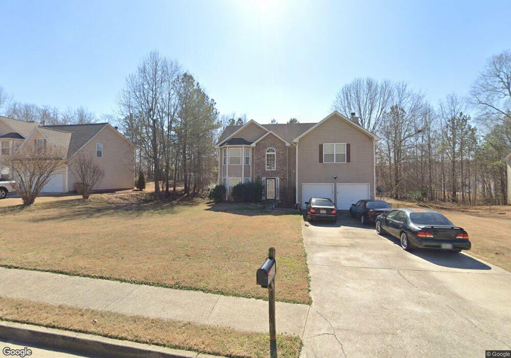
429 Peterson Dr Stockbridge, GA 30281
Estimated Value: $321,000 - $328,000
4
Beds
3
Baths
2,568
Sq Ft
$126/Sq Ft
Est. Value
About This Home
This home is located at 429 Peterson Dr, Stockbridge, GA 30281 and is currently estimated at $323,791, approximately $126 per square foot. 429 Peterson Dr is a home located in Henry County with nearby schools including Cotton Indian Elementary School, Stockbridge Middle School, and Stockbridge High School.
Ownership History
Date
Name
Owned For
Owner Type
Purchase Details
Closed on
Jul 11, 2018
Sold by
Benjamin Stacey E
Bought by
Benjamin James W
Current Estimated Value
Purchase Details
Closed on
Dec 10, 2004
Sold by
Homelife Communities Of Henry Inc
Bought by
Benjamin James W and Benjamin Stacey
Home Financials for this Owner
Home Financials are based on the most recent Mortgage that was taken out on this home.
Original Mortgage
$157,550
Interest Rate
5.66%
Mortgage Type
VA
Create a Home Valuation Report for This Property
The Home Valuation Report is an in-depth analysis detailing your home's value as well as a comparison with similar homes in the area
Home Values in the Area
Average Home Value in this Area
Purchase History
| Date | Buyer | Sale Price | Title Company |
|---|---|---|---|
| Benjamin James W | -- | -- | |
| Benjamin James W | $157,600 | -- |
Source: Public Records
Mortgage History
| Date | Status | Borrower | Loan Amount |
|---|---|---|---|
| Previous Owner | Benjamin James W | $157,550 |
Source: Public Records
Tax History Compared to Growth
Tax History
| Year | Tax Paid | Tax Assessment Tax Assessment Total Assessment is a certain percentage of the fair market value that is determined by local assessors to be the total taxable value of land and additions on the property. | Land | Improvement |
|---|---|---|---|---|
| 2024 | $4,537 | $114,760 | $14,000 | $100,760 |
| 2023 | $5,071 | $129,880 | $16,000 | $113,880 |
| 2022 | $3,874 | $98,680 | $10,000 | $88,680 |
| 2021 | $3,102 | $78,560 | $10,000 | $68,560 |
| 2020 | $2,828 | $71,400 | $8,000 | $63,400 |
| 2019 | $2,639 | $66,480 | $8,000 | $58,480 |
| 2018 | $2,272 | $56,920 | $8,000 | $48,920 |
| 2016 | $2,131 | $53,240 | $8,000 | $45,240 |
| 2015 | $1,906 | $45,960 | $6,000 | $39,960 |
| 2014 | $89 | $33,560 | $4,800 | $28,760 |
Source: Public Records
Map
Nearby Homes
- 297 Edison Dr
- 277 Edison Dr
- 135 Chimney Ridge Trail
- 128 Belair Ln Unit 1
- 0 Chimney Smoke Dr Unit 10412469
- 90 Chimney Rise Ct
- 135 Springvalley Way
- 0 Flakes Rd Unit 24
- 146 Springvalley Cir
- 0 Freeman Dr Unit 128 10480940
- 0 Freeman #128 Dr
- 0 Old Conyers Rd Unit 10574658
- 160 Springvalley Cir
- 364 Sound Cir
- 393 & 381 Old Conyers Rd
- 0 Oakview Dr Unit 10472931
- 0 Oakview Dr Unit 7533331
- 270 Mays Rd
- 180 Cowan Dr
- 159 Brookwood Estates Trail
- 429 Peterson Dr Unit 98/12
- 433 Peterson Dr
- 425 Peterson Dr
- 180 Edison Dr
- 184 Edison Dr
- 437 Peterson Dr
- 421 Peterson Dr
- 176 Edison Dr
- 428 Peterson Dr
- 432 Peterson Dr
- 424 Peterson Dr
- 0 Peterson Dr Unit 7500539
- 0 Peterson Dr Unit 8669531
- 0 Peterson Dr Unit 8656757
- 0 Peterson Dr Unit 8598258
- 0 Peterson Dr Unit 8458455
- 0 Peterson Dr Unit 7466491
- 0 Peterson Dr Unit 7275852
- 0 Peterson Dr Unit 8764540
- 0 Peterson Dr Unit 3261263