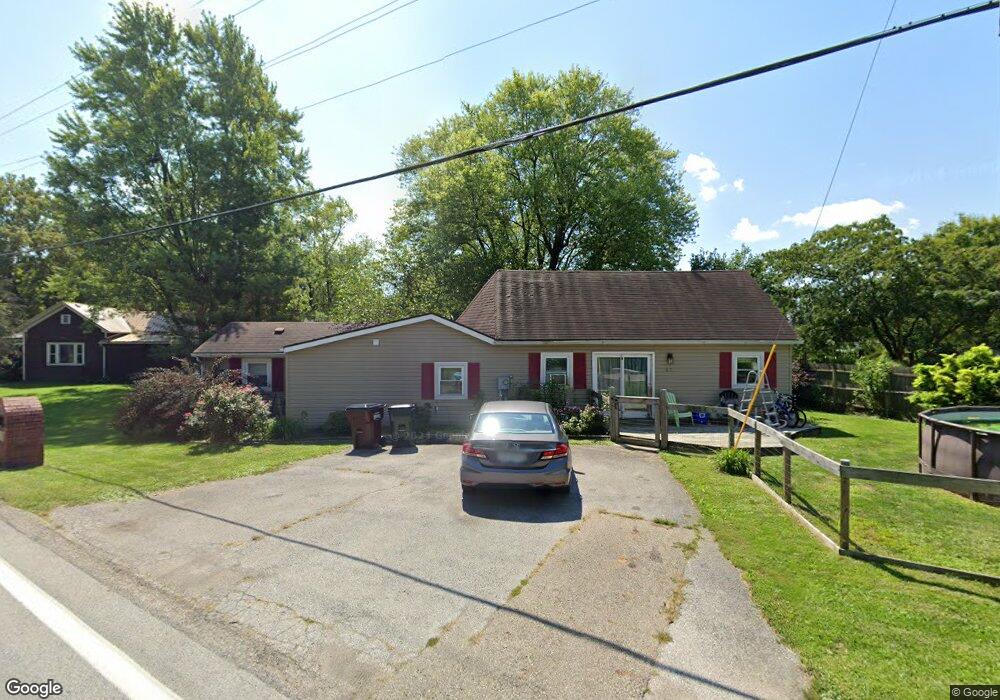
43 Main St Orient, OH 43146
Estimated Value: $129,897 - $285,000
3
Beds
1
Bath
1,366
Sq Ft
$145/Sq Ft
Est. Value
About This Home
This home is located at 43 Main St, Orient, OH 43146 and is currently estimated at $198,224, approximately $145 per square foot. 43 Main St is a home located in Pickaway County.
Ownership History
Date
Name
Owned For
Owner Type
Purchase Details
Closed on
Jan 28, 2022
Sold by
Wiles David
Bought by
Wiles David
Current Estimated Value
Home Financials for this Owner
Home Financials are based on the most recent Mortgage that was taken out on this home.
Original Mortgage
$92,592
Interest Rate
4.16%
Mortgage Type
FHA
Purchase Details
Closed on
Nov 16, 2005
Sold by
Bircher Sandra L
Bought by
Wiles David and Wiles Christy
Home Financials for this Owner
Home Financials are based on the most recent Mortgage that was taken out on this home.
Original Mortgage
$18,000
Interest Rate
5.73%
Mortgage Type
Stand Alone Second
Purchase Details
Closed on
Nov 18, 2004
Sold by
Bircher Kenneth L
Bought by
Bircher Sandra L
Purchase Details
Closed on
May 1, 1989
Create a Home Valuation Report for This Property
The Home Valuation Report is an in-depth analysis detailing your home's value as well as a comparison with similar homes in the area
Home Values in the Area
Average Home Value in this Area
Purchase History
| Date | Buyer | Sale Price | Title Company |
|---|---|---|---|
| Wiles David | -- | -- | |
| Wiles David | $90,000 | Valmer Land Title Agency | |
| Bircher Sandra L | -- | None Available | |
| -- | $10,500 | -- |
Source: Public Records
Mortgage History
| Date | Status | Borrower | Loan Amount |
|---|---|---|---|
| Previous Owner | Wiles David | $92,592 | |
| Previous Owner | Wiles David | $18,000 | |
| Previous Owner | Wiles David | $72,000 |
Source: Public Records
Tax History
| Year | Tax Paid | Tax Assessment Tax Assessment Total Assessment is a certain percentage of the fair market value that is determined by local assessors to be the total taxable value of land and additions on the property. | Land | Improvement |
|---|---|---|---|---|
| 2024 | -- | $21,340 | $2,970 | $18,370 |
| 2023 | $824 | $21,340 | $2,970 | $18,370 |
| 2022 | $608 | $14,470 | $2,440 | $12,030 |
| 2021 | $659 | $15,640 | $3,610 | $12,030 |
| 2020 | $659 | $15,640 | $3,610 | $12,030 |
| 2019 | $529 | $12,870 | $3,410 | $9,460 |
| 2018 | $516 | $12,870 | $3,410 | $9,460 |
| 2017 | $676 | $12,870 | $3,410 | $9,460 |
| 2016 | $499 | $12,110 | $3,220 | $8,890 |
| 2015 | $500 | $12,110 | $3,220 | $8,890 |
| 2014 | $5,582 | $12,110 | $3,220 | $8,890 |
| 2013 | $4,864 | $12,110 | $3,220 | $8,890 |
Source: Public Records
Map
Nearby Homes
- 305 Cherry Hills Rd
- 24 Erin Hills Rd
- 290 Olympic Loop
- 305 Olympic Loop
- 358 Oakmont Dr
- 359 Oakmont Dr
- 426 Bethpage Blvd
- 304 Cherry Hills Rd
- 277 Olympic Loop
- 284 Olympic Loop
- 282 Olympic Loop
- 507 Walker Pointe Dr
- 320 Cherry Hills Rd
- 338 Cherry Hills Rd
- 55 Genoa Cir
- 66 Genoa Cir
- 315 Genoa Rd
- 239 Peters Run Ct
- 484 Creekside Dr
- 38 Waterman Ave
Your Personal Tour Guide
Ask me questions while you tour the home.