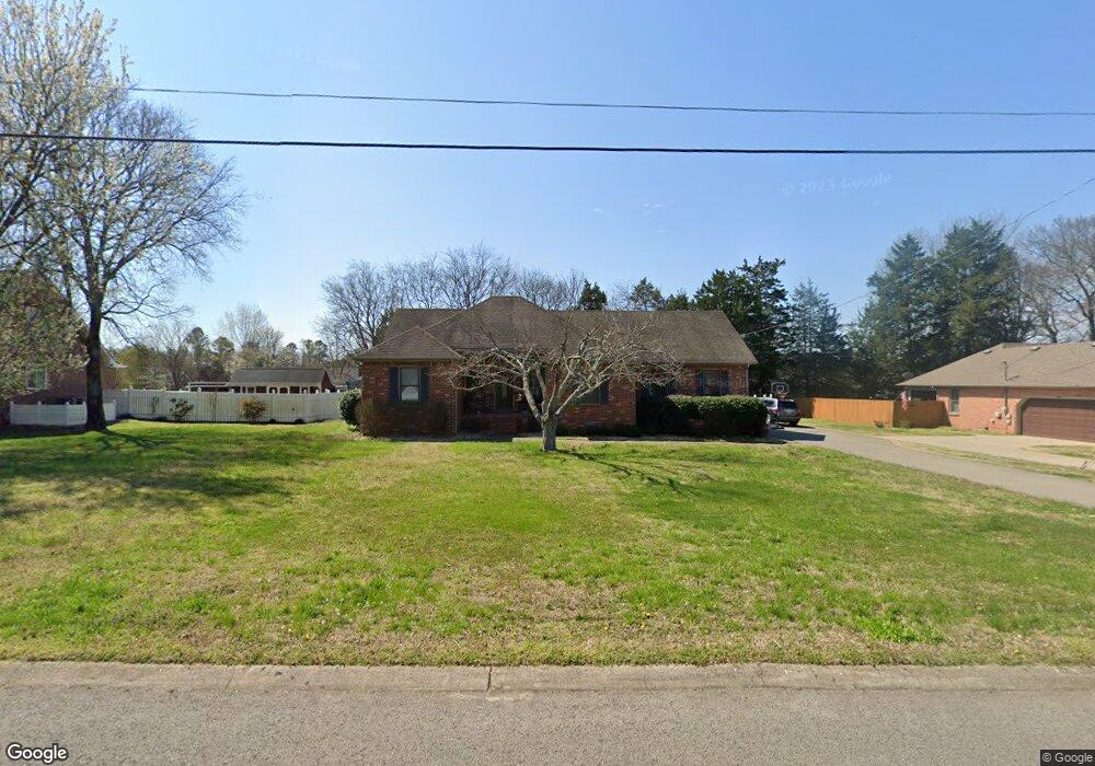
430 Whitney Dr Smyrna, TN 37167
Estimated Value: $393,733 - $481,000
--
Bed
3
Baths
1,764
Sq Ft
$252/Sq Ft
Est. Value
About This Home
This home is located at 430 Whitney Dr, Smyrna, TN 37167 and is currently estimated at $443,683, approximately $251 per square foot. 430 Whitney Dr is a home located in Rutherford County with nearby schools including Smyrna Elementary School, Smyrna Middle School, and Smyrna High School.
Ownership History
Date
Name
Owned For
Owner Type
Purchase Details
Closed on
Apr 11, 2011
Sold by
Cox Jesse W
Bought by
Cox Marc B
Current Estimated Value
Home Financials for this Owner
Home Financials are based on the most recent Mortgage that was taken out on this home.
Original Mortgage
$146,197
Outstanding Balance
$101,098
Interest Rate
4.85%
Mortgage Type
FHA
Estimated Equity
$342,585
Create a Home Valuation Report for This Property
The Home Valuation Report is an in-depth analysis detailing your home's value as well as a comparison with similar homes in the area
Home Values in the Area
Average Home Value in this Area
Purchase History
| Date | Buyer | Sale Price | Title Company |
|---|---|---|---|
| Cox Marc B | $150,000 | -- |
Source: Public Records
Mortgage History
| Date | Status | Borrower | Loan Amount |
|---|---|---|---|
| Open | Cox Marc B | $146,197 |
Source: Public Records
Tax History Compared to Growth
Tax History
| Year | Tax Paid | Tax Assessment Tax Assessment Total Assessment is a certain percentage of the fair market value that is determined by local assessors to be the total taxable value of land and additions on the property. | Land | Improvement |
|---|---|---|---|---|
| 2025 | $2,225 | $92,625 | $13,750 | $78,875 |
| 2024 | $2,225 | $92,625 | $13,750 | $78,875 |
| 2023 | $2,207 | $91,875 | $13,750 | $78,125 |
| 2022 | $1,968 | $91,875 | $13,750 | $78,125 |
| 2021 | $2,112 | $72,300 | $10,625 | $61,675 |
| 2020 | $2,112 | $72,300 | $10,625 | $61,675 |
| 2019 | $2,112 | $72,300 | $10,625 | $61,675 |
| 2018 | $2,025 | $72,300 | $0 | $0 |
| 2017 | $1,855 | $52,050 | $0 | $0 |
| 2016 | $1,855 | $52,050 | $0 | $0 |
| 2015 | $1,855 | $52,050 | $0 | $0 |
| 2014 | $1,294 | $52,050 | $0 | $0 |
| 2013 | -- | $48,225 | $0 | $0 |
Source: Public Records
Map
Nearby Homes
- 610 Virginia Belle Dr
- 307 Andy Johns Dr
- 112 Lakewood Cir
- 601 Mary Alice Dr
- 517 Matthew Miller Dr
- 402 Oakhaven Dr
- 1655 Ben Johns Rd
- 314 Lake Farm Rd
- 415 Lawson Rd
- 416 Lawson Rd
- 113 Joella Dr
- 111 Brandon Trail
- 402 Holston Dr
- 313 Mayfield Dr
- 401 Ravencliff Ct
- 7672 Knobdate Rd
- 7670 Knobdate
- 307 Dartford Ct
- 602 Mckean Dr
- 607 Mckean Dr
- 428 Whitney Dr
- 432 Whitney Dr
- 325 Andy Johns Dr
- 426 Whitney Dr
- 10001 Florence Rd
- 431 Whitney Dr
- 433 Whitney Dr
- 429 Whitney Dr
- 327 Andy Johns Dr
- 323 Andy Johns Dr
- 427 Whitney Dr
- 424 Whitney Dr
- 9975 Florence Rd
- 321 Andy Johns Dr
- 601 Virginia Belle Dr
- 10050 Florence Rd
- 525 Ellie Lee Dr
- 603 Virginia Belle Dr
- 425 Whitney Dr
- 523 Ellie Lee Dr