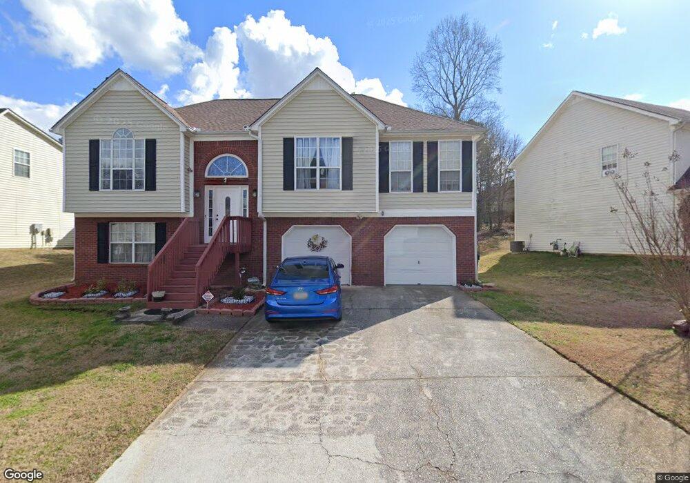
4303 Anderson Ridge Dr Austell, GA 30106
Estimated Value: $346,000 - $358,757
5
Beds
3
Baths
2,598
Sq Ft
$136/Sq Ft
Est. Value
About This Home
This home is located at 4303 Anderson Ridge Dr, Austell, GA 30106 and is currently estimated at $354,189, approximately $136 per square foot. 4303 Anderson Ridge Dr is a home located in Cobb County with nearby schools including Deerwood Elementary School, Clarkdale Elementary School, and Garrett Middle School.
Ownership History
Date
Name
Owned For
Owner Type
Purchase Details
Closed on
Nov 3, 2008
Sold by
Us Bank Na
Bought by
Culbreath Annie
Current Estimated Value
Home Financials for this Owner
Home Financials are based on the most recent Mortgage that was taken out on this home.
Original Mortgage
$111,034
Outstanding Balance
$71,894
Interest Rate
5.89%
Mortgage Type
FHA
Estimated Equity
$282,295
Purchase Details
Closed on
Sep 2, 2008
Sold by
Nwoko Nwoko I
Bought by
Us Bk Na
Purchase Details
Closed on
Dec 4, 1998
Sold by
King Jeffrey S
Bought by
King King J and King Banu-Koken
Home Financials for this Owner
Home Financials are based on the most recent Mortgage that was taken out on this home.
Original Mortgage
$125,100
Interest Rate
6.77%
Mortgage Type
New Conventional
Create a Home Valuation Report for This Property
The Home Valuation Report is an in-depth analysis detailing your home's value as well as a comparison with similar homes in the area
Home Values in the Area
Average Home Value in this Area
Purchase History
| Date | Buyer | Sale Price | Title Company |
|---|---|---|---|
| Culbreath Annie | $112,500 | -- | |
| Us Bk Na | $135,915 | -- | |
| King King J | -- | -- | |
| King Jeffrey S | $129,000 | -- |
Source: Public Records
Mortgage History
| Date | Status | Borrower | Loan Amount |
|---|---|---|---|
| Open | Culbreath Annie | $111,034 | |
| Previous Owner | King Jeffrey S | $125,100 |
Source: Public Records
Tax History Compared to Growth
Tax History
| Year | Tax Paid | Tax Assessment Tax Assessment Total Assessment is a certain percentage of the fair market value that is determined by local assessors to be the total taxable value of land and additions on the property. | Land | Improvement |
|---|---|---|---|---|
| 2025 | $951 | $133,116 | $14,000 | $119,116 |
| 2024 | $954 | $133,116 | $14,000 | $119,116 |
| 2023 | $748 | $133,116 | $14,000 | $119,116 |
| 2022 | $901 | $115,296 | $14,000 | $101,296 |
| 2021 | $820 | $88,304 | $14,000 | $74,304 |
| 2020 | $794 | $79,672 | $14,000 | $65,672 |
| 2019 | $694 | $67,996 | $12,000 | $55,996 |
| 2018 | $694 | $67,996 | $12,000 | $55,996 |
| 2017 | $476 | $55,184 | $6,000 | $49,184 |
| 2016 | $477 | $55,184 | $6,000 | $49,184 |
| 2015 | $298 | $34,956 | $6,000 | $28,956 |
| 2014 | $304 | $34,956 | $0 | $0 |
Source: Public Records
Map
Nearby Homes
- 4305 Anderson Ridge Dr
- 4301 Anderson Ridge Dr
- 4272 Anderson Ridge Way
- 4307 Anderson Ridge Dr
- 4302 Anderson Ridge Dr
- 4266 Anderson Ridge Way
- 4304 Anderson Ridge Dr
- 4274 Anderson Ridge Way
- 4309 Anderson Ridge Dr
- 4306 Anderson Ridge Dr
- 4269 Anderson Ridge Way
- 4267 Anderson Ridge Way
- 4271 Anderson Ridge Way
- 4275 Anderson Ridge Way
- 4311 Anderson Ridge Dr
- 4262 Anderson Ridge Way
- 4308 Anderson Ridge Dr
- 4265 Anderson Ridge Way
- 4273 Anderson Ridge Way
- 4256 Anderson Ridge Way