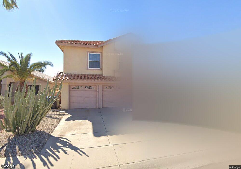
4309 E Silverwood Dr Phoenix, AZ 85048
Ahwatukee NeighborhoodEstimated Value: $501,788 - $585,000
Studio
3
Baths
2,303
Sq Ft
$240/Sq Ft
Est. Value
About This Home
This home is located at 4309 E Silverwood Dr, Phoenix, AZ 85048 and is currently estimated at $553,447, approximately $240 per square foot. 4309 E Silverwood Dr is a home located in Maricopa County with nearby schools including Kyrene del Milenio, Kyrene Akimel A-al Middle School, and Desert Vista High School.
Ownership History
Date
Name
Owned For
Owner Type
Purchase Details
Closed on
Feb 7, 2024
Sold by
Falstad Earl P and Falstad Olive E
Bought by
Falstad Family Living Trust and Falstad
Current Estimated Value
Purchase Details
Closed on
Jan 29, 1998
Sold by
Falstad Earl P
Bought by
Falstad Earl P and Falstad Olive E
Purchase Details
Closed on
Sep 26, 1994
Sold by
Falstad Olive E
Bought by
Falstad Earl P
Purchase Details
Closed on
Jun 29, 1994
Sold by
Namock M Keith and Namock Cathy J
Bought by
Falstad Earl P
Home Financials for this Owner
Home Financials are based on the most recent Mortgage that was taken out on this home.
Original Mortgage
$75,000
Interest Rate
5.5%
Mortgage Type
New Conventional
Create a Home Valuation Report for This Property
The Home Valuation Report is an in-depth analysis detailing your home's value as well as a comparison with similar homes in the area
Home Values in the Area
Average Home Value in this Area
Purchase History
| Date | Buyer | Sale Price | Title Company |
|---|---|---|---|
| Falstad Family Living Trust | -- | None Listed On Document | |
| Falstad Earl P | -- | Transnation Title Insurance | |
| Falstad Earl P | -- | Fidelity Title | |
| Falstad Earl P | $139,900 | Fidelity Title |
Source: Public Records
Mortgage History
| Date | Status | Borrower | Loan Amount |
|---|---|---|---|
| Previous Owner | Falstad Earl P | $75,000 |
Source: Public Records
Tax History
| Year | Tax Paid | Tax Assessment Tax Assessment Total Assessment is a certain percentage of the fair market value that is determined by local assessors to be the total taxable value of land and additions on the property. | Land | Improvement |
|---|---|---|---|---|
| 2025 | $2,961 | $33,037 | -- | -- |
| 2024 | $2,819 | $31,464 | -- | -- |
| 2023 | $2,819 | $42,060 | $8,410 | $33,650 |
| 2022 | $2,684 | $31,020 | $6,200 | $24,820 |
| 2021 | $2,800 | $29,330 | $5,860 | $23,470 |
| 2020 | $2,730 | $28,560 | $5,710 | $22,850 |
| 2019 | $2,643 | $27,530 | $5,500 | $22,030 |
| 2018 | $2,553 | $26,260 | $5,250 | $21,010 |
| 2017 | $2,437 | $25,930 | $5,180 | $20,750 |
| 2016 | $2,469 | $26,020 | $5,200 | $20,820 |
| 2015 | $2,211 | $22,220 | $4,440 | $17,780 |
Source: Public Records
Map
Nearby Homes
- 16044 S 41st Place
- 4114 E Muirwood Dr
- 4043 E Mountain Vista Dr
- 16232 S 41st St
- 4612 E Mountain Vista Dr
- 16629 S 44th Place
- 4251 E South Fork Dr
- 4114 E Liberty Ln
- 4457 E Verbena Dr
- 4533 E Glenhaven Dr
- 4338 E South Fork Dr Unit 8E
- 4315 E Redwood Ln
- 3925 E Wildwood Dr
- 4331 E Redwood Ln
- 4448 E Redwood Ln
- 4425 E Mountain Sky Ave
- 16620 S 48th St Unit 70
- 16620 S 48th St Unit 96
- 16620 S 48th St Unit 80
- 4745 E Silverwood Dr
- 4305 E Silverwood Dr
- 4313 E Silverwood Dr
- 4301 E Silverwood Dr
- 4317 E Silverwood Dr
- 4310 E Amberwood Dr
- 4240 E Amberwood Dr
- 4310 E Silverwood Dr
- 4306 E Silverwood Dr
- 4314 E Silverwood Dr
- 4217 E Silverwood Dr
- 4236 E Amberwood Dr
- 4314 E Amberwood Dr
- 4325 E Silverwood Dr
- 4302 E Silverwood Dr
- 4318 E Silverwood Dr
- 4232 E Amberwood Dr
- 4218 E Silverwood Dr
- 4318 E Amberwood Dr
- 4213 E Silverwood Dr
- 4322 E Silverwood Dr
Your Personal Tour Guide
Ask me questions while you tour the home.