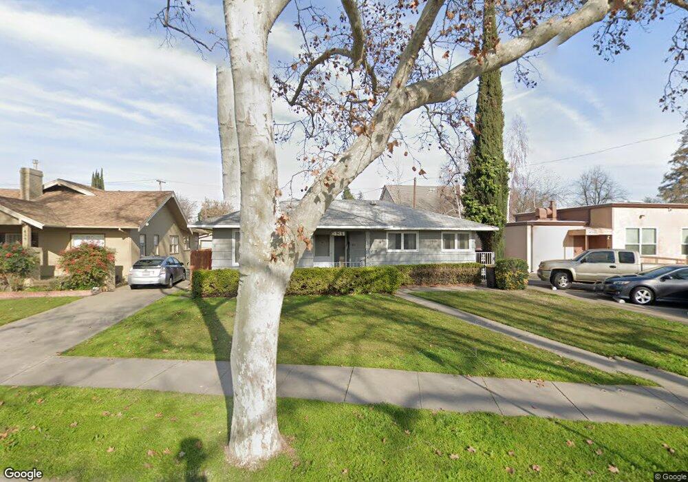
431 Bristol Ave Stockton, CA 95204
Midtown NeighborhoodEstimated Value: $349,000 - $399,000
1
Bed
1
Bath
1,212
Sq Ft
$308/Sq Ft
Est. Value
About This Home
This home is located at 431 Bristol Ave, Stockton, CA 95204 and is currently estimated at $373,415, approximately $308 per square foot. 431 Bristol Ave is a home located in San Joaquin County with nearby schools including Wilson Elementary School, El Dorado Elementary School, and Cleveland Elementary School.
Ownership History
Date
Name
Owned For
Owner Type
Purchase Details
Closed on
Aug 31, 2016
Sold by
Roach James R
Bought by
Roach James R and Roach Linda L
Current Estimated Value
Purchase Details
Closed on
May 13, 2014
Sold by
Roach Stephen G and The Jeanne Croce Revocable Liv
Bought by
Roach Stephen G and Roach James R
Purchase Details
Closed on
Jan 14, 2003
Sold by
Croce Jeanne
Bought by
Croce Jeanne and Roach Stephen G
Purchase Details
Closed on
Mar 20, 2001
Sold by
Croce Dave J
Bought by
Croce Dave J and Croce Jeanne
Create a Home Valuation Report for This Property
The Home Valuation Report is an in-depth analysis detailing your home's value as well as a comparison with similar homes in the area
Home Values in the Area
Average Home Value in this Area
Purchase History
| Date | Buyer | Sale Price | Title Company |
|---|---|---|---|
| Roach James R | -- | None Available | |
| Roach Stephen G | -- | None Available | |
| Croce Jeanne | -- | -- | |
| Croce Dave J | -- | Central Valley Title Company |
Source: Public Records
Tax History
| Year | Tax Paid | Tax Assessment Tax Assessment Total Assessment is a certain percentage of the fair market value that is determined by local assessors to be the total taxable value of land and additions on the property. | Land | Improvement |
|---|---|---|---|---|
| 2025 | $529 | $73,584 | $20,833 | $52,751 |
| 2024 | $80 | $72,142 | $20,425 | $51,717 |
| 2023 | $508 | $70,728 | $20,025 | $50,703 |
| 2022 | $890 | $69,342 | $19,633 | $49,709 |
| 2021 | $856 | $67,984 | $19,249 | $48,735 |
| 2020 | $872 | $67,288 | $19,052 | $48,236 |
| 2019 | $868 | $65,970 | $18,679 | $47,291 |
| 2018 | $852 | $64,677 | $18,313 | $46,364 |
| 2017 | $808 | $63,409 | $17,954 | $45,455 |
| 2016 | $822 | $62,166 | $17,602 | $44,564 |
| 2014 | $696 | $60,033 | $16,998 | $43,035 |
Source: Public Records
Map
Nearby Homes
- 450 Bristol Ave
- 618 N Regent St
- 456 S Regent St
- 2730 Dwight Way
- 625 N Central Ave
- 3227 Bonnie Ln
- 44 W Alpine Ave
- 11 E Geary St
- 465 S Tuxedo Ave
- 61 E Ellis St
- 64 E Noble St
- 52 W Adams St
- 915 W Mariposa Ave
- 2820 N El Dorado St
- 116 E Noble St
- 122 E Monterey Ave
- 686 S Tuxedo Ave
- 2634 Clarendon Ave
- 430 Bedford Rd
- 1030 Elmwood Ave
- 439 Bristol Ave
- 418 Smith Ln
- 447 Bristol Ave
- 2757 Pacific Ave
- 453 Bristol Ave
- 424 W Monterey Ave
- 416 W Monterey Ave
- 442 Bristol Ave
- 436 W Monterey Ave
- 434 Bristol Ave
- 2811 Pacific Ave
- 424 Bristol Ave
- 460 Bristol Ave
- 446 W Monterey Ave
- 471 Bristol Ave
- 420 Bristol Ave
- 466 Bristol Ave
- 454 W Monterey Ave
- 421 N Regent St
- 421 N Regent St
Your Personal Tour Guide
Ask me questions while you tour the home.