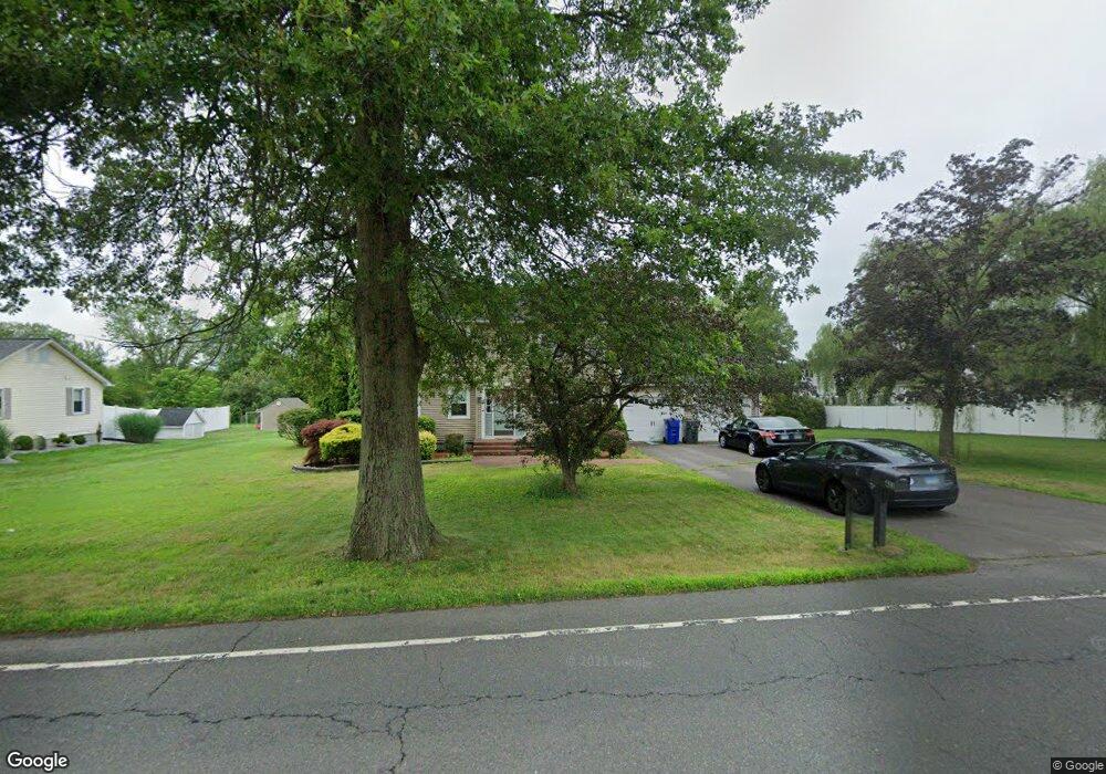
431 Thompsonville Rd Suffield, CT 06078
Estimated Value: $512,996 - $642,000
3
Beds
3
Baths
2,033
Sq Ft
$279/Sq Ft
Est. Value
About This Home
This home is located at 431 Thompsonville Rd, Suffield, CT 06078 and is currently estimated at $567,749, approximately $279 per square foot. 431 Thompsonville Rd is a home located in Hartford County with nearby schools including A. Ward Spaulding School, Mcalister Intermediate School, and Suffield Middle School.
Ownership History
Date
Name
Owned For
Owner Type
Purchase Details
Closed on
Nov 21, 2003
Sold by
Moores Robert and Moores Renee
Bought by
Wood Richard and Wood Julie
Current Estimated Value
Home Financials for this Owner
Home Financials are based on the most recent Mortgage that was taken out on this home.
Original Mortgage
$270,000
Interest Rate
5.98%
Purchase Details
Closed on
Jun 20, 1996
Sold by
Fhlmc
Bought by
Moores Robert and Moores Renee
Create a Home Valuation Report for This Property
The Home Valuation Report is an in-depth analysis detailing your home's value as well as a comparison with similar homes in the area
Home Values in the Area
Average Home Value in this Area
Purchase History
We collect this data history from publicly available records. To have your information removed, we recommend requesting removal directly through your county’s website.
| Date | Buyer | Sale Price | Title Company |
|---|---|---|---|
| Wood Richard | $300,000 | -- | |
| Moores Robert | $144,000 | -- |
Source: Public Records
Mortgage History
We collect this data history from publicly available records. To have your information removed, we recommend requesting removal directly through your county’s website.
| Date | Status | Borrower | Loan Amount |
|---|---|---|---|
| Closed | Moores Robert | $200,000 | |
| Closed | Moores Robert | $270,000 | |
| Previous Owner | Moores Robert | $50,000 | |
| Previous Owner | Moores Robert | $40,000 |
Source: Public Records
Tax History
| Year | Tax Paid | Tax Assessment Tax Assessment Total Assessment is a certain percentage of the fair market value that is determined by local assessors to be the total taxable value of land and additions on the property. | Land | Improvement |
|---|---|---|---|---|
| 2025 | $7,037 | $300,580 | $58,240 | $242,340 |
| 2024 | $6,802 | $300,580 | $58,240 | $242,340 |
| 2023 | $5,928 | $207,200 | $58,240 | $148,960 |
| 2022 | $5,928 | $207,200 | $58,240 | $148,960 |
| 2021 | $5,884 | $205,450 | $58,240 | $147,210 |
| 2020 | $5,884 | $205,450 | $58,240 | $147,210 |
| 2019 | $5,901 | $205,450 | $58,240 | $147,210 |
| 2018 | $5,929 | $202,230 | $58,030 | $144,200 |
| 2017 | $5,842 | $202,230 | $58,030 | $144,200 |
| 2016 | $5,703 | $202,230 | $58,030 | $144,200 |
| 2015 | $5,618 | $202,230 | $58,030 | $144,200 |
| 2014 | $5,484 | $202,230 | $58,030 | $144,200 |
Source: Public Records
Map
Nearby Homes
- 98 Kildeer Ln
- 278 Thompsonville Rd
- 98 1st St
- 45 Douglas St
- 8 Greendale Dr Unit 8
- 44 Farmstead Ln
- 230 E Bass Ln
- 886 Overhill Dr
- 921 Thompsonville Rd
- 551 N Main St
- 763 North St
- 92 Spring Ln Unit 92
- 7 Heather Ln
- 17 Heather Ln
- 36 Primrose Ln
- 90 Russell Ave
- 371 N Main St
- 67 Countryside Ln
- 160 Canal Rd
- 949 North St
- 447 Thompsonville Rd
- 11 Quail Run Rd
- 21 Quail Run Rd
- 461 Thompsonville Rd
- 414 Thompsonville Rd
- 31 Quail Run Rd
- 475 Thompsonville Rd
- 426 Thompsonville Rd
- 41 Quail Run Rd
- 402 Thompsonville Rd
- 390 Thompsonville Rd
- 12 Quail Run Rd
- 22 Quail Run Rd
- 491 Thompsonville Rd
- 32 Quail Run Rd
- 440 Thompsonville Rd
- 42 Quail Run Rd
- 51 Quail Run Rd
- 341 Quail Run Rd
- 378 Thompsonville Rd
Your Personal Tour Guide
Ask me questions while you tour the home.