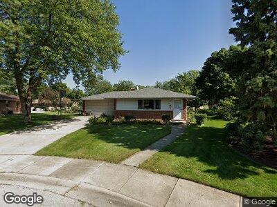
431 W Millers Rd Des Plaines, IL 60016
Estimated Value: $408,000 - $466,000
3
Beds
2
Baths
1,203
Sq Ft
$352/Sq Ft
Est. Value
About This Home
This home is located at 431 W Millers Rd, Des Plaines, IL 60016 and is currently estimated at $423,520, approximately $352 per square foot. 431 W Millers Rd is a home located in Cook County with nearby schools including Brentwood Elementary School, Friendship Jr High School, and Elk Grove High School.
Ownership History
Date
Name
Owned For
Owner Type
Purchase Details
Closed on
Oct 14, 2009
Sold by
Myasein Myasein Charles Charles and Myasein Hallier Thida
Bought by
Myasein Charles and Myasein Zaw Myo Htet F
Current Estimated Value
Home Financials for this Owner
Home Financials are based on the most recent Mortgage that was taken out on this home.
Original Mortgage
$202,000
Interest Rate
5.1%
Mortgage Type
New Conventional
Purchase Details
Closed on
Sep 12, 2005
Sold by
Myasein Charles and Mya Thida
Bought by
Myasein Charles and Myasein Thida
Home Financials for this Owner
Home Financials are based on the most recent Mortgage that was taken out on this home.
Original Mortgage
$261,600
Interest Rate
5.37%
Mortgage Type
Unknown
Purchase Details
Closed on
Mar 21, 2001
Sold by
Artemenko Annabell
Bought by
Myasein Charles and Mya Thida
Home Financials for this Owner
Home Financials are based on the most recent Mortgage that was taken out on this home.
Original Mortgage
$177,400
Interest Rate
7.02%
Create a Home Valuation Report for This Property
The Home Valuation Report is an in-depth analysis detailing your home's value as well as a comparison with similar homes in the area
Home Values in the Area
Average Home Value in this Area
Purchase History
| Date | Buyer | Sale Price | Title Company |
|---|---|---|---|
| Myasein Charles | -- | Chicago Title Insurance Co | |
| Myasein Charles | -- | Netco | |
| Myasein Charles | $222,000 | -- |
Source: Public Records
Mortgage History
| Date | Status | Borrower | Loan Amount |
|---|---|---|---|
| Open | Myasein Charles | $164,130 | |
| Closed | Myasein Charles | $202,000 | |
| Closed | Myasein Charles | $261,600 | |
| Closed | Myasein Charles | $177,400 |
Source: Public Records
Tax History Compared to Growth
Tax History
| Year | Tax Paid | Tax Assessment Tax Assessment Total Assessment is a certain percentage of the fair market value that is determined by local assessors to be the total taxable value of land and additions on the property. | Land | Improvement |
|---|---|---|---|---|
| 2024 | $6,745 | $34,000 | $8,153 | $25,847 |
| 2023 | $6,745 | $34,000 | $8,153 | $25,847 |
| 2022 | $6,745 | $34,000 | $8,153 | $25,847 |
| 2021 | $3,332 | $26,366 | $5,435 | $20,931 |
| 2020 | $3,036 | $26,366 | $5,435 | $20,931 |
| 2019 | $3,053 | $29,296 | $5,435 | $23,861 |
| 2018 | $3,457 | $23,790 | $4,529 | $19,261 |
| 2017 | $3,335 | $23,790 | $4,529 | $19,261 |
| 2016 | $3,868 | $23,790 | $4,529 | $19,261 |
| 2015 | $4,338 | $20,288 | $4,076 | $16,212 |
| 2014 | $4,200 | $20,288 | $4,076 | $16,212 |
| 2013 | $3,708 | $20,288 | $4,076 | $16,212 |
Source: Public Records
Map
Nearby Homes
- 567 W Dempster St
- 200 Marshall Dr
- 745 Dulles Rd Unit C
- 884 Arnold Ct
- 857 Beau Dr Unit 9
- 940 Beau Dr Unit 111
- 500 W Huntington Commons Rd Unit 152
- 502 W Huntington Commons Rd Unit 136
- 1048 Marshall Dr
- 1103 S Hunt Club Dr Unit 127
- 1103 S Hunt Club Dr Unit 325
- 1103 S Hunt Club Dr Unit 331
- 1024 S Hunt Club Dr
- 410 Dorothy Dr
- 220 E Washington St
- 901 S Westgate Rd
- 503 Dempster St
- 355 S Westgate Rd
- 229 Leahy Cir S
- 725 W Huntington Commons Rd Unit 407
- 431 W Millers Rd
- 417 W Millers Rd
- 445 W Millers Rd
- 566 Marshall Dr Unit 6
- 578 Marshall Dr
- 403 W Millers Rd
- 459 W Millers Rd
- 473 W Millers Rd
- 420 W Millers Rd
- 438 W Millers Rd
- 487 W Millers Rd
- 402 W Millers Rd
- 456 W Millers Rd
- 575 Marshall Dr
- 421 Sandy Ln
- 391 W Millers Rd
- 439 Sandy Ln
- 585 Marshall Dr
- 503 W Millers Rd
- 403 Sandy Ln