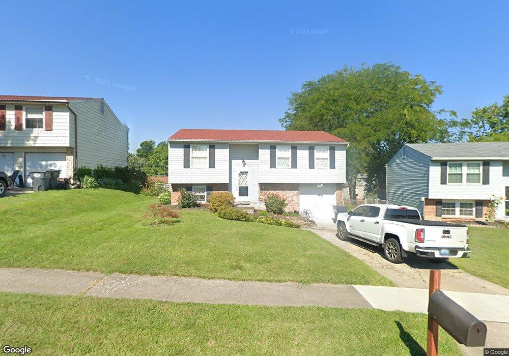
4310 Delryan Dr Cincinnati, OH 45238
Delshire NeighborhoodEstimated Value: $244,000 - $254,000
4
Beds
2
Baths
1,484
Sq Ft
$167/Sq Ft
Est. Value
About This Home
This home is located at 4310 Delryan Dr, Cincinnati, OH 45238 and is currently estimated at $247,511, approximately $166 per square foot. 4310 Delryan Dr is a home located in Hamilton County with nearby schools including Delshire Elementary School, Delhi Middle School, and Oak Hills High School.
Ownership History
Date
Name
Owned For
Owner Type
Purchase Details
Closed on
May 17, 2004
Sold by
Moore Richard A and Moore Kimberly F
Bought by
Masic Senad and Masic Beti
Current Estimated Value
Home Financials for this Owner
Home Financials are based on the most recent Mortgage that was taken out on this home.
Original Mortgage
$118,275
Outstanding Balance
$54,477
Interest Rate
5.25%
Mortgage Type
Unknown
Estimated Equity
$193,034
Purchase Details
Closed on
Aug 31, 1994
Sold by
Vollhardt Michael R and Vollhardt Charlene R
Bought by
Moore Richard A and Moore Kimberly F
Home Financials for this Owner
Home Financials are based on the most recent Mortgage that was taken out on this home.
Original Mortgage
$89,850
Interest Rate
8.65%
Mortgage Type
FHA
Create a Home Valuation Report for This Property
The Home Valuation Report is an in-depth analysis detailing your home's value as well as a comparison with similar homes in the area
Home Values in the Area
Average Home Value in this Area
Purchase History
| Date | Buyer | Sale Price | Title Company |
|---|---|---|---|
| Masic Senad | -- | -- | |
| Moore Richard A | -- | -- |
Source: Public Records
Mortgage History
| Date | Status | Borrower | Loan Amount |
|---|---|---|---|
| Open | Masic Senad | $118,275 | |
| Closed | Moore Richard A | $89,850 |
Source: Public Records
Tax History Compared to Growth
Tax History
| Year | Tax Paid | Tax Assessment Tax Assessment Total Assessment is a certain percentage of the fair market value that is determined by local assessors to be the total taxable value of land and additions on the property. | Land | Improvement |
|---|---|---|---|---|
| 2024 | $3,802 | $65,517 | $7,385 | $58,132 |
| 2023 | $4,071 | $65,517 | $7,385 | $58,132 |
| 2022 | $3,224 | $45,287 | $7,207 | $38,080 |
| 2021 | $3,168 | $45,287 | $7,207 | $38,080 |
| 2020 | $2,949 | $45,287 | $7,207 | $38,080 |
| 2019 | $2,691 | $37,121 | $5,908 | $31,213 |
| 2018 | $2,694 | $37,121 | $5,908 | $31,213 |
| 2017 | $2,434 | $37,121 | $5,908 | $31,213 |
| 2016 | $2,622 | $40,142 | $6,755 | $33,387 |
| 2015 | $2,625 | $40,142 | $6,755 | $33,387 |
| 2014 | $2,628 | $40,142 | $6,755 | $33,387 |
| 2013 | $2,523 | $40,961 | $6,892 | $34,069 |
Source: Public Records
Map
Nearby Homes
- 4351 Mount Alverno Rd
- 4340 Valence Dr
- 4382 Valence Dr
- 307 Pedretti Ave
- 440 Pedretti Ave
- 4635 Mayhew Ave
- 451 Kitty Ln
- 407 Elm St
- 3864 River Rd
- 3889 Hillside Ave
- 342 Lilienthal St
- 3738 Hillside Ave
- 3744 Hillside Ave
- 4305 Sunburst Ln
- 263 Clareknoll Ct
- 522 Rentz Place
- 4747 Basil Ln
- 543 Virgil Rd
- 4269 Skylark Dr
- 5084 Francisvalley Ct
- 4314 Delryan Dr
- 4306 Delryan Dr
- 4380 Champdale Ln
- 4372 Champdale Ln
- 4318 Delryan Dr
- 4302 Delryan Dr
- 4392 Champdale Ln
- 4310 Champdale Ln
- 4309 Delryan Dr
- 4298 Delryan Dr
- 4301 Delryan Dr
- 4398 Champdale Ln
- 4304 Champdale Ln
- 4294 Delryan Dr
- 4295 Delryan Dr
- 4381 Champdale Ln
- 4375 Champdale Ln
- 4327 Champdale Ln
- 4333 Champdale Ln
- 4357 Mount Alverno Rd