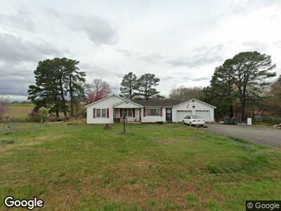
4310 Highway 105 Trezevant, TN 38258
Estimated Value: $100,000 - $159,000
--
Bed
1
Bath
1,082
Sq Ft
$112/Sq Ft
Est. Value
About This Home
This home is located at 4310 Highway 105, Trezevant, TN 38258 and is currently estimated at $120,827, approximately $111 per square foot. 4310 Highway 105 is a home located in Carroll County with nearby schools including West Carroll Primary School, West Carroll Elementary School, and West Carroll Junior/Senior High School.
Ownership History
Date
Name
Owned For
Owner Type
Purchase Details
Closed on
Mar 27, 2024
Sold by
Burress Alisha Gail
Bought by
Burress Alisha Gail
Current Estimated Value
Purchase Details
Closed on
Nov 17, 2017
Sold by
Burress Dorothy Jane
Bought by
Kilburn Lisa Kay and Burress Kenneth Ray
Purchase Details
Closed on
Jan 25, 1955
Bought by
Burress Ray and Dorothy Burress
Create a Home Valuation Report for This Property
The Home Valuation Report is an in-depth analysis detailing your home's value as well as a comparison with similar homes in the area
Home Values in the Area
Average Home Value in this Area
Purchase History
| Date | Buyer | Sale Price | Title Company |
|---|---|---|---|
| Burress Alisha Gail | -- | None Listed On Document | |
| Kilburn Lisa Kay | -- | -- | |
| Burress Ray | -- | -- |
Source: Public Records
Tax History Compared to Growth
Tax History
| Year | Tax Paid | Tax Assessment Tax Assessment Total Assessment is a certain percentage of the fair market value that is determined by local assessors to be the total taxable value of land and additions on the property. | Land | Improvement |
|---|---|---|---|---|
| 2024 | $429 | $16,300 | $3,275 | $13,025 |
| 2023 | $429 | $16,300 | $3,275 | $13,025 |
| 2022 | $429 | $16,300 | $3,275 | $13,025 |
| 2021 | $230 | $16,300 | $3,275 | $13,025 |
| 2020 | $429 | $16,300 | $3,275 | $13,025 |
| 2019 | $398 | $13,725 | $3,275 | $10,450 |
| 2018 | $398 | $13,725 | $3,275 | $10,450 |
| 2017 | $398 | $13,725 | $3,275 | $10,450 |
| 2016 | $583 | $13,725 | $3,275 | $10,450 |
| 2015 | $412 | $13,725 | $3,275 | $10,450 |
| 2014 | $434 | $13,725 | $3,275 | $10,450 |
| 2013 | $434 | $14,052 | $0 | $0 |
Source: Public Records
Map
Nearby Homes
- 0 Broad St S
- 290 Hurt St
- 45 Johnson St
- 160 Peggy Ln
- 13600 Church St
- 675 Pilgrims Rest Rd
- 0 Jax Rd
- 383 Big Buck Rd
- 5190 Clay Farm Rd
- 512 W Mitchell Rd
- 1810 Hinkledale Rd
- 740 Gann Rd
- 00 Idlewild Hollyleaf Rd
- 1570 Mccullough Rd
- 45 Sydnor Rd
- 42 Willard Willimson Rd
- 1946 Independence Rd
- 0 Bluebird Ln
- 00 Bluebird Ln
- 396 Windy Pines Ln