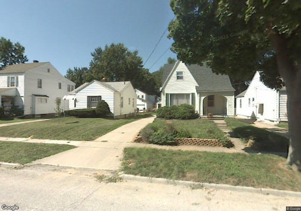
4311 Bales Rd Toledo, OH 43613
DeVeaux NeighborhoodEstimated Value: $97,000 - $125,000
3
Beds
1
Bath
792
Sq Ft
$144/Sq Ft
Est. Value
About This Home
This home is located at 4311 Bales Rd, Toledo, OH 43613 and is currently estimated at $114,241, approximately $144 per square foot. 4311 Bales Rd is a home located in Lucas County with nearby schools including Elmhurst Elementary School, Start High School, and Horizon Science Academy - Toledo High School.
Ownership History
Date
Name
Owned For
Owner Type
Purchase Details
Closed on
Aug 28, 2023
Sold by
Porter Karla A
Bought by
Fear Brenna L
Current Estimated Value
Home Financials for this Owner
Home Financials are based on the most recent Mortgage that was taken out on this home.
Original Mortgage
$76,800
Outstanding Balance
$75,125
Interest Rate
6.81%
Mortgage Type
Credit Line Revolving
Estimated Equity
$39,116
Purchase Details
Closed on
Apr 18, 1996
Sold by
Liber Corey D
Bought by
Porter Karla A
Home Financials for this Owner
Home Financials are based on the most recent Mortgage that was taken out on this home.
Original Mortgage
$42,800
Interest Rate
7.44%
Mortgage Type
Balloon
Purchase Details
Closed on
Sep 18, 1992
Sold by
Roberts Frances D
Create a Home Valuation Report for This Property
The Home Valuation Report is an in-depth analysis detailing your home's value as well as a comparison with similar homes in the area
Home Values in the Area
Average Home Value in this Area
Purchase History
| Date | Buyer | Sale Price | Title Company |
|---|---|---|---|
| Fear Brenna L | $96,000 | Louisville Title | |
| Porter Karla A | $53,500 | -- | |
| -- | $35,000 | -- |
Source: Public Records
Mortgage History
| Date | Status | Borrower | Loan Amount |
|---|---|---|---|
| Open | Fear Brenna L | $76,800 | |
| Previous Owner | Porter Karla A | $42,800 |
Source: Public Records
Tax History Compared to Growth
Tax History
| Year | Tax Paid | Tax Assessment Tax Assessment Total Assessment is a certain percentage of the fair market value that is determined by local assessors to be the total taxable value of land and additions on the property. | Land | Improvement |
|---|---|---|---|---|
| 2024 | $899 | $28,910 | $5,810 | $23,100 |
| 2023 | $1,163 | $17,150 | $4,270 | $12,880 |
| 2022 | $1,153 | $17,150 | $4,270 | $12,880 |
| 2021 | $1,192 | $17,150 | $4,270 | $12,880 |
| 2020 | $1,144 | $14,280 | $3,570 | $10,710 |
| 2019 | $1,104 | $14,280 | $3,570 | $10,710 |
| 2018 | $1,091 | $14,280 | $3,570 | $10,710 |
| 2017 | $1,054 | $13,055 | $4,655 | $8,400 |
| 2016 | $1,063 | $37,300 | $13,300 | $24,000 |
| 2015 | $1,074 | $37,300 | $13,300 | $24,000 |
| 2014 | $821 | $13,060 | $4,660 | $8,400 |
| 2013 | $821 | $13,060 | $4,660 | $8,400 |
Source: Public Records
Map
Nearby Homes
- 2640 Westbrook Dr
- 2645 Grantwood Dr
- 4440 Woodmont Rd
- 2513 Grantwood Dr
- 4210 Bowen Rd
- 4220 Douglas Rd
- 2728 Castleton Ave
- 2409 Lambert Dr
- 4128 Douglas Rd
- 2408 Lambert Dr
- 4250 Garrison Rd
- 2855 Castleton Ave
- 2842 Oak Grove Place
- 2316 Westbrook Dr
- 3951 Buell Ave
- 2605 Wyndale Rd
- 2560 Charlestown Ave
- 3905 Rushland Ave
- 2820 Claredale Rd
- 4015 Roanoke Rd
- 4307 Bales Rd
- 4301 Bales Rd
- 2616 Grantwood Dr
- 4319 Bales Rd
- 4323 Bales Rd
- 2620 Grantwood Dr
- 2567 Pershing Dr
- 2568 Grantwood Dr
- 4327 Bales Rd
- 2565 Pershing Dr
- 2564 Grantwood Dr
- 2625 Westbrook Dr
- 4331 Bales Rd
- 2603 Grantwood Dr
- 2628 Grantwood Dr
- 2611 Grantwood Dr
- 2601 Grantwood Dr
- 2563 Pershing Dr
- 2560 Grantwood Dr
- 2615 Grantwood Dr