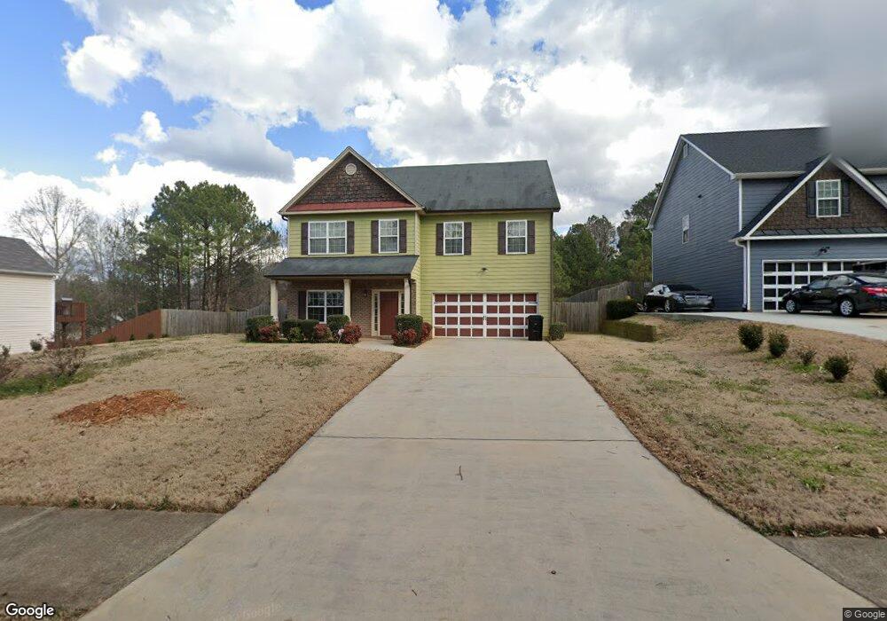
4317 Anderson Ridge Dr Austell, GA 30106
Estimated Value: $360,000 - $461,000
4
Beds
3
Baths
2,840
Sq Ft
$143/Sq Ft
Est. Value
About This Home
This home is located at 4317 Anderson Ridge Dr, Austell, GA 30106 and is currently estimated at $406,901, approximately $143 per square foot. 4317 Anderson Ridge Dr is a home located in Cobb County with nearby schools including Deerwood Elementary School, Clarkdale Elementary School, and Garrett Middle School.
Ownership History
Date
Name
Owned For
Owner Type
Purchase Details
Closed on
Mar 19, 2010
Sold by
Sweetwater Hms Inc
Bought by
Lueng Tafadzwa M
Current Estimated Value
Home Financials for this Owner
Home Financials are based on the most recent Mortgage that was taken out on this home.
Original Mortgage
$180,667
Outstanding Balance
$117,884
Interest Rate
4.75%
Mortgage Type
FHA
Estimated Equity
$289,017
Create a Home Valuation Report for This Property
The Home Valuation Report is an in-depth analysis detailing your home's value as well as a comparison with similar homes in the area
Home Values in the Area
Average Home Value in this Area
Purchase History
| Date | Buyer | Sale Price | Title Company |
|---|---|---|---|
| Lueng Tafadzwa M | $184,000 | -- |
Source: Public Records
Mortgage History
| Date | Status | Borrower | Loan Amount |
|---|---|---|---|
| Open | Lueng Tafadzwa M | $180,667 |
Source: Public Records
Tax History Compared to Growth
Tax History
| Year | Tax Paid | Tax Assessment Tax Assessment Total Assessment is a certain percentage of the fair market value that is determined by local assessors to be the total taxable value of land and additions on the property. | Land | Improvement |
|---|---|---|---|---|
| 2025 | $4,089 | $170,460 | $52,000 | $118,460 |
| 2024 | $4,092 | $170,460 | $52,000 | $118,460 |
| 2023 | $1,966 | $97,456 | $19,000 | $78,456 |
| 2022 | $2,526 | $97,456 | $19,000 | $78,456 |
| 2021 | $2,526 | $97,456 | $19,000 | $78,456 |
| 2020 | $2,526 | $97,456 | $19,000 | $78,456 |
| 2019 | $2,298 | $87,036 | $16,800 | $70,236 |
| 2018 | $2,298 | $87,036 | $16,800 | $70,236 |
| 2017 | $1,668 | $66,952 | $19,000 | $47,952 |
| 2016 | $1,669 | $66,952 | $19,000 | $47,952 |
| 2015 | $1,712 | $66,952 | $19,000 | $47,952 |
| 2014 | $1,727 | $66,952 | $0 | $0 |
Source: Public Records
Map
Nearby Homes
- 4323 Anderson Ridge Dr
- 4311 Anderson Ridge Dr
- 0 Anderson Ridge Dr Unit 8212664
- 4329 Anderson Ridge Dr
- 4309 Anderson Ridge Dr
- 4274 Anderson Ridge Way
- 4272 Anderson Ridge Way
- 4307 Anderson Ridge Dr
- 4253 Linworth Blvd
- 4335 Anderson Ridge Dr
- 2001 Rhinehart Rd
- 4305 Anderson Ridge Dr
- 4275 Anderson Ridge Way
- 4303 Anderson Ridge Dr
- 2016 Anderson Mill Rd
- 1920 Anderson Mill Rd
- 2005 Rhinehart Rd
- 1914 Anderson Mill Rd
- 4301 Anderson Ridge Dr
- 4259 Linworth Blvd