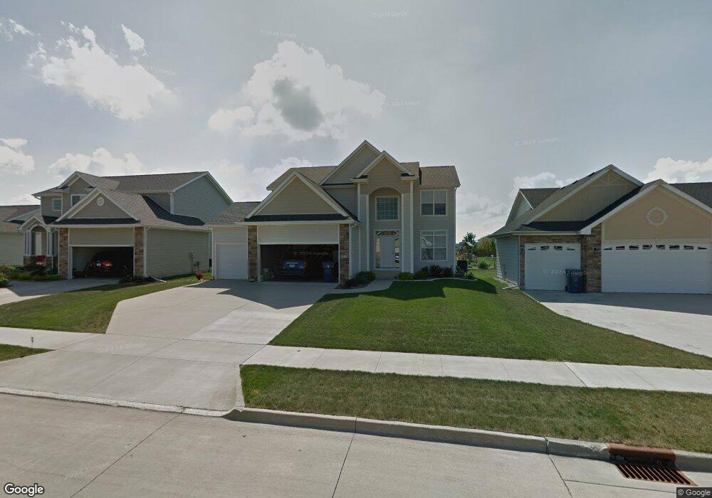
4318 129th St Urbandale, IA 50323
Estimated Value: $425,000 - $453,000
4
Beds
3
Baths
2,311
Sq Ft
$190/Sq Ft
Est. Value
About This Home
This home is located at 4318 129th St, Urbandale, IA 50323 and is currently estimated at $439,734, approximately $190 per square foot. 4318 129th St is a home located in Polk County with nearby schools including Webster Elementary School, Urbandale Middle School, and Urbandale High School.
Ownership History
Date
Name
Owned For
Owner Type
Purchase Details
Closed on
May 21, 2008
Sold by
Sunflower Development Inc
Bought by
Nelson Gabriel A and Nelson Jamie L
Current Estimated Value
Home Financials for this Owner
Home Financials are based on the most recent Mortgage that was taken out on this home.
Original Mortgage
$13,750
Interest Rate
6.01%
Mortgage Type
Unknown
Purchase Details
Closed on
Jul 19, 2007
Sold by
Hubbell Properties I Lc
Bought by
Sunflower Development Inc
Home Financials for this Owner
Home Financials are based on the most recent Mortgage that was taken out on this home.
Original Mortgage
$232,000
Interest Rate
6.54%
Mortgage Type
Purchase Money Mortgage
Create a Home Valuation Report for This Property
The Home Valuation Report is an in-depth analysis detailing your home's value as well as a comparison with similar homes in the area
Home Values in the Area
Average Home Value in this Area
Purchase History
| Date | Buyer | Sale Price | Title Company |
|---|---|---|---|
| Nelson Gabriel A | $274,500 | None Available | |
| Sunflower Development Inc | $47,000 | None Available |
Source: Public Records
Mortgage History
| Date | Status | Borrower | Loan Amount |
|---|---|---|---|
| Closed | Nelson Gabriel A | $13,750 | |
| Open | Nelson Gabriel A | $220,000 | |
| Previous Owner | Sunflower Development Inc | $232,000 |
Source: Public Records
Tax History Compared to Growth
Tax History
| Year | Tax Paid | Tax Assessment Tax Assessment Total Assessment is a certain percentage of the fair market value that is determined by local assessors to be the total taxable value of land and additions on the property. | Land | Improvement |
|---|---|---|---|---|
| 2025 | $7,274 | $438,200 | $70,400 | $367,800 |
| 2024 | $7,274 | $414,300 | $65,800 | $348,500 |
| 2023 | $6,778 | $414,300 | $65,800 | $348,500 |
| 2022 | $6,698 | $326,500 | $53,700 | $272,800 |
| 2021 | $6,944 | $326,500 | $53,700 | $272,800 |
| 2020 | $6,830 | $321,000 | $52,700 | $268,300 |
| 2019 | $6,830 | $321,000 | $52,700 | $268,300 |
| 2018 | $6,600 | $302,100 | $47,900 | $254,200 |
| 2017 | $6,170 | $302,100 | $47,900 | $254,200 |
| 2016 | $6,022 | $277,600 | $43,600 | $234,000 |
| 2015 | $6,022 | $277,600 | $43,600 | $234,000 |
| 2014 | $5,438 | $258,800 | $40,300 | $218,500 |
Source: Public Records
Map
Nearby Homes
- 4309 129th St
- 12912 Hammontree Dr
- 13114 Iltis Dr
- 4412 125th St
- 12335 Tanglewood Dr
- 12510 Prairie Dr
- 4016 127th St
- 12527 Airline Ave
- 12515 Airline Ave
- 4143 122nd St
- 12723 Sunflower Dr
- 4111 140th St
- 3935 122nd St
- 12220 Horton Ave
- 12324 Sunflower Dr
- 15217 Springbrook Trail
- 15015 Springbrook Trail
- 15019 Springbrook Trail
- 14509 Persimmon Dr
- 14627 Persimmon Dr
- 4322 129th St
- 4314 129th St
- 4310 129th St
- 4311 130th Cir
- 12906 Westbrook Dr
- 4319 129th St
- 4306 129th St
- 4323 129th St
- 4315 129th St
- 12916 Westbrook Dr
- 4307 130th Cir
- 4327 129th St
- 12920 Westbrook Dr
- 4305 129th St
- 12905 Westbrook Dr
- 13005 Twana Dr
- 4302 129th St
- 13004 Westbrook Dr
- 12909 Westbrook Dr
- 4301 129th St