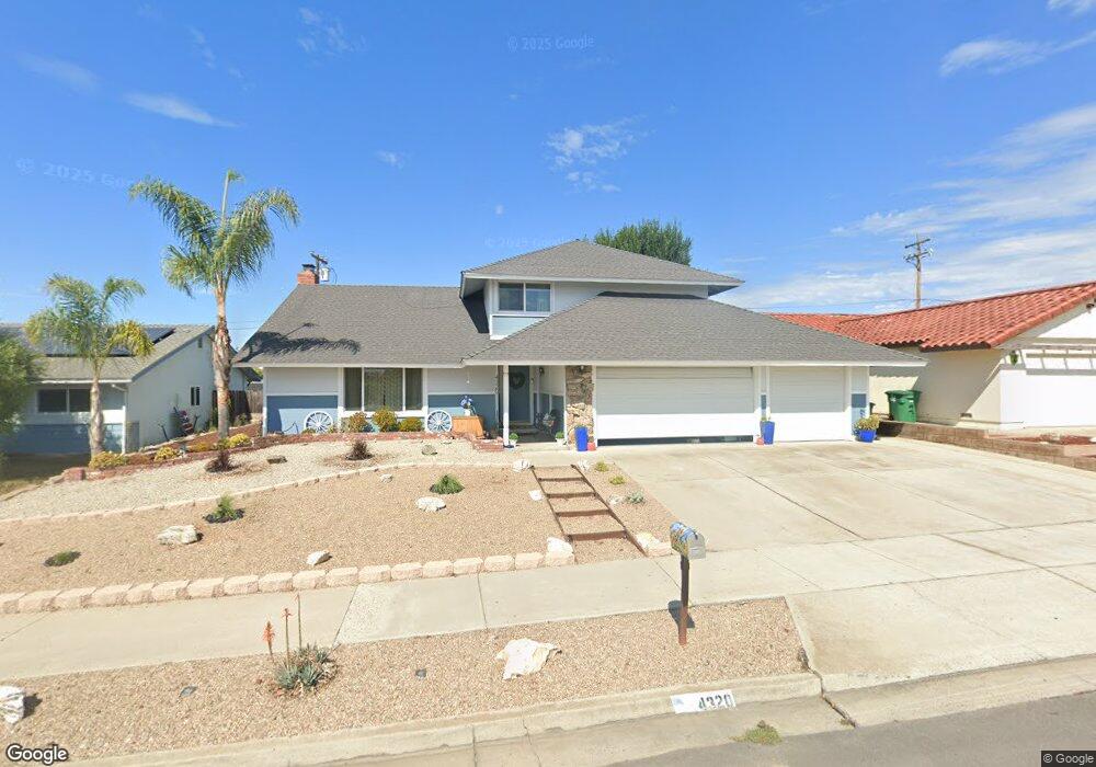
4320 Sirius Ave Unit 1 Lompoc, CA 93436
Estimated Value: $683,221 - $716,000
4
Beds
3
Baths
2,162
Sq Ft
$325/Sq Ft
Est. Value
About This Home
This home is located at 4320 Sirius Ave Unit 1, Lompoc, CA 93436 and is currently estimated at $703,055, approximately $325 per square foot. 4320 Sirius Ave Unit 1 is a home located in Santa Barbara County with nearby schools including Buena Vista Elementary School, Cabrillo High School, and Olive Grove Charter - Lompoc.
Ownership History
Date
Name
Owned For
Owner Type
Purchase Details
Closed on
May 17, 1995
Sold by
Donohue Judith Lynn
Bought by
Hinkens Thomas W and Hinkens Vicki L
Current Estimated Value
Home Financials for this Owner
Home Financials are based on the most recent Mortgage that was taken out on this home.
Original Mortgage
$121,500
Interest Rate
7.9%
Create a Home Valuation Report for This Property
The Home Valuation Report is an in-depth analysis detailing your home's value as well as a comparison with similar homes in the area
Home Values in the Area
Average Home Value in this Area
Purchase History
| Date | Buyer | Sale Price | Title Company |
|---|---|---|---|
| Hinkens Thomas W | $135,000 | Chicago Title Company |
Source: Public Records
Mortgage History
| Date | Status | Borrower | Loan Amount |
|---|---|---|---|
| Previous Owner | Hinkens Thomas W | $121,500 |
Source: Public Records
Tax History
| Year | Tax Paid | Tax Assessment Tax Assessment Total Assessment is a certain percentage of the fair market value that is determined by local assessors to be the total taxable value of land and additions on the property. | Land | Improvement |
|---|---|---|---|---|
| 2025 | $3,145 | $257,527 | $101,650 | $155,877 |
| 2023 | $3,145 | $247,528 | $97,703 | $149,825 |
| 2022 | $3,098 | $242,676 | $95,788 | $146,888 |
| 2021 | $3,130 | $237,918 | $93,910 | $144,008 |
| 2020 | $3,100 | $235,480 | $92,948 | $142,532 |
| 2019 | $3,056 | $230,864 | $91,126 | $139,738 |
| 2018 | $3,015 | $226,339 | $89,340 | $136,999 |
| 2017 | $2,877 | $221,902 | $87,589 | $134,313 |
| 2016 | $2,559 | $217,552 | $85,872 | $131,680 |
| 2015 | $2,541 | $214,286 | $84,583 | $129,703 |
| 2014 | $2,505 | $210,090 | $82,927 | $127,163 |
Source: Public Records
Map
Nearby Homes
- 4447 Falcon Dr
- 113 Gemini Ave
- 3939 Mesa Circle Dr
- 18 Galaxy Way
- 3922 Mesa Circle Dr
- 3916 Mesa Circle Dr Unit A
- 6 Stanford Cir
- 73 Stanford Cir
- 372 Oak Hill Dr
- 240 Oak Hill Dr
- 4166 Oakwood Ct
- 4173 Oakwood Ct
- 0 Oak Hill Dr Unit 24-783
- 250 Saint Andrews Way
- 649 Burning Tree Way
- 4473 Greenbrier Rd
- 384 Falcon Crest Dr
- 3843 Cassini Cir Unit 3
- 372 Falcon Crest Dr
- 3725 Jupiter Ave
- 4310 Sirius Ave
- 4328 Sirius Ave
- 4304 Sirius Ave
- 4336 Sirius Ave
- 4290 Polaris Ave
- 204 Pegasus Ave
- 4344 Sirius Ave
- 4296 Sirius Ave
- 4289 Polaris Ave
- 208 Pegasus Ave
- 4290 Sirius Ave
- 4279 Polaris Ave
- 4270 Polaris Ave
- 205 Pegasus Ave
- 4312 Constellation Rd
- 214 Pegasus Ave
- 4290 Constellation Rd
- 209 Pegasus Ave
- 4271 Polaris Ave
Your Personal Tour Guide
Ask me questions while you tour the home.