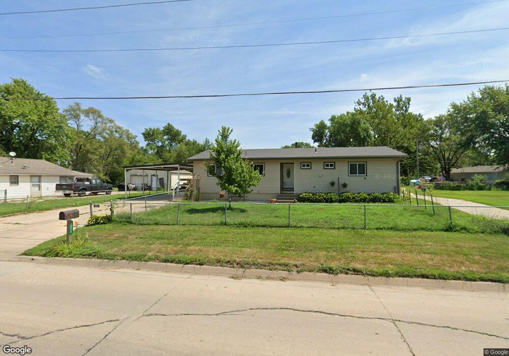
4325 N 9th St Carter Lake, IA 51510
Estimated Value: $281,996 - $346,000
3
Beds
2
Baths
2,880
Sq Ft
$107/Sq Ft
Est. Value
About This Home
This home is located at 4325 N 9th St, Carter Lake, IA 51510 and is currently estimated at $308,249, approximately $107 per square foot. 4325 N 9th St is a home located in Pottawattamie County with nearby schools including Carter Lake Elementary School, Woodrow Wilson Middle School, and Thomas Jefferson High School.
Ownership History
Date
Name
Owned For
Owner Type
Purchase Details
Closed on
Feb 24, 2009
Sold by
Wight Donald D
Bought by
Reisis Troy and Reisis Toni
Current Estimated Value
Home Financials for this Owner
Home Financials are based on the most recent Mortgage that was taken out on this home.
Original Mortgage
$142,500
Outstanding Balance
$90,659
Interest Rate
5.14%
Mortgage Type
Purchase Money Mortgage
Estimated Equity
$217,590
Create a Home Valuation Report for This Property
The Home Valuation Report is an in-depth analysis detailing your home's value as well as a comparison with similar homes in the area
Home Values in the Area
Average Home Value in this Area
Purchase History
| Date | Buyer | Sale Price | Title Company |
|---|---|---|---|
| Reisis Troy | $150,000 | Omaha Title & Escrow Inc |
Source: Public Records
Mortgage History
| Date | Status | Borrower | Loan Amount |
|---|---|---|---|
| Open | Reisis Troy | $142,500 |
Source: Public Records
Tax History Compared to Growth
Tax History
| Year | Tax Paid | Tax Assessment Tax Assessment Total Assessment is a certain percentage of the fair market value that is determined by local assessors to be the total taxable value of land and additions on the property. | Land | Improvement |
|---|---|---|---|---|
| 2025 | $4,086 | $284,500 | $47,100 | $237,400 |
| 2024 | $4,086 | $260,100 | $41,000 | $219,100 |
| 2023 | $4,034 | $260,100 | $41,000 | $219,100 |
| 2022 | $3,248 | $178,700 | $41,300 | $137,400 |
| 2021 | $4,646 | $178,700 | $41,300 | $137,400 |
| 2020 | $2,822 | $141,310 | $25,633 | $115,677 |
| 2019 | $2,944 | $141,310 | $25,633 | $115,677 |
| 2018 | $2,952 | $141,310 | $25,633 | $115,677 |
| 2017 | $2,952 | $141,310 | $25,633 | $115,677 |
| 2015 | $3,008 | $141,310 | $25,633 | $115,677 |
| 2014 | $3,006 | $141,310 | $25,633 | $115,677 |
Source: Public Records
Map
Nearby Homes
- 145 Carter Lake Club
- 1005 Cachelin Dr
- 520 Coronado Cir
- 113 Shoreline Dr
- 1206 Redick Blvd
- 1317 Silver Ln
- 1510 Silver Ln
- 3510 N 9th St Unit 317
- Lot 1 Fort Crook Addition
- 5111 N 13th St E
- 1305 Janbrook Blvd
- 5415 N 6th Ave
- 4545 N 14th St
- 4744 N 13th St
- 5323 N 8th St
- 5326 N 8th St
- 4537 N 14th Ave
- 4522 N 15th St
- 4935 N 15th St
- 1415 Browne St