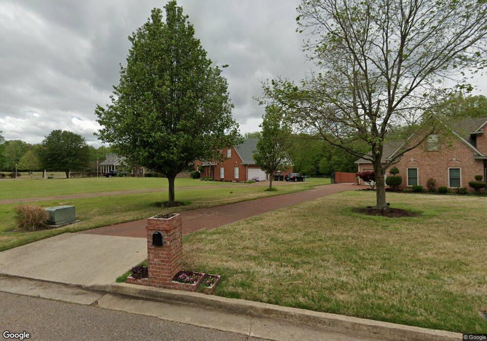
4327 High Plains Rd Memphis, TN 38135
Estimated Value: $337,000 - $479,000
4
Beds
3
Baths
3,831
Sq Ft
$110/Sq Ft
Est. Value
About This Home
This home is located at 4327 High Plains Rd, Memphis, TN 38135 and is currently estimated at $420,660, approximately $109 per square foot. 4327 High Plains Rd is a home located in Shelby County with nearby schools including Bon Lin Elementary School, Bon Lin Middle School, and Bartlett High School.
Ownership History
Date
Name
Owned For
Owner Type
Purchase Details
Closed on
Apr 4, 2014
Sold by
Carter Steve
Bought by
Greer Darla D and Carter Darla
Current Estimated Value
Purchase Details
Closed on
Nov 14, 2002
Sold by
Keith & David Grant Homes Llc
Bought by
Carter Steve and Carter Darla
Home Financials for this Owner
Home Financials are based on the most recent Mortgage that was taken out on this home.
Original Mortgage
$208,950
Outstanding Balance
$87,069
Interest Rate
5.95%
Estimated Equity
$333,591
Purchase Details
Closed on
Dec 11, 2001
Sold by
Mcswain William B and Griffin William N
Bought by
Mcswain William B
Home Financials for this Owner
Home Financials are based on the most recent Mortgage that was taken out on this home.
Original Mortgage
$90,000
Interest Rate
6.99%
Create a Home Valuation Report for This Property
The Home Valuation Report is an in-depth analysis detailing your home's value as well as a comparison with similar homes in the area
Home Values in the Area
Average Home Value in this Area
Purchase History
| Date | Buyer | Sale Price | Title Company |
|---|---|---|---|
| Greer Darla D | -- | Realty Title & Escrow Co Inc | |
| Carter Steve | $219,950 | Memphis Title Company | |
| Mcswain William B | -- | -- |
Source: Public Records
Mortgage History
| Date | Status | Borrower | Loan Amount |
|---|---|---|---|
| Open | Carter Steve | $208,950 | |
| Previous Owner | Mcswain William B | $90,000 |
Source: Public Records
Tax History Compared to Growth
Tax History
| Year | Tax Paid | Tax Assessment Tax Assessment Total Assessment is a certain percentage of the fair market value that is determined by local assessors to be the total taxable value of land and additions on the property. | Land | Improvement |
|---|---|---|---|---|
| 2025 | $2,756 | $92,200 | $21,750 | $70,450 |
| 2024 | $2,756 | $81,300 | $17,050 | $64,250 |
| 2023 | $4,163 | $81,300 | $17,050 | $64,250 |
| 2022 | $4,163 | $81,300 | $17,050 | $64,250 |
| 2021 | $4,228 | $81,300 | $17,050 | $64,250 |
| 2020 | $4,115 | $69,975 | $17,050 | $52,925 |
| 2019 | $4,115 | $69,975 | $17,050 | $52,925 |
| 2018 | $4,115 | $69,975 | $17,050 | $52,925 |
| 2017 | $2,876 | $69,975 | $17,050 | $52,925 |
| 2016 | $2,721 | $62,275 | $0 | $0 |
| 2014 | $2,721 | $62,275 | $0 | $0 |
Source: Public Records
Map
Nearby Homes
- 4045 Bartlett Country Rd
- 4350 Bridgestone Cir
- 4431 Broadway Rd
- 8224 Memphis Arlington Rd
- 7514 3rd Rd
- 4621 Westbrook Rd
- 7686 Shadow Glen Ln
- 4250 Oak Rd
- 3869 Appling Rd
- 4717 Shira Dr
- 4500 Greencedar Ln
- 3942 Kimberly Dawn Cove
- 4836 Shadow Pine Cove
- 4816 Avi Dr
- 7883 Linda Joyce Dr
- 3785 Aaron Cove
- 8070 Memphis Arlington Rd
- 8007 Steven Franklin Dr
- 7341 4th Ave
- 4864 Avi Dr
- 7624 Dove Ridge Cove
- 4331 High Plains Rd
- 4335 High Plains Rd
- 7614 Dove Ridge Cove
- 4332 High Plains Rd
- 4339 High Plains Rd
- 4311 High Plains Rd
- 4338 High Plains Rd
- 4320 High Plains Rd
- 4343 High Plains Rd
- 4310 High Plains Rd
- 4299 High Plains Rd
- 4344 High Plains Rd
- 4347 High Plains Rd
- 4302 High Plains Rd
- 4327 Sunny Trail Cove
- 4289 High Plains Rd
- 4348 High Plains Rd
- 4321 Sunny Trail Cove
- 4292 High Plains Rd