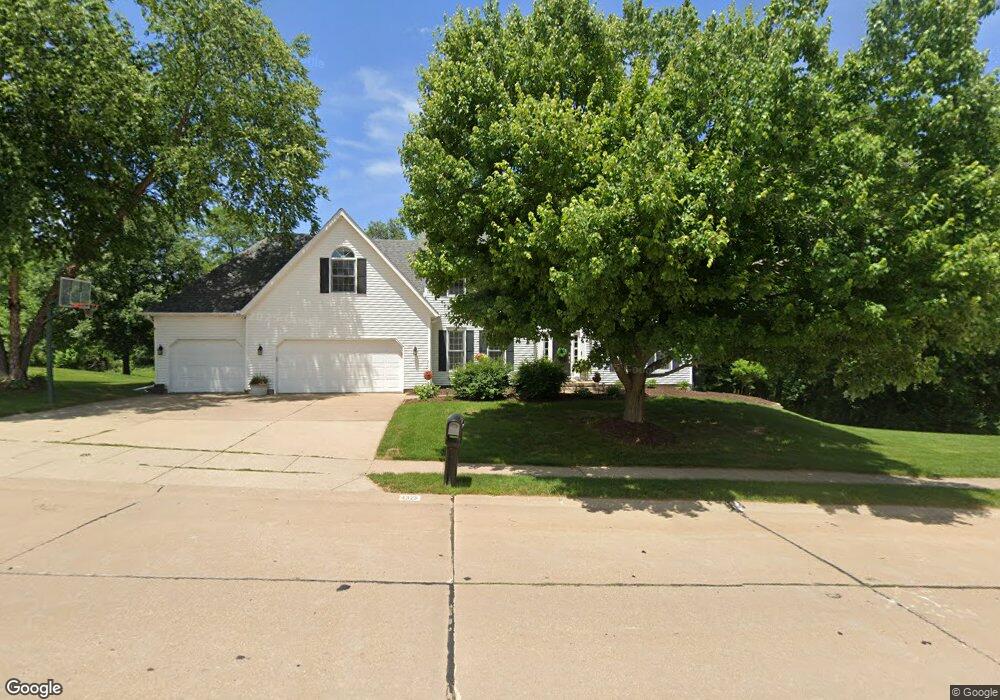
4328 Forest Rd Davenport, IA 52807
North Side NeighborhoodEstimated Value: $433,608 - $496,000
4
Beds
6
Baths
2,924
Sq Ft
$163/Sq Ft
Est. Value
About This Home
This home is located at 4328 Forest Rd, Davenport, IA 52807 and is currently estimated at $475,902, approximately $162 per square foot. 4328 Forest Rd is a home located in Scott County with nearby schools including Jones Park Elementary School, Eisenhower Elementary School, and Casey County Middle School.
Ownership History
Date
Name
Owned For
Owner Type
Purchase Details
Closed on
Jun 16, 2005
Sold by
Zaentz S Donald and Zaentz Dorothy N
Bought by
Doyle Patrick W and Doyle Kelli J
Current Estimated Value
Home Financials for this Owner
Home Financials are based on the most recent Mortgage that was taken out on this home.
Original Mortgage
$27,700
Interest Rate
5.86%
Mortgage Type
Credit Line Revolving
Create a Home Valuation Report for This Property
The Home Valuation Report is an in-depth analysis detailing your home's value as well as a comparison with similar homes in the area
Home Values in the Area
Average Home Value in this Area
Purchase History
| Date | Buyer | Sale Price | Title Company |
|---|---|---|---|
| Doyle Patrick W | $277,500 | None Available |
Source: Public Records
Mortgage History
| Date | Status | Borrower | Loan Amount |
|---|---|---|---|
| Closed | Doyle Patrick W | $27,700 | |
| Open | Doyle Patrick W | $222,000 |
Source: Public Records
Tax History Compared to Growth
Tax History
| Year | Tax Paid | Tax Assessment Tax Assessment Total Assessment is a certain percentage of the fair market value that is determined by local assessors to be the total taxable value of land and additions on the property. | Land | Improvement |
|---|---|---|---|---|
| 2025 | $6,578 | $397,710 | $60,140 | $337,570 |
| 2024 | $6,394 | $359,130 | $60,140 | $298,990 |
| 2023 | $6,586 | $359,130 | $60,140 | $298,990 |
| 2022 | $6,860 | $317,230 | $53,810 | $263,420 |
| 2021 | $6,616 | $317,230 | $53,810 | $263,420 |
| 2020 | $6,700 | $301,730 | $53,810 | $247,920 |
| 2019 | $6,926 | $317,230 | $53,810 | $263,420 |
| 2018 | $6,776 | $317,230 | $53,810 | $263,420 |
| 2017 | $1,764 | $317,230 | $53,810 | $263,420 |
| 2016 | $6,056 | $285,210 | $0 | $0 |
| 2015 | $6,056 | $270,080 | $0 | $0 |
| 2014 | $5,804 | $271,460 | $0 | $0 |
| 2013 | $5,730 | $0 | $0 | $0 |
| 2012 | -- | $273,550 | $51,280 | $222,270 |
Source: Public Records
Map
Nearby Homes
- 4005 Forest Rd
- 2919 E 44th Ct
- 2916 E 45th Ct
- 2924 E 45th Ct
- 4230 Jersey Ridge Rd
- 2318 E 46th St
- 4919 Lorton Ave
- 2321 E 47th St
- 2203 E 46th St
- 4406 Belle Ave
- 2403 E 51st St Unit 102E
- 2506 E 35th Street Ct
- 2422 E 51st St Unit E
- 2501 E 34th Street Ct
- 3315 Fairhaven Rd
- 4324 Spring St
- 3000 E 32nd St Unit 14
- 1960 E 50th Ct
- 4600 Eastern Ave
- 2805 Carriage Hill Dr
- 4318 Forest Rd
- 4335 Forest Rd
- 4338 Forest Rd
- 4325 Forest Rd
- 2728 Edgewild Dr
- 4315 Forest Rd
- 2805 E 43rd St
- 2800 E 43rd St
- 4402 Forest Rd
- 2718 Edgewild Dr
- 4221 Forest Rd
- 4349 Forest Rd
- 4410 Forest Rd
- 2815 E 43rd St
- 2810 E 43rd St
- 4210 Forest Rd
- 2710 Edgewild Dr
- 4409 Lorton Ave
- 2804 E 42nd Ct
- 4405 Forest Rd