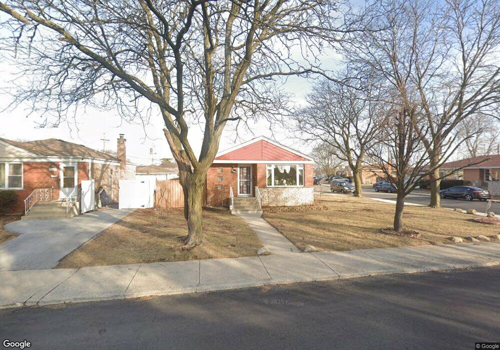
4328 W 81st St Chicago, IL 60652
Scottsdale NeighborhoodEstimated Value: $214,000 - $291,000
2
Beds
1
Bath
1,025
Sq Ft
$253/Sq Ft
Est. Value
About This Home
This home is located at 4328 W 81st St, Chicago, IL 60652 and is currently estimated at $258,973, approximately $252 per square foot. 4328 W 81st St is a home located in Cook County with nearby schools including Stevenson Elementary School, Bogan Computer Technical High School, and St Bede-Venerable School.
Ownership History
Date
Name
Owned For
Owner Type
Purchase Details
Closed on
Nov 4, 2025
Sold by
Jimenez Luis and Jimenez Ana M
Bought by
Luis Jimenez And Ana M Jimenez Family Trust and Jimenez
Current Estimated Value
Purchase Details
Closed on
Nov 7, 2023
Sold by
Jimenez Luis and Jimenez Ana M
Bought by
Luis Jimenez And Ana M Jimenez Family Trust and Jimenez
Purchase Details
Closed on
Jul 29, 1998
Sold by
Puhr Dennis George and Puhr Margaret A
Bought by
Jimenez Luis and Jimenez Ana M
Home Financials for this Owner
Home Financials are based on the most recent Mortgage that was taken out on this home.
Original Mortgage
$80,750
Interest Rate
7.03%
Create a Home Valuation Report for This Property
The Home Valuation Report is an in-depth analysis detailing your home's value as well as a comparison with similar homes in the area
Home Values in the Area
Average Home Value in this Area
Purchase History
| Date | Buyer | Sale Price | Title Company |
|---|---|---|---|
| Luis Jimenez And Ana M Jimenez Family Trust | -- | None Listed On Document | |
| Luis Jimenez And Ana M Jimenez Family Trust | -- | None Listed On Document | |
| Jimenez Luis | $85,000 | -- |
Source: Public Records
Mortgage History
| Date | Status | Borrower | Loan Amount |
|---|---|---|---|
| Previous Owner | Jimenez Luis | $80,750 | |
| Closed | Jimenez Luis | $3,000 |
Source: Public Records
Tax History
| Year | Tax Paid | Tax Assessment Tax Assessment Total Assessment is a certain percentage of the fair market value that is determined by local assessors to be the total taxable value of land and additions on the property. | Land | Improvement |
|---|---|---|---|---|
| 2025 | $1,268 | $21,000 | $3,780 | $17,220 |
| 2024 | $1,268 | $21,000 | $3,780 | $17,220 |
| 2023 | $1,276 | $20,000 | $4,725 | $15,275 |
| 2022 | $1,276 | $20,000 | $4,725 | $15,275 |
| 2021 | $1,215 | $20,000 | $4,725 | $15,275 |
| 2020 | $1,254 | $16,203 | $4,725 | $11,478 |
| 2019 | $1,250 | $18,206 | $4,725 | $13,481 |
| 2018 | $1,232 | $18,206 | $4,725 | $13,481 |
| 2017 | $1,319 | $13,488 | $4,095 | $9,393 |
| 2016 | $1,730 | $13,488 | $4,095 | $9,393 |
| 2015 | $1,663 | $13,488 | $4,095 | $9,393 |
| 2014 | $1,662 | $13,587 | $3,780 | $9,807 |
| 2013 | $2,496 | $13,587 | $3,780 | $9,807 |
Source: Public Records
Map
Nearby Homes
- 8213 S Kildare Ave
- 4410 W 81st Place
- 4263 W 81st St
- 8169 S Tripp Ave
- 8017 S Kostner Ave
- 7964 S Tripp Ave
- 8132 S Kilbourn Ave
- 4131 W 81st Place
- 4601 W 82nd St
- 4536 W 83rd St
- 8411 S Kostner Ave
- 8416 S Kenneth Ave
- 7958 S Knox Ave
- 8417 S Scottsdale Ave
- 4707 W 82nd Place
- 7900 S Kilpatrick Ave
- 8020 S Pulaski Rd Unit 3W
- 8400 S Knox Ave
- 4605 W 84th Place
- 4300 W Ford City Dr Unit 401A
- 8058 S Kolin Ave
- 4338 W 81st St
- 8073 S Kolin Ave
- 8127 S Kostner Ave
- 8059 S Kolin Ave
- 8054 S Kolin Ave
- 4312 W 81st St
- 4331 W 81st St
- 4323 W 81st St
- 8123 S Kostner Ave
- 8051 S Kolin Ave
- 4341 W 81st St
- 8050 S Kolin Ave
- 4317 W 81st St
- 4308 W 81st St
- 8047 S Kolin Ave
- 8046 S Kolin Ave
- 8111 S Kostner Ave
- 4313 W 81st St
- 8145 S Kostner Ave
Your Personal Tour Guide
Ask me questions while you tour the home.