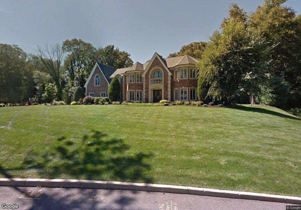
433 Devonshire Dr Franklin Lakes, NJ 07417
Estimated Value: $2,550,000 - $3,069,000
Studio
--
Bath
6,044
Sq Ft
$463/Sq Ft
Est. Value
About This Home
This home is located at 433 Devonshire Dr, Franklin Lakes, NJ 07417 and is currently estimated at $2,799,334, approximately $463 per square foot. 433 Devonshire Dr is a home located in Bergen County with nearby schools including High Mountain Road Elementary School, Franklin Avenue Middle School, and Ramapo High School.
Ownership History
Date
Name
Owned For
Owner Type
Purchase Details
Closed on
Nov 30, 2020
Sold by
Longo Joseph A and Longo Toni Ann
Bought by
Yeschenko Lyudmila and Mcknight Katya
Current Estimated Value
Purchase Details
Closed on
Aug 29, 2003
Sold by
Stone Manor At Franklin Lakes
Bought by
Longo Joseph and Longo Toni Ann
Home Financials for this Owner
Home Financials are based on the most recent Mortgage that was taken out on this home.
Original Mortgage
$250,000
Interest Rate
6.22%
Create a Home Valuation Report for This Property
The Home Valuation Report is an in-depth analysis detailing your home's value as well as a comparison with similar homes in the area
Home Values in the Area
Average Home Value in this Area
Purchase History
| Date | Buyer | Sale Price | Title Company |
|---|---|---|---|
| Yeschenko Lyudmila | $1,800,000 | Westcor Land Title Ins Co | |
| Yeschenko Lyudmila | $1,800,000 | None Listed On Document | |
| Longo Joseph | $400,000 | -- |
Source: Public Records
Mortgage History
| Date | Status | Borrower | Loan Amount |
|---|---|---|---|
| Previous Owner | Longo Joseph | $250,000 |
Source: Public Records
Tax History
| Year | Tax Paid | Tax Assessment Tax Assessment Total Assessment is a certain percentage of the fair market value that is determined by local assessors to be the total taxable value of land and additions on the property. | Land | Improvement |
|---|---|---|---|---|
| 2025 | $34,650 | $1,929,300 | $434,600 | $1,494,700 |
| 2024 | $33,377 | $1,929,300 | $434,600 | $1,494,700 |
| 2023 | $32,528 | $1,929,300 | $434,600 | $1,494,700 |
| 2022 | $32,528 | $1,929,300 | $434,600 | $1,494,700 |
| 2021 | $32,065 | $1,929,300 | $434,600 | $1,494,700 |
| 2020 | $31,795 | $1,929,300 | $434,600 | $1,494,700 |
| 2019 | $31,679 | $1,929,300 | $434,600 | $1,494,700 |
| 2018 | $31,351 | $1,929,300 | $434,600 | $1,494,700 |
| 2017 | $31,563 | $1,929,300 | $434,600 | $1,494,700 |
| 2016 | $31,660 | $1,929,300 | $434,600 | $1,494,700 |
| 2015 | $30,850 | $1,929,300 | $434,600 | $1,494,700 |
| 2014 | $30,329 | $1,929,300 | $434,600 | $1,494,700 |
Source: Public Records
Map
Nearby Homes
- 457 Devonshire Dr
- 576 Haddon Place
- 608 Covington Place W
- 538 Franklin Ave
- 525 Franklin Ave
- 6 Northwood Dr
- 520 Clinton Ave
- 910 Huron Rd
- 707 Black Hawk Ln
- 253 Madison Ave
- 37 Spring Wolf Trail
- 444B Bromley Place Unit B
- 444B Bromley Place
- 265 Terrace Rd
- 872 Old Mill Rd
- 1055 High Mountain Rd
- 219 Haven Rd
- 339 Kay Ln
- 254 Godwin Ave
- 754 Wyckoff Ave
- 425 Devonshire Dr
- 434 Devonshire Dr
- 633 Ewing Ave
- 441 Devonshire Dr
- 417 Devonshire Dr
- 416 Devonshire Dr
- 460 Devonshire Dr
- 449 Devonshire Dr
- 371 Vance Ave
- 379 Vance Ave
- 468 Devonshire Dr
- 409 Devonshire Dr
- 408 Devonshire Dr
- 225 Mabel Place
- 387 Vance Ave
- 221 Mabel Place
- 231 Mabel Place
- 363 Vance Ave
- 465 Devonshire Dr
- 217 Mabel Place
Your Personal Tour Guide
Ask me questions while you tour the home.