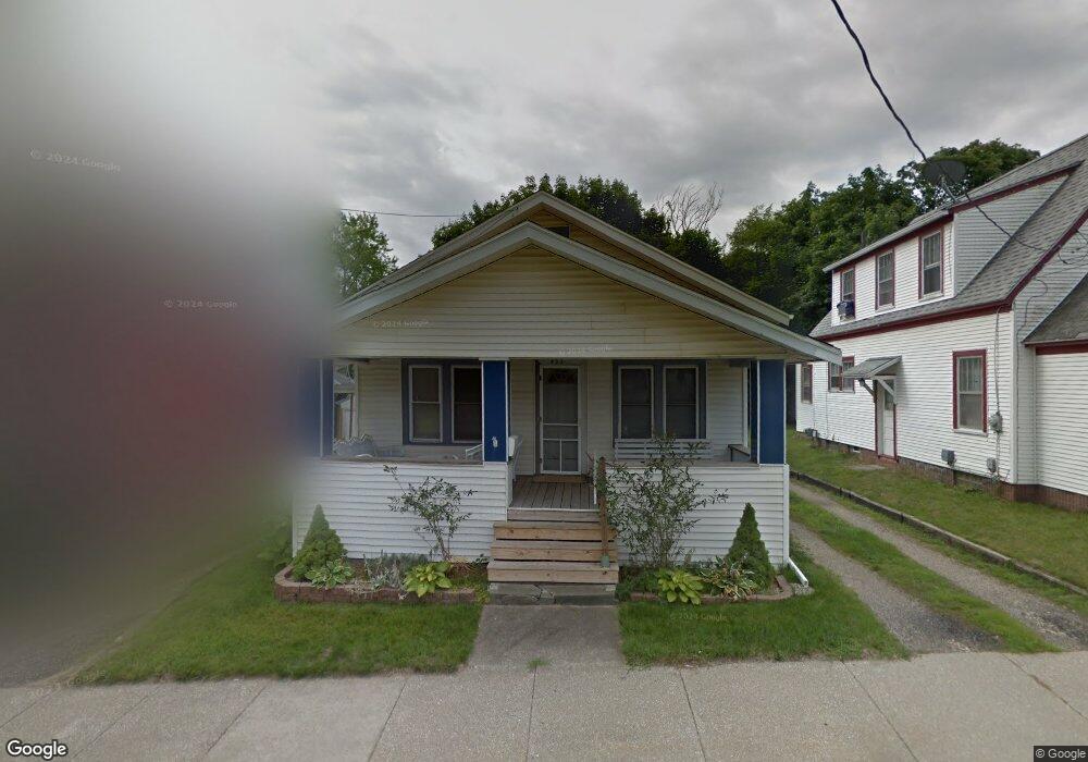
433 Forest St Kalamazoo, MI 49001
Vine NeighborhoodEstimated Value: $129,000 - $145,178
2
Beds
1
Bath
995
Sq Ft
$139/Sq Ft
Est. Value
About This Home
This home is located at 433 Forest St, Kalamazoo, MI 49001 and is currently estimated at $138,545, approximately $139 per square foot. 433 Forest St is a home located in Kalamazoo County with nearby schools including Woods Lake Elementary School, Maple Street Magnet School for the Arts, and Loy Norrix High School.
Ownership History
Date
Name
Owned For
Owner Type
Purchase Details
Closed on
Feb 1, 2017
Sold by
Perigo Andrew and Perigo Whitney G
Bought by
Perigo Matthew Robert
Current Estimated Value
Home Financials for this Owner
Home Financials are based on the most recent Mortgage that was taken out on this home.
Original Mortgage
$65,960
Outstanding Balance
$54,795
Interest Rate
4.32%
Mortgage Type
New Conventional
Estimated Equity
$83,750
Purchase Details
Closed on
Aug 8, 2008
Sold by
Peet Gregory A
Bought by
Perigo Andrew
Purchase Details
Closed on
Jun 10, 2004
Sold by
Peet Gregory A
Bought by
Peet Gregory A and Gregory A Peet Revocable Trust
Create a Home Valuation Report for This Property
The Home Valuation Report is an in-depth analysis detailing your home's value as well as a comparison with similar homes in the area
Home Values in the Area
Average Home Value in this Area
Purchase History
| Date | Buyer | Sale Price | Title Company |
|---|---|---|---|
| Perigo Matthew Robert | $68,000 | Chicago Title Of Michigan | |
| Perigo Andrew | $59,500 | Metro | |
| Peet Gregory A | -- | -- |
Source: Public Records
Mortgage History
| Date | Status | Borrower | Loan Amount |
|---|---|---|---|
| Open | Perigo Matthew Robert | $65,960 |
Source: Public Records
Tax History Compared to Growth
Tax History
| Year | Tax Paid | Tax Assessment Tax Assessment Total Assessment is a certain percentage of the fair market value that is determined by local assessors to be the total taxable value of land and additions on the property. | Land | Improvement |
|---|---|---|---|---|
| 2025 | $1,447 | $63,000 | $0 | $0 |
| 2024 | $808 | $57,000 | $0 | $0 |
| 2023 | $770 | $50,000 | $0 | $0 |
| 2022 | $1,312 | $43,000 | $0 | $0 |
| 2021 | $1,269 | $39,400 | $0 | $0 |
| 2020 | $1,243 | $35,400 | $0 | $0 |
| 2019 | $1,185 | $30,000 | $0 | $0 |
| 2018 | $1,157 | $26,500 | $0 | $0 |
| 2017 | $1,210 | $25,000 | $0 | $0 |
| 2016 | $1,210 | $22,700 | $0 | $0 |
| 2015 | $1,210 | $22,700 | $0 | $0 |
| 2014 | $1,210 | $22,700 | $0 | $0 |
Source: Public Records
Map
Nearby Homes
- 429 Forest St
- 435 Forest St
- 437 Forest St
- 441 Forest St
- 420 Forest St
- 428 Den Adel Ct
- 424 Den Adel Ct
- 409 Forest St
- 434 Den Adel Ct
- 416 Forest St
- 438 Forest St
- 1301 S Westnedge Ave
- 1301 S Westnedge Ave
- 412 Forest St
- 1317 S Westnedge Ave
- 1321 S Westnedge Ave
- 51852 Forest St
- 1303 S Westnedge Ave
- 1325 S Westnedge Ave
- 1310 S Park St