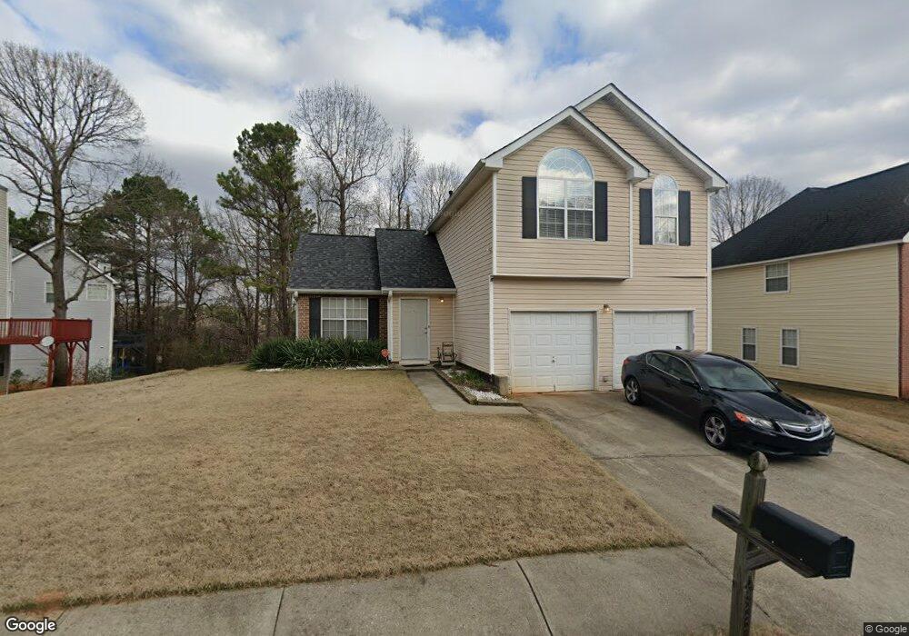
433 Gresham Dr Stockbridge, GA 30281
Estimated Value: $253,000 - $277,000
3
Beds
3
Baths
1,647
Sq Ft
$162/Sq Ft
Est. Value
About This Home
This home is located at 433 Gresham Dr, Stockbridge, GA 30281 and is currently estimated at $267,487, approximately $162 per square foot. 433 Gresham Dr is a home located in Henry County with nearby schools including Red Oak Elementary School, Dutchtown Middle School, and Dutchtown High School.
Ownership History
Date
Name
Owned For
Owner Type
Purchase Details
Closed on
Sep 4, 2008
Sold by
Wells Fargo Bank Na
Bought by
Fenwick Jocelyn N
Current Estimated Value
Home Financials for this Owner
Home Financials are based on the most recent Mortgage that was taken out on this home.
Original Mortgage
$112,791
Outstanding Balance
$74,571
Interest Rate
6.48%
Mortgage Type
FHA
Estimated Equity
$192,916
Purchase Details
Closed on
Jul 1, 2008
Sold by
Livingston Omario A
Bought by
Wells Fargo Bank Na
Purchase Details
Closed on
May 30, 2002
Sold by
Homelife Communities/Henry Inc
Bought by
Livingston Mario A
Home Financials for this Owner
Home Financials are based on the most recent Mortgage that was taken out on this home.
Original Mortgage
$122,000
Interest Rate
6.77%
Mortgage Type
FHA
Create a Home Valuation Report for This Property
The Home Valuation Report is an in-depth analysis detailing your home's value as well as a comparison with similar homes in the area
Home Values in the Area
Average Home Value in this Area
Purchase History
| Date | Buyer | Sale Price | Title Company |
|---|---|---|---|
| Fenwick Jocelyn N | $114,000 | -- | |
| Wells Fargo Bank Na | $94,457 | -- | |
| Livingston Mario A | $124,000 | -- |
Source: Public Records
Mortgage History
| Date | Status | Borrower | Loan Amount |
|---|---|---|---|
| Open | Fenwick Jocelyn N | $112,791 | |
| Previous Owner | Livingston Mario A | $122,000 |
Source: Public Records
Tax History
| Year | Tax Paid | Tax Assessment Tax Assessment Total Assessment is a certain percentage of the fair market value that is determined by local assessors to be the total taxable value of land and additions on the property. | Land | Improvement |
|---|---|---|---|---|
| 2025 | $4,752 | $113,880 | $14,000 | $99,880 |
| 2024 | $4,752 | $109,200 | $14,000 | $95,200 |
| 2023 | $4,272 | $99,240 | $10,000 | $89,240 |
| 2022 | $3,630 | $88,160 | $10,000 | $78,160 |
| 2021 | $2,679 | $63,200 | $8,000 | $55,200 |
| 2020 | $2,556 | $59,960 | $8,000 | $51,960 |
| 2019 | $2,269 | $54,480 | $8,000 | $46,480 |
| 2018 | $2,140 | $51,120 | $8,000 | $43,120 |
| 2016 | $1,974 | $46,800 | $8,000 | $38,800 |
| 2015 | $1,661 | $37,480 | $7,200 | $30,280 |
| 2014 | $1,385 | $30,120 | $4,800 | $25,320 |
Source: Public Records
Map
Nearby Homes
- 568 Ransom Way
- 652 Rayella Dr
- 705 Brentwood Pkwy
- 404 Northwind Place
- 1528 Buckingham Place Unit 1
- 512 Chaucer Way Unit 1
- 213 Sunderland Way Unit 1
- 1005 Borrington Ln
- 223 Monarch Village Way
- 137 Arbor Cove Way
- 309 Fairdale Trace
- 602 Brookwater Dr
- 115 Jasper Dr
- 511 Anglewood Trace
- 5005 Kens Ct
- 431 Broder Farms Dr
- 607 Brookwater Dr
- 677 Armitage Way
- 300 Monarch Village Way
- 640 Armitage Way
Your Personal Tour Guide
Ask me questions while you tour the home.