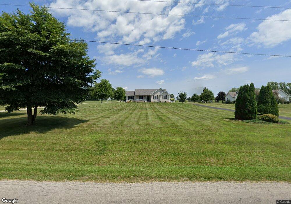
4334 Maple Grove Rd Wooster, OH 44691
Estimated Value: $354,000 - $394,000
3
Beds
2
Baths
1,592
Sq Ft
$231/Sq Ft
Est. Value
About This Home
This home is located at 4334 Maple Grove Rd, Wooster, OH 44691 and is currently estimated at $368,210, approximately $231 per square foot. 4334 Maple Grove Rd is a home located in Wayne County with nearby schools including Triway High School and Country Corner.
Ownership History
Date
Name
Owned For
Owner Type
Purchase Details
Closed on
Feb 16, 2012
Sold by
Corbett Jerry L
Bought by
Corbett David L
Current Estimated Value
Purchase Details
Closed on
Aug 1, 2007
Sold by
Grabowski Christopher W and Grabowski Ericka M
Bought by
Corbett Jerry L and Corbett Esther P
Purchase Details
Closed on
Jul 9, 2007
Sold by
Corbett Jerry L and Corbett Esther P
Bought by
Corbett Jerry L and The Jerry L Corbett Revocable Trust
Purchase Details
Closed on
Apr 6, 2001
Sold by
Davis Dean
Bought by
Grabowski Christopher W and Grabowski Ericka
Create a Home Valuation Report for This Property
The Home Valuation Report is an in-depth analysis detailing your home's value as well as a comparison with similar homes in the area
Home Values in the Area
Average Home Value in this Area
Purchase History
| Date | Buyer | Sale Price | Title Company |
|---|---|---|---|
| Corbett David L | $95,000 | Wayne County Title Agency | |
| Corbett Jerry L | $200,000 | Attorney | |
| Corbett Jerry L | -- | Attorney | |
| Grabowski Christopher W | $23,000 | -- |
Source: Public Records
Tax History Compared to Growth
Tax History
| Year | Tax Paid | Tax Assessment Tax Assessment Total Assessment is a certain percentage of the fair market value that is determined by local assessors to be the total taxable value of land and additions on the property. | Land | Improvement |
|---|---|---|---|---|
| 2024 | $3,145 | $91,460 | $25,240 | $66,220 |
| 2023 | $3,145 | $91,460 | $25,240 | $66,220 |
| 2022 | $2,648 | $70,360 | $19,420 | $50,940 |
| 2021 | $2,654 | $70,360 | $19,420 | $50,940 |
| 2020 | $2,685 | $70,360 | $19,420 | $50,940 |
| 2019 | $2,283 | $57,960 | $14,260 | $43,700 |
| 2018 | $2,325 | $57,960 | $14,260 | $43,700 |
| 2017 | $2,316 | $57,960 | $14,260 | $43,700 |
| 2016 | $2,248 | $55,730 | $13,710 | $42,020 |
| 2015 | $2,091 | $55,730 | $13,710 | $42,020 |
| 2014 | $2,093 | $55,730 | $13,710 | $42,020 |
| 2013 | $2,126 | $54,110 | $12,410 | $41,700 |
Source: Public Records
Map
Nearby Homes
- 4324 Maple Grove Rd
- 4354 Maple Grove Rd
- 4390 Maple Grove Rd
- 6221 Kister Rd
- 6249 Kister Rd
- 4270 Maple Grove Rd
- 4242 Maple Grove Rd
- 6185 Kister Rd
- 6275 Kister Rd
- 6161 Kister Rd
- 4373 Maple Grove Rd
- 6133 Kister Rd
- 4520 Maple Grove Rd
- 6101 Kister Rd
- 6110 Kister Rd
- 4600 Maple Grove Rd
- 6090 Kister Rd
- 5857 Kister Rd
- 6030 Kister Rd
- 6060 Kister Rd