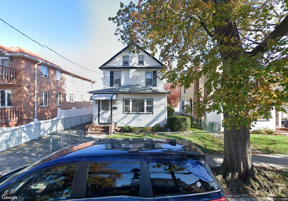
4335 189th St Flushing, NY 11358
Auburndale NeighborhoodEstimated Value: $1,811,000 - $2,136,349
Studio
--
Bath
2,625
Sq Ft
$763/Sq Ft
Est. Value
About This Home
This home is located at 4335 189th St, Flushing, NY 11358 and is currently estimated at $2,002,587, approximately $762 per square foot. 4335 189th St is a home located in Queens County with nearby schools including P.S. 107 Thomas A Dooley, I.S. 25 Adrien Block, and Francis Lewis High School.
Ownership History
Date
Name
Owned For
Owner Type
Purchase Details
Closed on
May 16, 2024
Sold by
Q & T Real Estate Ny Inc
Bought by
Yu Xiaojie
Current Estimated Value
Purchase Details
Closed on
Sep 17, 2021
Sold by
Colardi Michael F and Colardi Regina E
Bought by
Q & T Real Estate Ny Inc
Purchase Details
Closed on
Jun 29, 2000
Sold by
Colardi Frances
Bought by
Colardi Regina E and Colardi Michael F
Create a Home Valuation Report for This Property
The Home Valuation Report is an in-depth analysis detailing your home's value as well as a comparison with similar homes in the area
Home Values in the Area
Average Home Value in this Area
Purchase History
| Date | Buyer | Sale Price | Title Company |
|---|---|---|---|
| Yu Xiaojie | $1,964,090 | -- | |
| Yu Xiaojie | $1,964,090 | -- | |
| Yu Xiaojie | $1,964,090 | -- | |
| Q & T Real Estate Ny Inc | $999,000 | -- | |
| Q & T Real Estate Ny Inc | $999,000 | -- | |
| Q & T Real Estate Ny Inc | $999,000 | -- | |
| Colardi Regina E | -- | -- | |
| Colardi Regina E | -- | -- |
Source: Public Records
Tax History
| Year | Tax Paid | Tax Assessment Tax Assessment Total Assessment is a certain percentage of the fair market value that is determined by local assessors to be the total taxable value of land and additions on the property. | Land | Improvement |
|---|---|---|---|---|
| 2025 | $13,520 | $68,494 | $14,495 | $53,999 |
| 2024 | $13,520 | $67,312 | $15,051 | $52,261 |
| 2023 | $8,981 | $44,716 | $12,754 | $31,962 |
| 2022 | $8,497 | $66,720 | $19,440 | $47,280 |
| 2021 | $8,209 | $58,320 | $19,440 | $38,880 |
| 2020 | $8,255 | $60,000 | $19,440 | $40,560 |
| 2019 | $7,952 | $60,240 | $19,440 | $40,800 |
| 2018 | $7,298 | $37,263 | $16,561 | $20,702 |
| 2017 | $6,931 | $35,470 | $14,205 | $21,265 |
| 2016 | $6,423 | $35,470 | $14,205 | $21,265 |
| 2015 | $3,816 | $33,664 | $15,637 | $18,027 |
| 2014 | $3,816 | $32,844 | $16,043 | $16,801 |
Source: Public Records
Map
Nearby Homes
- 188-02 Northern Blvd
- 42-25 189th St
- 42-28 189th St
- 45-32 Utopia Pkwy
- 190-17 42nd Ave
- 43-32 194th St
- 4539 192nd St
- 43-44 195th St
- 45-47 193rd St
- 19112 Station Rd
- 4048 194th St Unit A3
- 192-14 Station Rd
- 40-38 194th St Unit 1A
- 4038 194th St Unit 3B
- 191-02 39th Ave
- 43-28 196th St
- 189-23 39th Ave Unit 122
- 4032 195th St
- 190-05 39th Ave Unit 142
- 45-31 195th St
- 43-35 189th St
- 43-39 189th St
- 4333 189th St
- 4339 189th St
- 4333 189th St
- 43-45 189th St
- 4331 189th St
- 4345 189th St
- 18912 43rd Rd
- 189-18 43rd Rd
- 18911 44th Ave
- 189-12 43rd Rd
- 18914 43rd Rd
- 18915 44th Ave
- 43-31 189th St
- 18918 43rd Rd
- 4338 189th St Unit 2 3315257
- 4338 189th St Unit 1 3315256
- 4338 189th St Unit 3277029
Your Personal Tour Guide
Ask me questions while you tour the home.