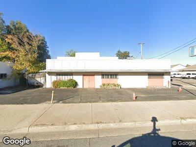
4344 Westside Rd Redding, CA 96001
Country Heights NeighborhoodEstimated Value: $216,273
--
Bed
--
Bath
3,072
Sq Ft
$70/Sq Ft
Est. Value
About This Home
This home is located at 4344 Westside Rd, Redding, CA 96001 and is currently estimated at $216,273, approximately $70 per square foot. 4344 Westside Rd is a home located in Shasta County with nearby schools including Juniper, Sequoia Middle School, and Shasta High School.
Ownership History
Date
Name
Owned For
Owner Type
Purchase Details
Closed on
Apr 20, 2023
Sold by
Palumbo Sandra Lou and Palumbo Neil John
Bought by
Palumbo Frank B
Current Estimated Value
Purchase Details
Closed on
Dec 28, 2021
Sold by
Palumbo Frank B
Bought by
Palumbo Neil John and Palumbo Sandra Lou
Purchase Details
Closed on
Nov 1, 2017
Sold by
Heier Alfred and Heier Colleen
Bought by
Palumbo Frank B
Home Financials for this Owner
Home Financials are based on the most recent Mortgage that was taken out on this home.
Original Mortgage
$109,000
Interest Rate
3.83%
Mortgage Type
Purchase Money Mortgage
Purchase Details
Closed on
Sep 4, 2007
Sold by
Heier Alfred and Heier Colleen
Bought by
Heier Alfred and Heier Colleen
Create a Home Valuation Report for This Property
The Home Valuation Report is an in-depth analysis detailing your home's value as well as a comparison with similar homes in the area
Home Values in the Area
Average Home Value in this Area
Purchase History
| Date | Buyer | Sale Price | Title Company |
|---|---|---|---|
| Palumbo Frank B | -- | None Listed On Document | |
| Palumbo Neil John | -- | None Available | |
| Palumbo Frank B | $149,000 | Placer Title Co | |
| Heier Alfred | -- | None Available |
Source: Public Records
Mortgage History
| Date | Status | Borrower | Loan Amount |
|---|---|---|---|
| Previous Owner | Palumbo Frank B | $109,000 |
Source: Public Records
Tax History Compared to Growth
Tax History
| Year | Tax Paid | Tax Assessment Tax Assessment Total Assessment is a certain percentage of the fair market value that is determined by local assessors to be the total taxable value of land and additions on the property. | Land | Improvement |
|---|---|---|---|---|
| 2024 | $1,788 | $166,208 | $55,774 | $110,434 |
| 2023 | $1,788 | $162,950 | $54,681 | $108,269 |
| 2022 | $1,759 | $159,756 | $53,609 | $106,147 |
| 2021 | $1,750 | $156,624 | $52,558 | $104,066 |
| 2020 | $1,772 | $155,019 | $52,020 | $102,999 |
| 2019 | $1,685 | $151,980 | $51,000 | $100,980 |
| 2018 | $1,699 | $149,000 | $50,000 | $99,000 |
| 2017 | $1,654 | $142,741 | $72,803 | $69,938 |
| 2016 | $1,607 | $140,366 | $71,376 | $68,990 |
| 2015 | $1,591 | $138,577 | $70,304 | $68,273 |
| 2014 | $1,583 | $136,126 | $68,927 | $67,199 |
Source: Public Records
Map
Nearby Homes
- 2098 El Reno Ln
- 4666 Cedars Rd
- 4680 Cedars Rd
- 3660-3671 Technology Way
- 3859 Sea Lavender Ct
- 3994 Sea Lavender Ct
- 0000 Wyndham Pointe Subdivision
- 2836 River Mist Ln
- 1905 Riviera Dr
- 3826 Railroad Ave
- 3800 Lagoon Dr
- 4987 Bidwell Rd
- 4576 Crimsonwood Dr
- 2876 River Mist Walk
- 2864 River Mist Walk
- 2844 River Mist Ln
- 4330 Rising Mist Cir
- 5101 Bidwell Rd
- 2773 Crystal Tree Dr
- 1425+ 1427 Riviera Dr
- 4344 Westside Rd
- 4410 Westside Rd Unit 64
- 4410 Westside Rd Unit 68
- 4410 Westside Rd Unit 48
- 2126 Pray Rd
- 4460 Westside Rd
- 4484 Westside Rd
- 2124 Pray Rd
- 2380 Buenaventura Blvd
- 2130 Pray Rd
- 2230 El Reno Ln
- 2206 El Reno Ln
- 2210 El Reno Ln
- 2200 El Reno Ln
- 2180 El Reno Ln
- 2180 El Reno 1weup7n136y3
- 2229 El Reno Ln
- 2227 El Reno Ln
- 4515 Harrison Ave
- 2166 El Reno Ln