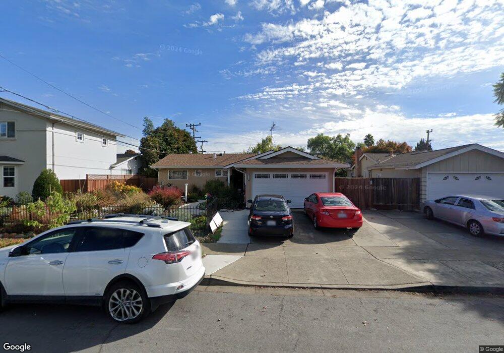
4346 Sloat Rd Fremont, CA 94538
Sundale NeighborhoodEstimated Value: $1,200,000 - $1,414,000
3
Beds
2
Baths
1,438
Sq Ft
$935/Sq Ft
Est. Value
About This Home
This home is located at 4346 Sloat Rd, Fremont, CA 94538 and is currently estimated at $1,345,050, approximately $935 per square foot. 4346 Sloat Rd is a home located in Alameda County with nearby schools including Brier Elementary School, G.M. Walters Middle School, and John F. Kennedy High School.
Ownership History
Date
Name
Owned For
Owner Type
Purchase Details
Closed on
Aug 30, 2024
Sold by
Chao Chentung and Xiao Hong
Bought by
Chentung Chao And Hong Xiaos Living Trust and Chao
Current Estimated Value
Purchase Details
Closed on
Sep 23, 2019
Sold by
Chapman Larry L and Chapman Renee K
Bought by
Hong Chao Chen Tung and Hong Xiao
Home Financials for this Owner
Home Financials are based on the most recent Mortgage that was taken out on this home.
Original Mortgage
$600,000
Interest Rate
3.6%
Mortgage Type
New Conventional
Create a Home Valuation Report for This Property
The Home Valuation Report is an in-depth analysis detailing your home's value as well as a comparison with similar homes in the area
Home Values in the Area
Average Home Value in this Area
Purchase History
| Date | Buyer | Sale Price | Title Company |
|---|---|---|---|
| Chentung Chao And Hong Xiaos Living Trust | -- | None Listed On Document | |
| Hong Chao Chen Tung | $865,000 | Chicago Title Company |
Source: Public Records
Mortgage History
| Date | Status | Borrower | Loan Amount |
|---|---|---|---|
| Previous Owner | Hong Chao Chen Tung | $600,000 |
Source: Public Records
Tax History Compared to Growth
Tax History
| Year | Tax Paid | Tax Assessment Tax Assessment Total Assessment is a certain percentage of the fair market value that is determined by local assessors to be the total taxable value of land and additions on the property. | Land | Improvement |
|---|---|---|---|---|
| 2025 | $11,248 | $938,989 | $437,452 | $508,537 |
| 2024 | $11,248 | $920,444 | $428,876 | $498,568 |
| 2023 | $10,948 | $909,262 | $420,468 | $488,794 |
| 2022 | $10,810 | $884,434 | $412,224 | $479,210 |
| 2021 | $10,543 | $866,961 | $404,144 | $469,817 |
| 2020 | $10,584 | $865,000 | $400,000 | $465,000 |
| 2019 | $3,366 | $241,521 | $124,436 | $117,085 |
| 2018 | $3,297 | $236,786 | $121,996 | $114,790 |
| 2017 | $3,214 | $232,144 | $119,605 | $112,539 |
| 2016 | $3,147 | $227,593 | $117,260 | $110,333 |
| 2015 | $3,094 | $224,175 | $115,499 | $108,676 |
| 2014 | $3,031 | $219,783 | $113,236 | $106,547 |
Source: Public Records
Map
Nearby Homes
- 39090 Presidio Way Unit 237
- 39530 Dorrington Ct
- 4714 Serra Ave
- 38837 Fremont Blvd
- 39134 Memorial St
- 4328 Cognina Ct
- 39193 State St
- 4600 Nelson St
- 4692 Nelson St
- 38265 Corrigan Ct
- 4715 Eggers Dr
- 39751 Bissy Common
- 39753 Placer Way
- 38611 Country Common
- 5033 Blacksand Rd
- 3275 Capitol Ave
- 4737 Boone Dr
- 3455 Gilman Common
- 3583 Madison Common
- 3833 Burton Common
- 4328 Sloat Rd
- 4364 Sloat Rd
- 39102 Delano Ct
- 4382 Sloat Rd
- 39061 Presidio Way
- 39077 Presidio Way
- 39100 Delano Ct
- 4343 Sloat Rd
- 4359 Sloat Rd
- 39093 Presidio Way
- 39116 Delano Ct
- 39035 Presidio Way
- 4398 Sloat Rd
- 4375 Sloat Rd
- 39103 Delano Ct
- 39101 Presidio Way
- 4391 Sloat Rd
- 39019 Presidio Way
- 4408 Sloat Rd
- 4412 Sloat Rd