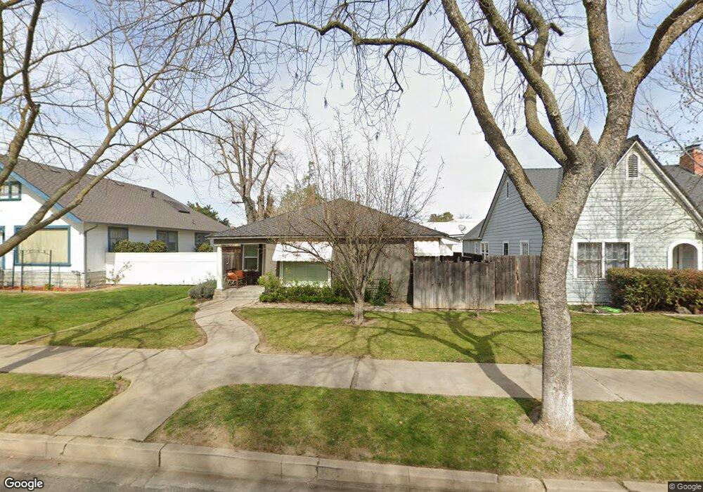
435 Forrest Ave Lodi, CA 95240
North Lodi NeighborhoodEstimated Value: $299,000 - $401,000
2
Beds
1
Bath
1,085
Sq Ft
$329/Sq Ft
Est. Value
About This Home
This home is located at 435 Forrest Ave, Lodi, CA 95240 and is currently estimated at $356,915, approximately $328 per square foot. 435 Forrest Ave is a home located in San Joaquin County with nearby schools including Lakewood Elementary School, Millswood Middle School, and Lodi High School.
Ownership History
Date
Name
Owned For
Owner Type
Purchase Details
Closed on
Dec 27, 2012
Sold by
Schultz Judith D
Bought by
Schultz Judith D and Judith D Schultz 2012 Trust
Current Estimated Value
Purchase Details
Closed on
Aug 15, 2012
Sold by
Gluffra Angelo
Bought by
Schultz Judith D
Purchase Details
Closed on
May 4, 2004
Sold by
Giuffra Maria and The Maria Giuffra Revocable Tr
Bought by
Giuffra Maria
Purchase Details
Closed on
Nov 27, 2001
Sold by
Giuffra Maria Adele
Bought by
Giuffra Maria and The Maria Giuffra Revocable Tr
Create a Home Valuation Report for This Property
The Home Valuation Report is an in-depth analysis detailing your home's value as well as a comparison with similar homes in the area
Home Values in the Area
Average Home Value in this Area
Purchase History
| Date | Buyer | Sale Price | Title Company |
|---|---|---|---|
| Schultz Judith D | -- | None Available | |
| Schultz Judith D | $95,000 | Old Republic Title Company | |
| Giuffra Maria | -- | None Available | |
| Giuffra Angelo | -- | None Available | |
| Giuffra Maria | -- | -- |
Source: Public Records
Tax History
| Year | Tax Paid | Tax Assessment Tax Assessment Total Assessment is a certain percentage of the fair market value that is determined by local assessors to be the total taxable value of land and additions on the property. | Land | Improvement |
|---|---|---|---|---|
| 2025 | $1,290 | $116,977 | $61,568 | $55,409 |
| 2024 | $1,255 | $114,684 | $60,361 | $54,323 |
| 2023 | $1,232 | $112,436 | $59,178 | $53,258 |
| 2022 | $1,205 | $110,232 | $58,018 | $52,214 |
| 2021 | $1,227 | $108,072 | $56,881 | $51,191 |
| 2020 | $1,195 | $106,965 | $56,298 | $50,667 |
| 2019 | $1,171 | $104,869 | $55,195 | $49,674 |
| 2018 | $1,155 | $102,813 | $54,113 | $48,700 |
| 2017 | $1,129 | $100,798 | $53,052 | $47,746 |
| 2016 | $1,059 | $98,822 | $52,012 | $46,810 |
| 2015 | $1,048 | $97,338 | $51,231 | $46,107 |
| 2014 | $1,035 | $95,431 | $50,227 | $45,204 |
Source: Public Records
Map
Nearby Homes
- 525 Eureka Ave
- 606 W Turner Rd
- 518 N Church St
- 705 N School St
- 333 W Locust St
- 625 N Sacramento St
- 507 N Sunset Dr
- 101 W Lockeford St
- 0 W Turner Rd Unit 226006338
- 1258 Rivergate Dr
- 1180 Northwood Dr
- 909 Greenwood Dr
- 1416 Reiman St
- 1427 Reiman St
- 1424 Graffigna Ave
- 1413 Mariposa Way
- 1507 Holly Dr
- 1729 Le Bec Ct
- 527 Cross St
- 1786 Le Bec Ct
- 439 Forrest Ave
- 431 Forrest Ave
- 427 Forrest Ave
- 423 Forrest Ave
- 720 N California St
- 715 N California St
- 620 N California St
- 419 Forrest Ave
- 430 Forrest Ave
- 430 Forrest Ave
- 501 Forrest Ave
- 430 Louie Ave
- 501 Falls Ave
- 504 Falls Ave
- 432 Louie Ave
- 740 N California St
- 436 Louie Ave
- 415 Forrest Ave
- 614 N California St
- 418 Louie Ave
Your Personal Tour Guide
Ask me questions while you tour the home.