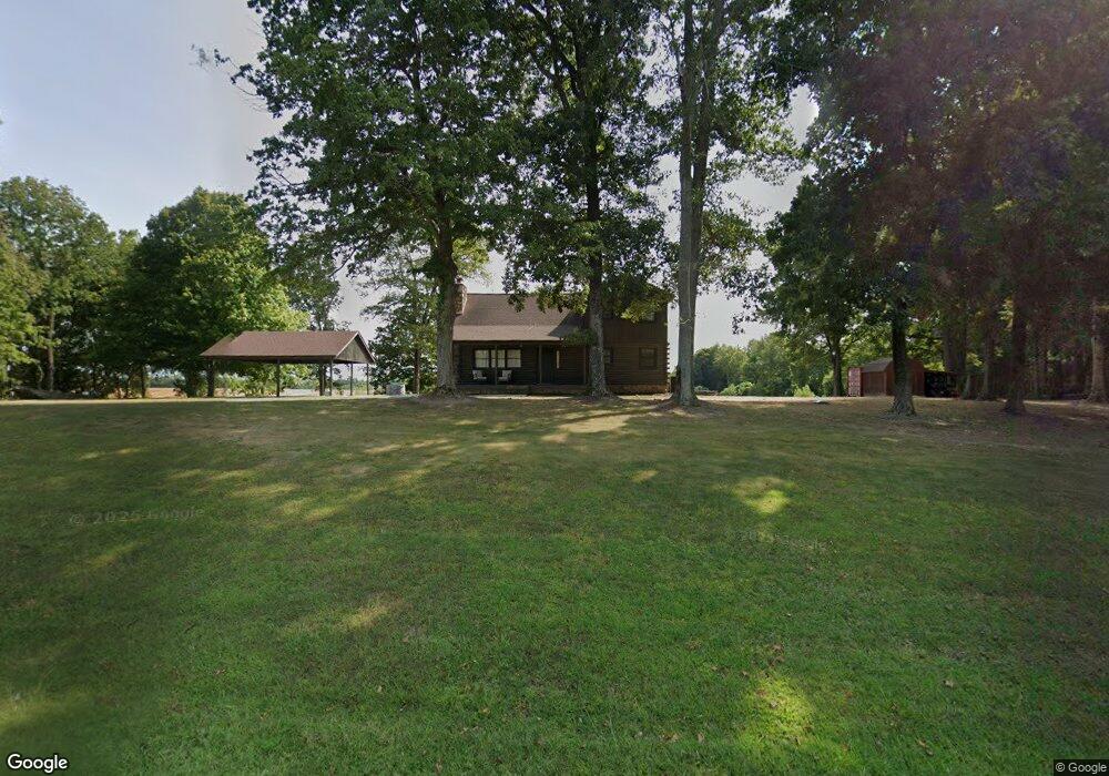
435 W State Line Rd Union City, TN 38261
Estimated Value: $213,000 - $248,000
--
Bed
2
Baths
1,508
Sq Ft
$155/Sq Ft
Est. Value
About This Home
This home is located at 435 W State Line Rd, Union City, TN 38261 and is currently estimated at $233,746, approximately $155 per square foot. 435 W State Line Rd is a home located in Obion County.
Ownership History
Date
Name
Owned For
Owner Type
Purchase Details
Closed on
Feb 8, 2021
Sold by
Wright Terry L and Wright Jean
Bought by
Kalb Kirk
Current Estimated Value
Home Financials for this Owner
Home Financials are based on the most recent Mortgage that was taken out on this home.
Original Mortgage
$152,000
Outstanding Balance
$135,397
Interest Rate
2.6%
Mortgage Type
New Conventional
Estimated Equity
$98,349
Purchase Details
Closed on
Nov 7, 2018
Sold by
Wright Terry L
Bought by
Wright Terry L and Wright Jean
Purchase Details
Closed on
Jan 1, 1983
Bought by
Wright Terry L
Create a Home Valuation Report for This Property
The Home Valuation Report is an in-depth analysis detailing your home's value as well as a comparison with similar homes in the area
Home Values in the Area
Average Home Value in this Area
Purchase History
| Date | Buyer | Sale Price | Title Company |
|---|---|---|---|
| Kalb Kirk | $160,000 | None Available | |
| Wright Terry L | -- | -- | |
| Wright Terry L | $6,800 | -- |
Source: Public Records
Mortgage History
| Date | Status | Borrower | Loan Amount |
|---|---|---|---|
| Open | Kalb Kirk | $152,000 |
Source: Public Records
Tax History Compared to Growth
Tax History
| Year | Tax Paid | Tax Assessment Tax Assessment Total Assessment is a certain percentage of the fair market value that is determined by local assessors to be the total taxable value of land and additions on the property. | Land | Improvement |
|---|---|---|---|---|
| 2025 | $748 | $54,175 | $0 | $0 |
| 2024 | $748 | $54,175 | $4,000 | $50,175 |
| 2023 | $538 | $38,975 | $4,000 | $34,975 |
| 2022 | $436 | $22,925 | $2,600 | $20,325 |
| 2021 | $436 | $22,925 | $2,600 | $20,325 |
| 2020 | $434 | $22,925 | $2,600 | $20,325 |
| 2019 | $434 | $22,825 | $2,600 | $20,225 |
| 2018 | $435 | $22,825 | $2,600 | $20,225 |
| 2017 | $471 | $23,500 | $2,600 | $20,900 |
| 2016 | $471 | $23,500 | $2,600 | $20,900 |
| 2015 | $471 | $23,500 | $2,600 | $20,900 |
| 2014 | $471 | $23,500 | $2,600 | $20,900 |
Source: Public Records
Map
Nearby Homes
- Tract 1 Walter Whipple Rd
- 4478 Crystal Rd
- 3272 St Rt 925
- 105 Cherry Laurel Ln
- 2310 S 7th St
- 2011 Myron Cory Dr
- 1535 Lattus Ln
- 0 Burrus Rd
- 1405 Myron Cory Dr
- 4744 N Clayton Antioch Rd
- 1308 Nelson St
- 370 S Thompson St
- 920 Troy Ave
- 919 Troy Ave
- 1559 Ella Groom Rd
- 115 E Wellington St
- 5030 Rogers Marshall Rd
- 317 W Highway 22
- 0 Denson Rd
- 72 W Highway 22
- 6002 State Line Rd
- 5919 Walter Whipple Rd
- 5636 State Line Rd
- 3108 Lattus Rd
- 6922 State Line Rd
- 6922 W State Line Rd
- 2930 Lattus Rd
- 5998 N Old State Line Rd
- 5528 State Line Rd
- 5907 N Old State Line Rd
- 821 Mangold Rd
- 428 Mangold Rd
- 55 E State Line Rd
- 5745 State Route 1463
- 5642 State Route 1463
- 5783 N Old State Line Rd
- 2429 Lattus Rd