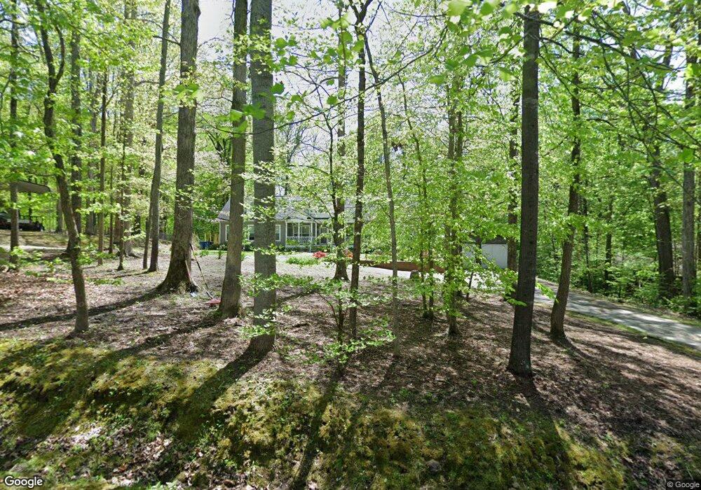
4353 Brandy Rd Greensboro, NC 27407
Kirkman Crossroad NeighborhoodEstimated Value: $278,000 - $399,000
3
Beds
2
Baths
2,055
Sq Ft
$160/Sq Ft
Est. Value
About This Home
This home is located at 4353 Brandy Rd, Greensboro, NC 27407 and is currently estimated at $327,884, approximately $159 per square foot. 4353 Brandy Rd is a home located in Guilford County with nearby schools including Southern Guilford Middle and Southern Guilford High School.
Ownership History
Date
Name
Owned For
Owner Type
Purchase Details
Closed on
Dec 30, 2015
Sold by
Taylor Thomas B and Taylor Terrie N
Bought by
Willard Crispin D and Willard Kelli F
Current Estimated Value
Purchase Details
Closed on
May 19, 2006
Sold by
Sink Aaron Michael
Bought by
Taylor Thomas B and Taylor Terrie N
Home Financials for this Owner
Home Financials are based on the most recent Mortgage that was taken out on this home.
Original Mortgage
$32,000
Interest Rate
6.39%
Mortgage Type
Purchase Money Mortgage
Purchase Details
Closed on
Dec 28, 2005
Sold by
Abn Amro Mortgage Group Inc
Bought by
Sink Aaron Michael
Purchase Details
Closed on
Nov 7, 2005
Sold by
Vest Michael
Bought by
Abn Amro Mortgage Group Inc
Create a Home Valuation Report for This Property
The Home Valuation Report is an in-depth analysis detailing your home's value as well as a comparison with similar homes in the area
Home Values in the Area
Average Home Value in this Area
Purchase History
| Date | Buyer | Sale Price | Title Company |
|---|---|---|---|
| Willard Crispin D | $38,000 | Attorney | |
| Taylor Thomas B | $45,000 | None Available | |
| Sink Aaron Michael | -- | None Available | |
| Abn Amro Mortgage Group Inc | $44,784 | None Available |
Source: Public Records
Mortgage History
| Date | Status | Borrower | Loan Amount |
|---|---|---|---|
| Previous Owner | Taylor Thomas B | $32,000 |
Source: Public Records
Tax History Compared to Growth
Tax History
| Year | Tax Paid | Tax Assessment Tax Assessment Total Assessment is a certain percentage of the fair market value that is determined by local assessors to be the total taxable value of land and additions on the property. | Land | Improvement |
|---|---|---|---|---|
| 2025 | $1,547 | $178,300 | $28,000 | $150,300 |
| 2024 | $1,547 | $178,300 | $28,000 | $150,300 |
| 2023 | $1,547 | $178,300 | $28,000 | $150,300 |
| 2022 | $1,547 | $178,300 | $28,000 | $150,300 |
| 2021 | $1,398 | $161,100 | $20,000 | $141,100 |
| 2020 | $1,398 | $161,100 | $20,000 | $141,100 |
| 2019 | $1,370 | $161,100 | $0 | $0 |
| 2018 | $1,363 | $161,100 | $0 | $0 |
| 2017 | $1,370 | $161,100 | $0 | $0 |
| 2016 | $173 | $20,000 | $0 | $0 |
| 2015 | $174 | $20,000 | $0 | $0 |
| 2014 | $176 | $20,000 | $0 | $0 |
Source: Public Records
Map
Nearby Homes
- 4805 Bisbee
- 5217 Overlea Dr
- 5509 Fallingbrooks Dr
- 5009 Wiley Park Dr
- 7 Hadley Park Ct
- 4507 Trailwood Dr
- 4714 Postbridge Dr
- 4711 Postbridge Dr
- 4712 Postbridge Dr
- 4707 Postbridge Dr
- 4710 Postbridge Dr
- 2 Claridge Ct
- 4704 Postbridge Dr
- 4107 S Rockingham Rd
- 4900 Postbridge Dr
- 39 Creswell Manor Dr
- 1 Postbridge Ct
- 4500 Pemberton Rd
- 4904 Postbridge Dr
- 22 Creswell Manor Dr
- 4357 Brandy Rd
- 4351 Brandy Rd
- 4350 Brandy Rd
- 4349 Brandy Rd
- 4348 Brandy Rd
- 4345 Brandy Rd
- 4342 Brandy Rd
- 4341 Brandy Rd
- 2712 Kivett Dr
- 4337 Brandy Rd
- 4338 Brandy Rd
- 4335 Brandy Rd
- 4334 Brandy Rd
- 4333 Brandy Rd
- 4332 Brandy Rd
- 4331 Brandy Rd
- 4330 Brandy Rd
- 4333 Cimmaron Ct
- 4327 Brandy Rd
- 4328 Brandy Rd