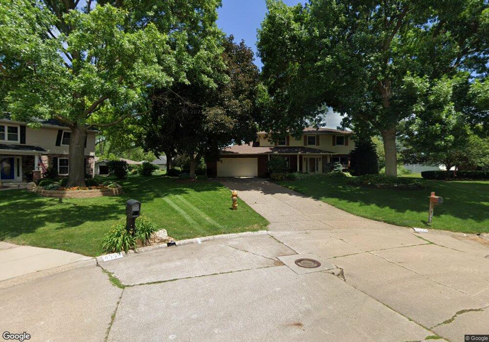
4355 Edwards Ct Davenport, IA 52807
North Side NeighborhoodEstimated Value: $399,000 - $516,000
4
Beds
7
Baths
3,114
Sq Ft
$147/Sq Ft
Est. Value
About This Home
This home is located at 4355 Edwards Ct, Davenport, IA 52807 and is currently estimated at $458,650, approximately $147 per square foot. 4355 Edwards Ct is a home located in Scott County with nearby schools including Jones Park Elementary School, Eisenhower Elementary School, and Casey County Middle School.
Ownership History
Date
Name
Owned For
Owner Type
Purchase Details
Closed on
Dec 2, 2022
Sold by
Congdon Marcia A and Congdon Ralph H
Bought by
Marcia A Congdon And Ralph H Congdon Joint Re and Congdon
Current Estimated Value
Create a Home Valuation Report for This Property
The Home Valuation Report is an in-depth analysis detailing your home's value as well as a comparison with similar homes in the area
Home Values in the Area
Average Home Value in this Area
Purchase History
| Date | Buyer | Sale Price | Title Company |
|---|---|---|---|
| Marcia A Congdon And Ralph H Congdon Joint Re | -- | None Listed On Document |
Source: Public Records
Tax History Compared to Growth
Tax History
| Year | Tax Paid | Tax Assessment Tax Assessment Total Assessment is a certain percentage of the fair market value that is determined by local assessors to be the total taxable value of land and additions on the property. | Land | Improvement |
|---|---|---|---|---|
| 2025 | $6,972 | $447,310 | $47,450 | $399,860 |
| 2024 | $6,796 | $408,780 | $47,450 | $361,330 |
| 2023 | $7,714 | $408,780 | $47,450 | $361,330 |
| 2022 | $7,628 | $373,400 | $42,460 | $330,940 |
| 2021 | $7,628 | $367,890 | $42,460 | $325,430 |
| 2020 | $7,248 | $345,820 | $42,460 | $303,360 |
| 2019 | $7,000 | $323,760 | $42,460 | $281,300 |
| 2018 | $6,542 | $323,760 | $42,460 | $281,300 |
| 2017 | $1,706 | $309,970 | $42,460 | $267,510 |
| 2016 | $6,404 | $304,450 | $0 | $0 |
| 2015 | $6,404 | $282,610 | $0 | $0 |
| 2014 | $6,010 | $274,670 | $0 | $0 |
| 2013 | $5,726 | $0 | $0 | $0 |
| 2012 | -- | $280,250 | $42,330 | $237,920 |
Source: Public Records
Map
Nearby Homes
- 2203 E 46th St
- 4406 Belle Ave
- 4230 Jersey Ridge Rd
- 2318 E 46th St
- 2321 E 47th St
- 4324 Spring St
- 4600 Eastern Ave
- 1960 E 50th Ct
- 2403 E 51st St Unit 102E
- 4005 Forest Rd
- 2418 E 51st St Unit A
- 2422 E 51st St Unit E
- 4919 Lorton Ave
- 2919 E 44th Ct
- 2506 E 35th Street Ct
- 2916 E 45th Ct
- 2501 E 34th Street Ct
- 2924 E 45th Ct
- 1227 E Kimberly Rd
- 3315 Fairhaven Rd
- 4354 Edwards Ct
- 4349 Edwards Ct
- 2217 E 45th St
- 4424 Winding Hill Rd
- 2231 E 45th St
- 4414 Winding Hill Rd
- 4338 Winding Hill Rd
- 2207 E 45th St
- 4438 Winding Hill Rd
- 4350 Edwards Ct
- 4339 Edwards Ct
- 4328 Winding Hill Rd
- 2119 E 45th St
- 4340 Edwards Ct
- 4318 Winding Hill Rd
- 4329 Edwards Ct
- 2212 E 45th St
- 4417 Winding Hill Rd
- 2234 E 45th St
- 4429 Winding Hill Rd