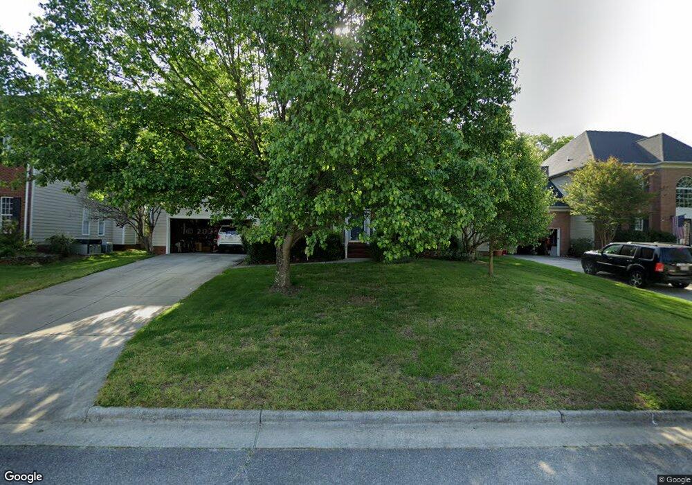
4364 Cedar Trail Ct High Point, NC 27265
Bent Tree NeighborhoodEstimated Value: $409,866 - $424,000
4
Beds
3
Baths
2,514
Sq Ft
$166/Sq Ft
Est. Value
About This Home
This home is located at 4364 Cedar Trail Ct, High Point, NC 27265 and is currently estimated at $417,467, approximately $166 per square foot. 4364 Cedar Trail Ct is a home located in Guilford County with nearby schools including Southwest Elementary School, Southwest Guilford Middle School, and Southwest Guilford High School.
Ownership History
Date
Name
Owned For
Owner Type
Purchase Details
Closed on
Mar 1, 2005
Sold by
Piemonte Joseph P and Piemonte Tami A
Bought by
Drew John B and Drew Laura A
Current Estimated Value
Home Financials for this Owner
Home Financials are based on the most recent Mortgage that was taken out on this home.
Original Mortgage
$182,500
Outstanding Balance
$91,048
Interest Rate
5.37%
Mortgage Type
Fannie Mae Freddie Mac
Estimated Equity
$326,419
Purchase Details
Closed on
Feb 1, 2001
Sold by
The New Fortis Corp
Bought by
Piemonte Joseph P and Piemonte Tami A
Home Financials for this Owner
Home Financials are based on the most recent Mortgage that was taken out on this home.
Original Mortgage
$213,567
Interest Rate
6.12%
Create a Home Valuation Report for This Property
The Home Valuation Report is an in-depth analysis detailing your home's value as well as a comparison with similar homes in the area
Home Values in the Area
Average Home Value in this Area
Purchase History
| Date | Buyer | Sale Price | Title Company |
|---|---|---|---|
| Drew John B | $238,000 | -- | |
| Piemonte Joseph P | $225,000 | -- |
Source: Public Records
Mortgage History
| Date | Status | Borrower | Loan Amount |
|---|---|---|---|
| Open | Drew John B | $182,500 | |
| Previous Owner | Piemonte Joseph P | $213,567 |
Source: Public Records
Tax History Compared to Growth
Tax History
| Year | Tax Paid | Tax Assessment Tax Assessment Total Assessment is a certain percentage of the fair market value that is determined by local assessors to be the total taxable value of land and additions on the property. | Land | Improvement |
|---|---|---|---|---|
| 2025 | $4,414 | $320,300 | $85,000 | $235,300 |
| 2024 | $4,414 | $320,300 | $85,000 | $235,300 |
| 2023 | $4,414 | $320,300 | $85,000 | $235,300 |
| 2022 | $4,318 | $320,300 | $85,000 | $235,300 |
| 2021 | $2,821 | $204,700 | $48,000 | $156,700 |
| 2020 | $2,821 | $204,700 | $48,000 | $156,700 |
| 2019 | $2,821 | $204,700 | $0 | $0 |
| 2018 | $2,807 | $204,700 | $0 | $0 |
| 2017 | $2,807 | $204,700 | $0 | $0 |
| 2016 | $2,526 | $180,100 | $0 | $0 |
| 2015 | $2,539 | $180,100 | $0 | $0 |
| 2014 | $2,583 | $180,100 | $0 | $0 |
Source: Public Records
Map
Nearby Homes
- 3007 Maple Branch Dr
- 3171 Riley Ford Trail Unit Lot 38
- Richmond Plan at Williard Place
- 3296 Alyssa Way
- Cameron Plan at Williard Place
- Southport Plan at Williard Place
- Columbia Plan at Williard Place
- Bailey Plan at Williard Place
- 3273 Alyssa Way
- 3301 Alyssa Way
- 3171 Riley Ford Trail
- 3199 Riley Ford Trail
- 3199 Riley Ford Trail Unit Lot 33
- 3525 Covent Oak Ct
- 2350 Birch View Dr
- 4103 Quarterstaff Ct
- 2305 Faircloth Way
- 1515 Skeet Club Rd
- 3924 Braddock Rd
- 737 Carneros Cir
- 4362 Cedar Trail Ct
- 4368 Cedar Trail Ct
- 4358 Cedar Trail Ct
- 4372 Cedar Trail Ct
- 4363 Cedar Trail Ct
- 4359 Cedar Trail Ct
- 4367 Cedar Trail Ct
- 4371 Cedar Trail Ct
- 4355 Cedar Trail Ct
- 4354 Cedar Trail Ct
- 2970 Maple Branch Dr
- 2974 Maple Branch Dr
- 2980 Maple Branch Dr
- 4351 Cedar Trail Ct
- 2964 Maple Branch Dr
- 4350 Cedar Trail Ct
- 2960 Maple Branch Dr
- 2992 Maple Branch Dr
- 4384 Peaceford Glen Dr
- 4380 Peaceford Glen Dr