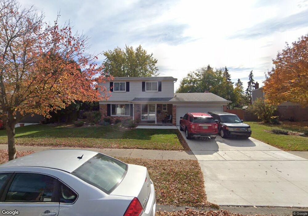
43673 Lancaster Ct Canton, MI 48187
Estimated Value: $385,973 - $407,000
Studio
3
Baths
1,785
Sq Ft
$224/Sq Ft
Est. Value
About This Home
This home is located at 43673 Lancaster Ct, Canton, MI 48187 and is currently estimated at $399,493, approximately $223 per square foot. 43673 Lancaster Ct is a home located in Wayne County with nearby schools including Canton High School, Salem High School, and East Middle School.
Ownership History
Date
Name
Owned For
Owner Type
Purchase Details
Closed on
Jun 24, 2002
Sold by
Price Edwin E
Bought by
Baer Michelle R
Current Estimated Value
Home Financials for this Owner
Home Financials are based on the most recent Mortgage that was taken out on this home.
Original Mortgage
$184,800
Outstanding Balance
$77,529
Interest Rate
6.7%
Mortgage Type
Purchase Money Mortgage
Estimated Equity
$321,964
Purchase Details
Closed on
Sep 2, 1997
Sold by
Nastelin Jennifer Green
Bought by
Price Edwin E
Create a Home Valuation Report for This Property
The Home Valuation Report is an in-depth analysis detailing your home's value as well as a comparison with similar homes in the area
Home Values in the Area
Average Home Value in this Area
Purchase History
| Date | Buyer | Sale Price | Title Company |
|---|---|---|---|
| Baer Michelle R | $231,000 | -- | |
| Price Edwin E | $152,000 | -- |
Source: Public Records
Mortgage History
| Date | Status | Borrower | Loan Amount |
|---|---|---|---|
| Open | Baer Michelle R | $184,800 |
Source: Public Records
Tax History
| Year | Tax Paid | Tax Assessment Tax Assessment Total Assessment is a certain percentage of the fair market value that is determined by local assessors to be the total taxable value of land and additions on the property. | Land | Improvement |
|---|---|---|---|---|
| 2025 | $1,923 | $180,000 | $0 | $0 |
| 2024 | $1,869 | $164,100 | $0 | $0 |
| 2023 | $1,782 | $149,700 | $0 | $0 |
| 2022 | $4,006 | $136,900 | $0 | $0 |
| 2021 | $3,882 | $132,100 | $0 | $0 |
| 2020 | $3,825 | $130,900 | $0 | $0 |
| 2019 | $3,757 | $119,530 | $0 | $0 |
| 2018 | $1,514 | $117,120 | $0 | $0 |
| 2017 | $3,960 | $114,000 | $0 | $0 |
| 2016 | $3,447 | $111,700 | $0 | $0 |
| 2015 | $8,320 | $100,600 | $0 | $0 |
| 2013 | $8,060 | $83,840 | $0 | $0 |
| 2010 | -- | $83,390 | $45,258 | $38,132 |
Source: Public Records
Map
Nearby Homes
- 43086 Versailles Rd
- 43529 Oakbrook Rd
- 7925 N Sheldon Rd
- 44570 Tillotson Dr
- 44432 Newburyport Dr
- 8830 Northern Ave
- 8815 Marlowe Ave
- 6852 New Providence Way Unit 104
- 0 Joy Rd Unit Parcel 3
- 0 Joy Rd Unit Parcel 2
- 0 Joy Rd Unit Parcel B
- 0 Joy Rd Unit Parcel A
- 8887 Morrison Ave
- 42542 Saratoga Rd Unit 26
- 9011 Elmhurst Ave
- 44805 Joy Rd
- 41950 Coventry Way Unit 135
- 42090 Saratoga Cir Unit 53
- 9048 Brookline Ave
- 835 Coldrose Way
- 43663 Lancaster Ct
- 43697 Lancaster Ct
- 43651 Lancaster Ct
- 43694 Lombardy Dr
- 43670 Lombardy Dr
- 43672 Lancaster Ct
- 43658 Lombardy Dr
- 43641 Lancaster Ct
- 43684 Lancaster Ct
- 43662 Lancaster Ct
- 43696 Lancaster Ct
- 43650 Lancaster Ct
- 43646 Lombardy Dr
- 43718 Brandywyne Rd
- 43629 Lancaster Ct
- 7783 Hillsboro Dr
- 43705 Brandywyne Rd
- 43640 Lancaster Ct
- 7771 Hillsboro Dr
- 43634 Lombardy Dr
Your Personal Tour Guide
Ask me questions while you tour the home.