4372 State Route 66 Apollo, PA 15613
Washington Township NeighborhoodEstimated Value: $199,000 - $214,000
--
Bed
--
Bath
960
Sq Ft
$213/Sq Ft
Est. Value
About This Home
This home is located at 4372 State Route 66, Apollo, PA 15613 and is currently estimated at $204,667, approximately $213 per square foot. 4372 State Route 66 is a home located in Westmoreland County with nearby schools including Kiski Area High School.
Ownership History
Date
Name
Owned For
Owner Type
Purchase Details
Closed on
Aug 14, 2022
Sold by
Tobin Ashleigh O
Bought by
Mcdivitt Shaun A
Current Estimated Value
Home Financials for this Owner
Home Financials are based on the most recent Mortgage that was taken out on this home.
Original Mortgage
$192,000
Outstanding Balance
$186,221
Interest Rate
5.51%
Mortgage Type
New Conventional
Create a Home Valuation Report for This Property
The Home Valuation Report is an in-depth analysis detailing your home's value as well as a comparison with similar homes in the area
Home Values in the Area
Average Home Value in this Area
Purchase History
| Date | Buyer | Sale Price | Title Company |
|---|---|---|---|
| Mcdivitt Shaun A | $240,000 | None Listed On Document |
Source: Public Records
Mortgage History
| Date | Status | Borrower | Loan Amount |
|---|---|---|---|
| Open | Mcdivitt Shaun A | $192,000 | |
| Previous Owner | Mckown William | $426,000 |
Source: Public Records
Tax History Compared to Growth
Tax History
| Year | Tax Paid | Tax Assessment Tax Assessment Total Assessment is a certain percentage of the fair market value that is determined by local assessors to be the total taxable value of land and additions on the property. | Land | Improvement |
|---|---|---|---|---|
| 2025 | $2,558 | $17,150 | $3,230 | $13,920 |
| 2024 | $2,425 | $17,150 | $3,230 | $13,920 |
| 2023 | $2,214 | $17,150 | $3,230 | $13,920 |
| 2022 | $2,145 | $17,150 | $3,230 | $13,920 |
| 2021 | $2,145 | $17,150 | $3,230 | $13,920 |
| 2020 | $2,140 | $17,150 | $3,230 | $13,920 |
| 2019 | $2,114 | $17,150 | $3,230 | $13,920 |
| 2018 | $2,080 | $17,440 | $3,230 | $14,210 |
| 2017 | $2,029 | $17,150 | $3,230 | $13,920 |
| 2016 | $1,997 | $17,150 | $3,230 | $13,920 |
| 2015 | $1,997 | $17,150 | $3,230 | $13,920 |
| 2014 | $1,986 | $17,150 | $3,230 | $13,920 |
Source: Public Records
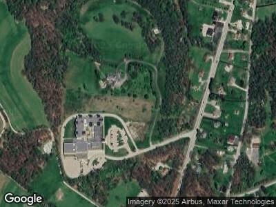
Map
Nearby Homes
- 380 Northgate Dr Unit D
- 184 Pine Run Church Rd
- 628 Grange Dr
- 231 Pine Run Church Rd
- 457 Blue Jay Ln
- 614 Lark Ln
- 4555 State Route 66
- 843 Pine Run Rd
- 150 Watson Rd
- 845 Kiski Park Dr
- 216 Karen Dr
- 208 Roselle Dr
- 121 Beatty St
- 139 Willow Rd
- 4792 State Route 66
- 125 Kochka Dr
- 271 Kochka Dr
- 621 Canal Rd
- 1682 Hancock Ave
- 718 Route 356
- 4372 State Route 66
- 4372 State Route 66
- 4372 State Route 66
- 4376 State Route 66
- 582 Sportsman Dr
- 572 Sportsman Dr
- 576 Sportsman Dr
- 568 Sportsman Dr
- 4363 State Route 66
- 4359 State Route 66
- 4353 State Route 66
- 4359 State Rt 66
- 4390 State Route 66
- 596 Sportsman Dr
- 558 Sportsman Dr
- 550 Sportsman Dr
- 606 Sportsman Dr
- 600 Sportsman Dr
- 4400 State Route 66
- 4354 State Route 66