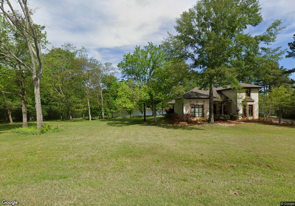
438 Mannsdale Rd Madison, MS 39110
Estimated Value: $757,172 - $811,000
--
Bed
--
Bath
3,780
Sq Ft
$207/Sq Ft
Est. Value
About This Home
This home is located at 438 Mannsdale Rd, Madison, MS 39110 and is currently estimated at $782,057, approximately $206 per square foot. 438 Mannsdale Rd is a home with nearby schools including Mannsdale Elementary School, Germantown Middle School, and Germantown High School.
Ownership History
Date
Name
Owned For
Owner Type
Purchase Details
Closed on
Jan 4, 2021
Sold by
Tunney Richard
Bought by
Tunney Melodie
Current Estimated Value
Home Financials for this Owner
Home Financials are based on the most recent Mortgage that was taken out on this home.
Original Mortgage
$300,000
Interest Rate
2.71%
Mortgage Type
New Conventional
Create a Home Valuation Report for This Property
The Home Valuation Report is an in-depth analysis detailing your home's value as well as a comparison with similar homes in the area
Home Values in the Area
Average Home Value in this Area
Purchase History
| Date | Buyer | Sale Price | Title Company |
|---|---|---|---|
| Tunney Melodie | -- | None Available |
Source: Public Records
Mortgage History
| Date | Status | Borrower | Loan Amount |
|---|---|---|---|
| Closed | Tunney Melodie | $300,000 |
Source: Public Records
Tax History Compared to Growth
Tax History
| Year | Tax Paid | Tax Assessment Tax Assessment Total Assessment is a certain percentage of the fair market value that is determined by local assessors to be the total taxable value of land and additions on the property. | Land | Improvement |
|---|---|---|---|---|
| 2025 | $4,330 | $44,904 | $0 | $0 |
| 2024 | $4,330 | $44,904 | $0 | $0 |
| 2023 | $4,009 | $41,796 | $0 | $0 |
| 2022 | $4,009 | $41,796 | $0 | $0 |
| 2021 | $1,289 | $12,750 | $0 | $0 |
| 2020 | $1,289 | $12,750 | $0 | $0 |
| 2019 | $1,289 | $12,750 | $0 | $0 |
| 2018 | $1,289 | $12,750 | $0 | $0 |
| 2017 | $1,289 | $12,750 | $0 | $0 |
| 2016 | $1,289 | $12,750 | $0 | $0 |
| 2015 | $1,238 | $12,750 | $0 | $0 |
| 2014 | $1,187 | $12,750 | $0 | $0 |
Source: Public Records
Map
Nearby Homes
- 105 Brierfield Dr
- 119 Brierfield Dr
- 111 Johnstone Dr
- 122 Oakdale Rd
- No Cove
- 154 Oakdale Rd
- 128 Charlton Dr
- 97 Chestnut Hill Rd
- 177 Chestnut Hill Rd
- 138 Chestnut Hill Rd
- 131 Devlin Springs Dr
- 107 Chestnut Hill Rd
- 135 Devlin Springs Dr
- 66 Chestnut Spring Rd
- 0 Chestnut Hill Rd Unit 4108110
- 0 Chestnut Hill Rd Unit 4119153
- 0 Chestnut Hill Rd Unit 4108109
- 0 Chestnut Hill Rd Unit 4099183
- 0 Chestnut Hill Rd Unit 4119156
- 0 Chestnut Hill Rd Unit 4119157
- 426 Mannsdale Rd
- 9 Highway 463 None Unit acres
- 9 Highway 463 None
- 424 Mannsdale Rd
- 400 Mannsdale Rd
- 474 Mannsdale Rd
- 384 Mannsdale Rd Unit 6
- 384 Mannsdale Rd
- 125 Livingston Dr
- 127 Livingston Dr
- 123 Livingston Dr
- 121 Livingston Dr
- 0000 Mannsdale Rd
- 470 Mannsdale Rd Unit B
- 470 Mannsdale Rd
- 129 Livingston Dr
- 382 Mannsdale Rd
- 128 Livingston Dr
- 126 Livingston Dr
- 119 Livingston Dr