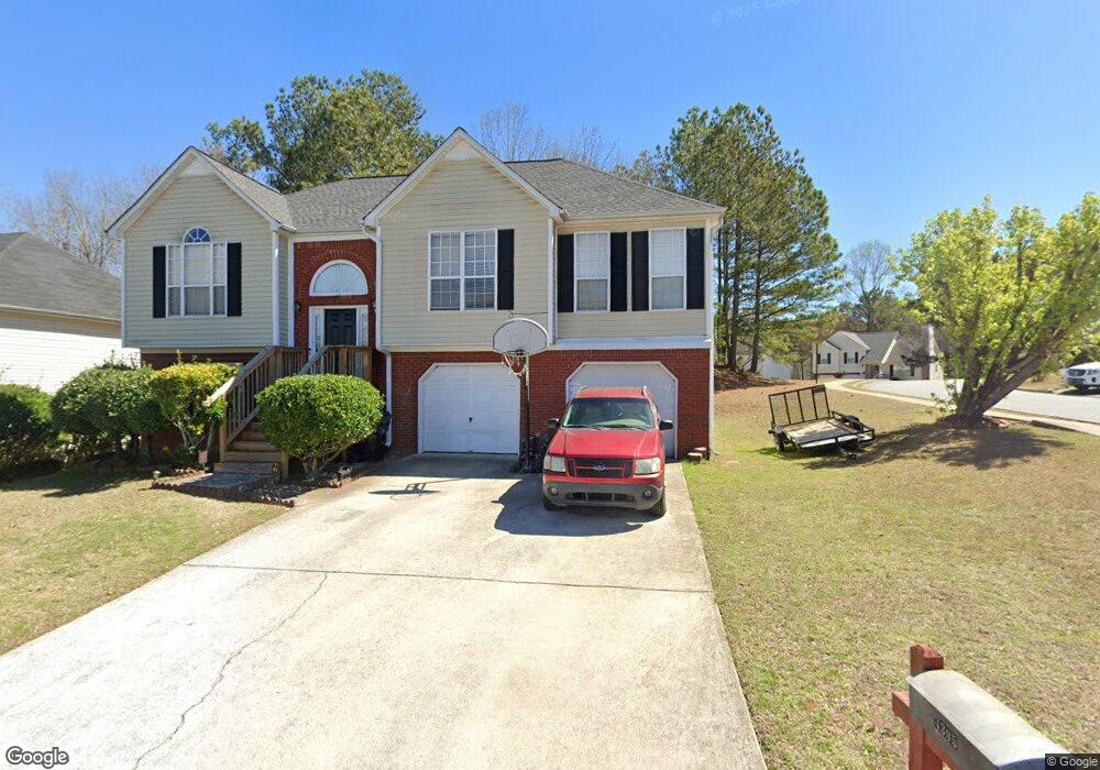
4395 Rhinehart Ln Unit 2 Austell, GA 30106
Estimated Value: $308,000 - $346,000
4
Beds
3
Baths
1,584
Sq Ft
$209/Sq Ft
Est. Value
About This Home
This home is located at 4395 Rhinehart Ln Unit 2, Austell, GA 30106 and is currently estimated at $331,299, approximately $209 per square foot. 4395 Rhinehart Ln Unit 2 is a home located in Cobb County with nearby schools including Deerwood Elementary School, Clarkdale Elementary School, and Garrett Middle School.
Ownership History
Date
Name
Owned For
Owner Type
Purchase Details
Closed on
Mar 31, 1999
Sold by
Palladium Homes Inc
Bought by
Mitchell Ronald
Current Estimated Value
Home Financials for this Owner
Home Financials are based on the most recent Mortgage that was taken out on this home.
Original Mortgage
$127,800
Outstanding Balance
$31,115
Interest Rate
6.82%
Mortgage Type
FHA
Estimated Equity
$300,184
Create a Home Valuation Report for This Property
The Home Valuation Report is an in-depth analysis detailing your home's value as well as a comparison with similar homes in the area
Home Values in the Area
Average Home Value in this Area
Purchase History
| Date | Buyer | Sale Price | Title Company |
|---|---|---|---|
| Mitchell Ronald | $127,900 | -- | |
| Palladium Homes Inc | $26,000 | -- |
Source: Public Records
Mortgage History
| Date | Status | Borrower | Loan Amount |
|---|---|---|---|
| Open | Palladium Homes Inc | $127,800 |
Source: Public Records
Tax History Compared to Growth
Tax History
| Year | Tax Paid | Tax Assessment Tax Assessment Total Assessment is a certain percentage of the fair market value that is determined by local assessors to be the total taxable value of land and additions on the property. | Land | Improvement |
|---|---|---|---|---|
| 2025 | $3,831 | $127,152 | $14,000 | $113,152 |
| 2024 | $3,834 | $127,152 | $14,000 | $113,152 |
| 2023 | $3,834 | $127,152 | $14,000 | $113,152 |
| 2022 | $3,353 | $110,492 | $14,000 | $96,492 |
| 2021 | $2,540 | $83,688 | $14,000 | $69,688 |
| 2020 | $2,257 | $74,360 | $14,000 | $60,360 |
| 2019 | $1,864 | $61,416 | $12,000 | $49,416 |
| 2018 | $1,864 | $61,416 | $12,000 | $49,416 |
| 2017 | $1,487 | $51,724 | $6,000 | $45,724 |
| 2016 | $1,487 | $51,724 | $6,000 | $45,724 |
| 2015 | $956 | $32,464 | $6,000 | $26,464 |
| 2014 | $965 | $32,464 | $0 | $0 |
Source: Public Records
Map
Nearby Homes
- 4391 Rhinehart Ln
- 4308 Anderson Ridge Dr
- 4387 Rhinehart Ln
- 4398 Rhinehart Ln Unit 2
- 2001 Rhinehart Rd
- 2005 Rhinehart Rd
- 4394 Rhinehart Ln Unit 2
- 4306 Anderson Ridge Dr
- 2009 Rhinehart Rd
- 4390 Rhinehart Ln Unit 2
- 4254 Anderson Ridge Way
- 4383 Rhinehart Ln Unit 2
- 4256 Anderson Ridge Way
- 2014 Rhinehart Rd
- 4304 Anderson Ridge Dr
- 4307 Anderson Ridge Dr
- 2013 Rhinehart Rd Unit 2
- 0 Rhinehart Rd Unit 8461640
- 0 Rhinehart Rd Unit 8535310
- 0 Rhinehart Rd Unit 3281276